
Severe weather outbreak to peak in central U.S. Get Bill Steffen's weekend forecast
A multiday severe weather outbreak will intensify Friday with tornadoes, large hail and damaging winds from the Plains to the Midwest before shifting east into the weekend.
A multiday severe weather outbreak will intensify Friday with tornadoes, large hail and damaging winds from the Plains to the Midwest before shifting east into the weekend.
"A multiday severe weather outbreak has unfolded across the central United States, with perhaps the most dangerous conditions yet to come on Friday,” said AccuWeather Senior Meteorologist Adam Douty. Tornadoes are possible through Saturday.
There have been more than 550 filtered reports of severe weather from Tuesday to Thursday night, including nearly two dozen reports of tornadoes, according to the Storm Prediction Center.
The bulk of the severe weather has focused on the Midwest and the Plains, with some additional reports of damaging wind and hail in parts of the Northeast. A significant share of the severe weather and tornado reports this week have been from Wisconsin and Iowa.
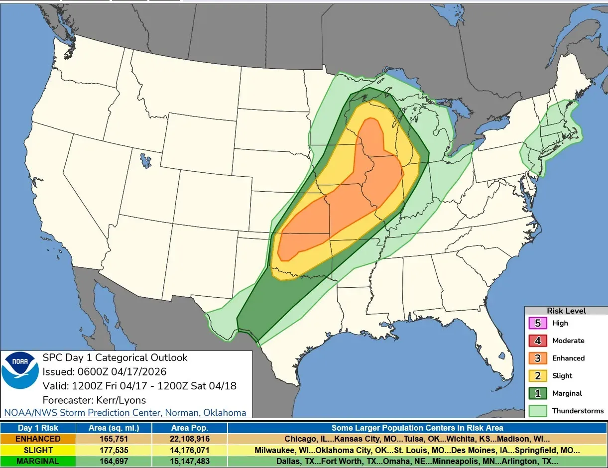
This is the Severe Weather Outlook Map for Friday from the Storm Prediction Center. There is a relatively large level 3 Enhanced Risk of severe thunderstorms from Oklahoma to Wisconsin, which includes Chicago. The level 2 Slight Risk extends from Texas to Upper Michigan. The slight risk comes into southwest Michigan, generally south of a line from Muskegon to Sturgis. The level 1 Marginal Risk covers much of West Michigan.
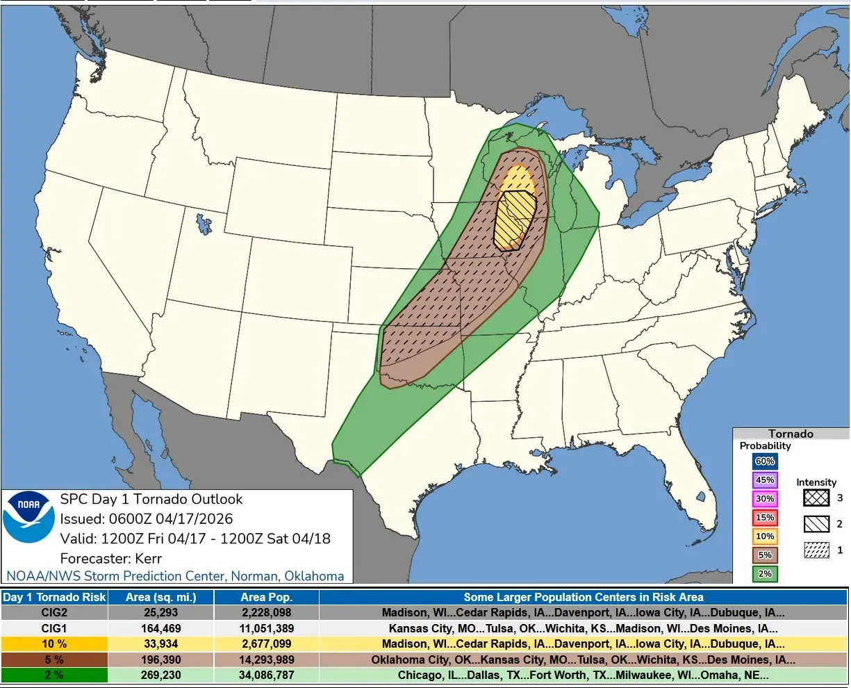
Here’s the Tornado Risk Map for Friday. The yellow area on the map is a 10% chance of a tornado within 25 miles of a given point. This is the most likely area to see tornadoes. The 2% risk in the green color comes into West Michigan.
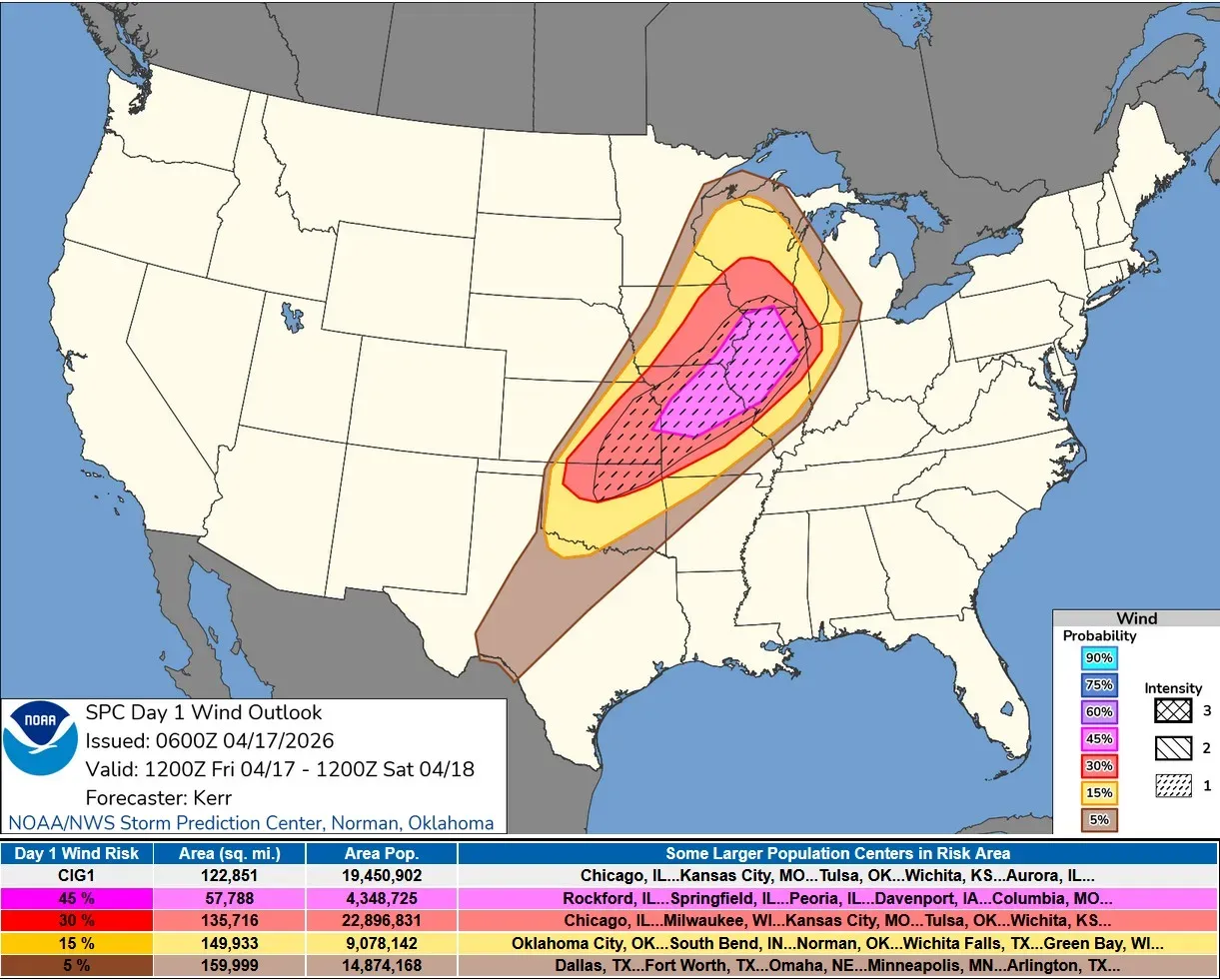
This is the Wind Damage Outlook Map. There is a 45% chance of a severe wind report in the magenta-colored area. The red 30% outlook area runs from Oklahoma to Lake Michigan. The 15% chance comes into the corner of southwest Michigan.
The best chance of severe weather in Lower Michigan will be this evening and tonight as strong to severe storms will move from Wisconsin and Illinois to Lake Michigan and then Lower Michigan. Some of these storms may still pack some strong winds as they move onshore. However, the best bet for tornadoes and wind damage will be across the lake in Wisconsin and Illinois.
The Chicago National Weather Service says: “An extensive frontal squall line is likely to develop west of the Mississippi River along the approaching cold front. Severe weather is likely, especially damaging wind.”
This line of storms won’t reach Michigan until at least after sunset — if not more toward midnight — by that time instability will be decreasing and the threat of severe weather should diminish as the line pushes across Lower Michigan.
The storm should produce a period of moderate to heavy rain.
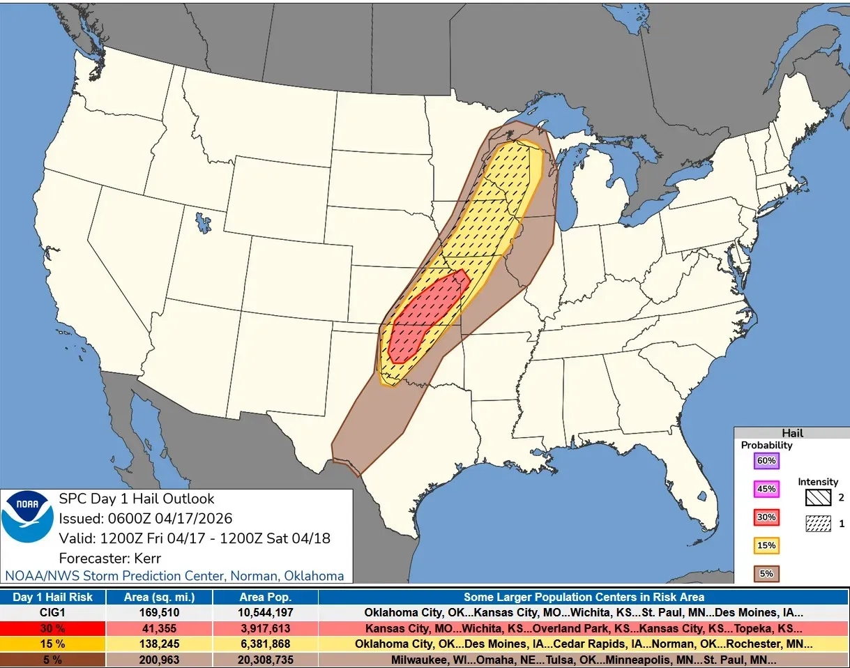
West Michigan is not in the severe hail outlook area.
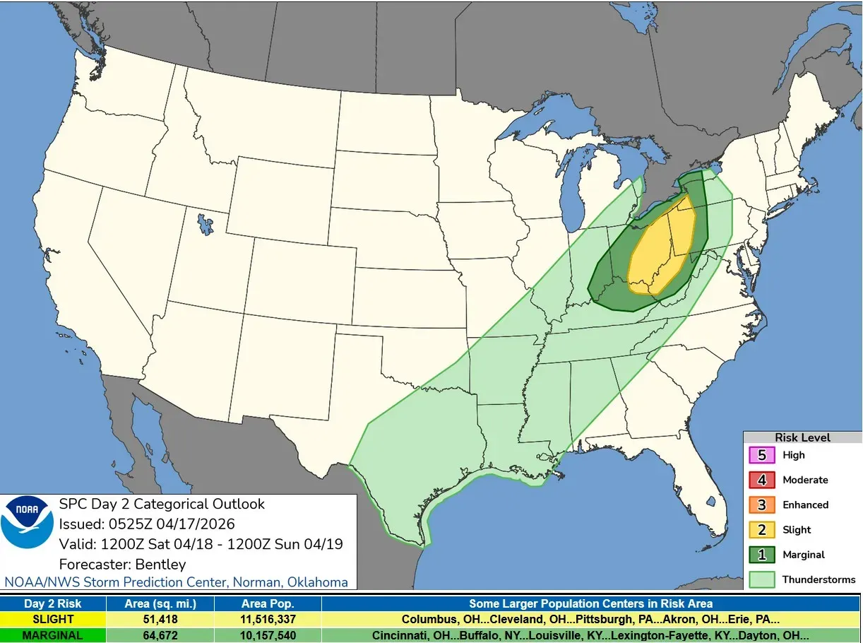
This is the Severe Weather Outlook Area for Saturday. The last storms will likely be non-severe as they exit Michigan, with the storms intensifying again in Ohio and Pennsylvania.
Early next week should be mostly or completely dry, giving floodwaters a chance to recede.

This lake is in the soybean field just south of the Alpine Athletic Field. Usually, this lake isn’t there, but when there is heavy rain or rapid snowmelt in spring, a temporary lake forms.
I’ve been walking here for years, and this picture (taken Thursday, April 16) is the biggest I have ever seen. I’d say it covered more than an acre and was probably 2 feet deep in the middle. It’s become the home for numerous ducks and geese. This is the largest of several temporary ponds in the fields south and east of the field. Creeks in the area were bankfull.
5-day forecast
- Friday: Mostly cloudy and warm, with the temperature approaching the record high of 81 degrees set in 1977. There will be dense fog this morning, becoming breezy this afternoon. Tonight will be cloudy and windy with a low of 45 degrees, with showers and late heavy thunderstorms that could bring flooding, downpours and localized damaging wind gusts.
- Saturday: Very windy, with rain early in the morning; then becoming mostly cloudy and cooler and a dramatic cooldown with a high of 51 degrees. The afternoon/evening will be clear and windy with a low of 37 degrees.
- Sunday: Mostly sunny, windy and chilly with a high of 45 degrees. The afternoon/evening will be clear and cold with a low of 29 degrees.
- Monday: Partly sunny and chilly with a high of 49 degrees. The afternoon/evening will be mostly cloudy and breezy with a low of 41 degrees.
- Tuesday: Windy with sunshine and a few clouds. Temperatures will rise back to seasonal norms with a high of 60 degrees. The afternoon/evening will be mainly clear with a low of 40 degrees.
— Check out Bill Steffen's Substack channel.


