
A mostly nice weekend, but strong storms are coming. Get Bill Steffen's weekend forecast
Forecasters are already predicting that severe weather is likely to come on Tuesday afternoon, with strong thunderstorms stretching from Texas to Michigan.
Severe weather
Rain will feature prominently this weekend with temperatures gradually rising into the 50s and 60s.
However, with the warm temperatures come volatile weather systems. Forecasters are already predicting that severe weather is likely to come on Tuesday afternoon, with strong thunderstorms stretching from Texas to Michigan.
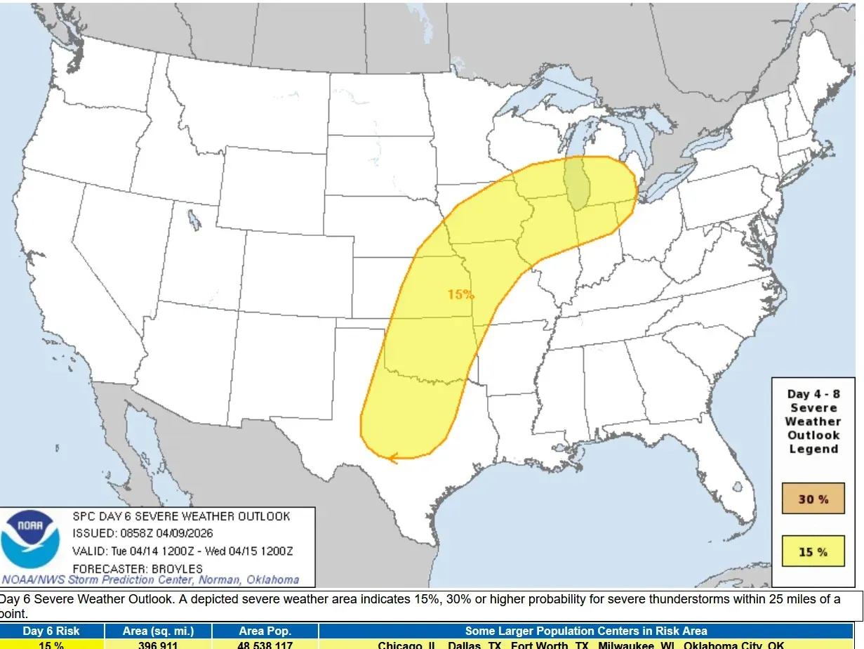
A fairly long stretch of severe weather is likely for the central U.S. starting this weekend and continuing through the middle of next week.
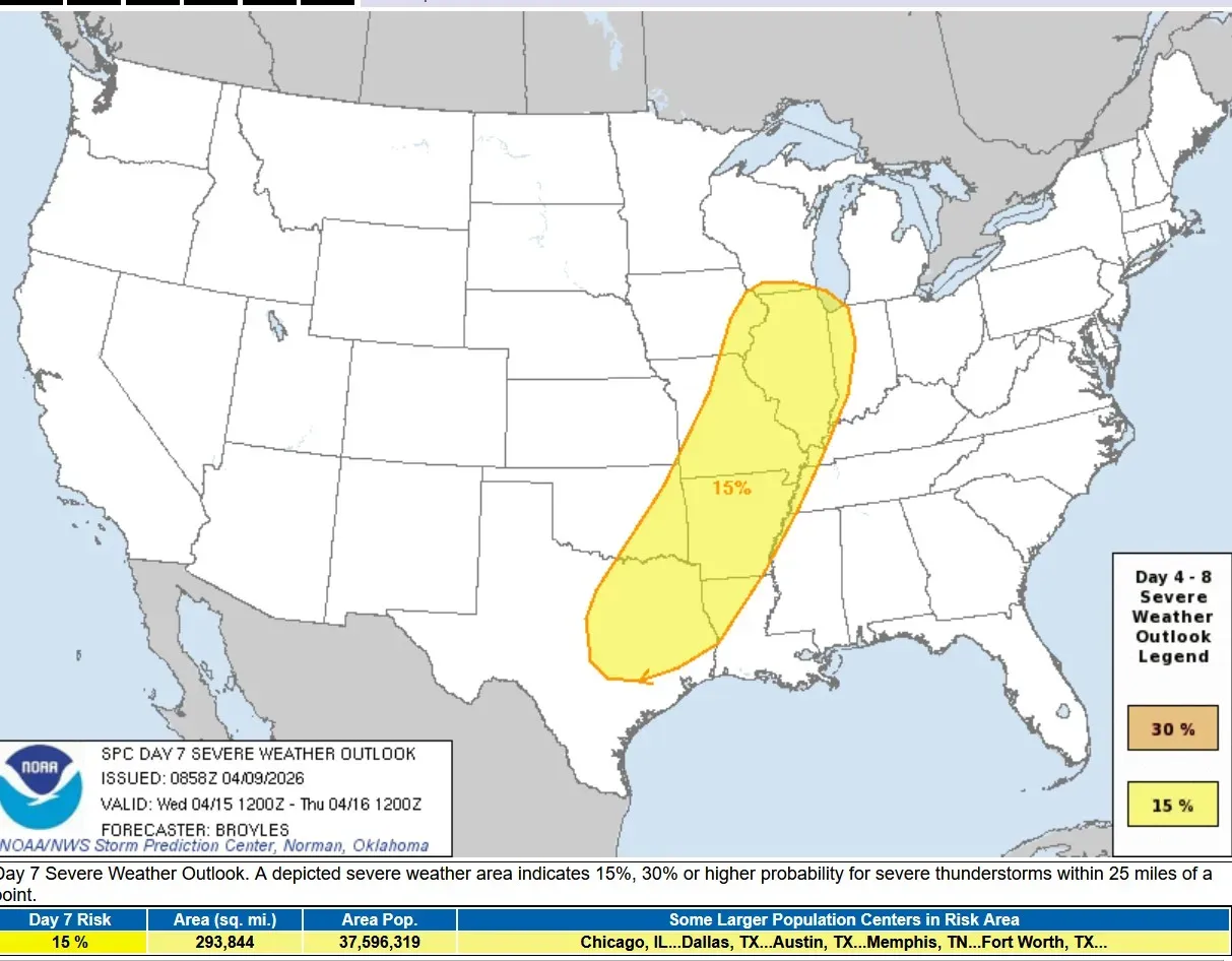
Below is the severe weather outlook for Wednesday, April 15. Again, a large area from Texas to Lake Michigan is expected to see severe weather. There will be a front wobbling back and forth, aiding in storm development.
So far this year, the U.S. has had 313 tornadoes. The most in any state is 59 in Illinois. Michigan has had 11 twisters. None in Nebraska and only four in Kansas so far this year.
Precipitation
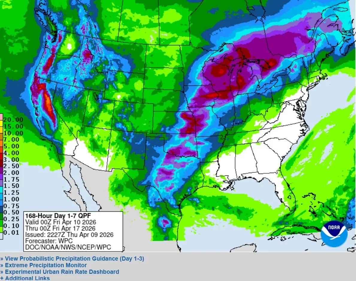
Below is the latest seven-day rainfall outlook from the Weather Prediction Center. There’s a large area of 1.5-3 inches of rain from Texas to Michigan. This would keep river levels high and might even produce new flooding.
Moderate flooding is occurring in Comstock Park in Kent County. The river is about at flood stage; it’s crested at Ada. The river is 3.47 feet above flood stage. There is some residential flooding along Abrigador Trail, Konkle Drive, Willow Drive and Riverbank.
The record crest on the Grand River at Comstock Park is 17.8 feet in April 2013. The river reached 16.85 feet in 2018.
This is the first time Michigan has been drought-free in three years.

Temperatures
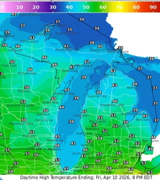
Below are the high temperatures for today (Friday) in Michigan. In general, it's a few degrees cooler than yesterday with temperatures in the mid-50s inland and the mid- to upper 40s at Lake Michigan. The Upper Peninsula will see upper 30s to mid-40s.
5-day forecast
- Friday: Showers should clear by early afternoon, and by late in the day, the sun may return. Expect a high of 51 degrees and a low of 33 degrees.
- Saturday: It should be a nice day, mostly sunny and mild. There will be a high of 56 degrees and a low of 46 degrees. Rain will return Saturday evening and the winds will pick up.
- Sunday: Windy with a couple of showers; cloudy in the morning, then intervals of clouds and sun in the afternoon. Expect a high of 64 degrees and a low of 52 degrees.
- Monday: Windy in the morning; mainly cloudy with a passing shower. Highs will surpass 65 degrees with lows in the low 50s.
- Tuesday-Wednesday: Several rounds of showers and thunderstorms will roll in, with the possibility of strong storms. Temperatures will peak near 70 degrees.
— Check out Bill Steffen's Substack channel.


