Another winter storm? Weather service warns more snow coming
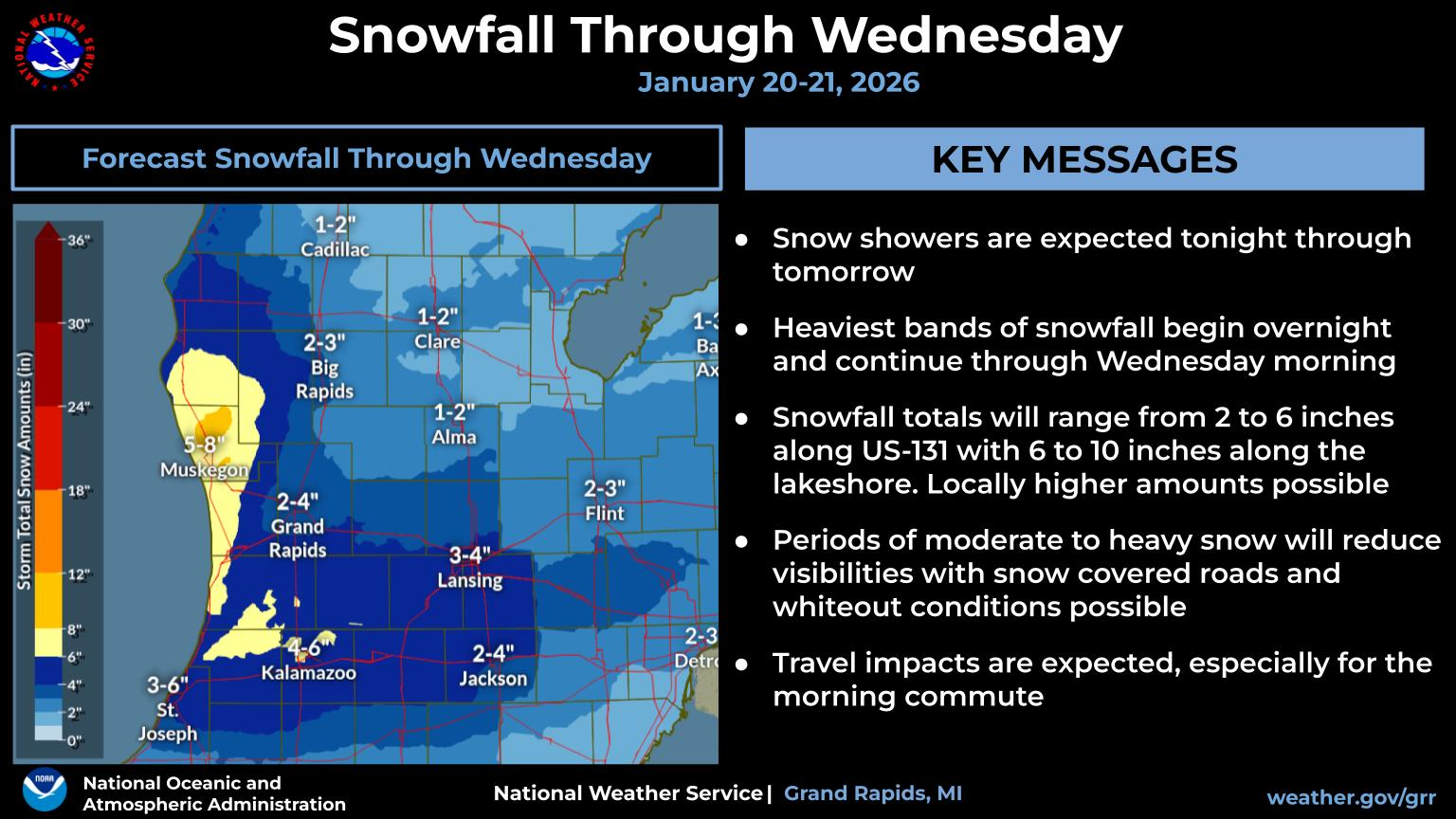
The new weather system is expected to drop an additional 3-8 inches — with some areas expected to receive 9-12 inches — by the time the storm warning expires at 10 a.m. Wednesday.


OTTAWA COUNTY — The Grand Rapids office of the National Weather Service has issued another winter storm warning for Ottawa, Muskegon and Oceana counties, which is set to begin at 12:01 a.m. Wednesday, Jan. 21.
While totals vary across the county, the average accumulation for the week is estimated between 8 and 12 inches since Sunday, with higher amounts reported near the lakeshore.
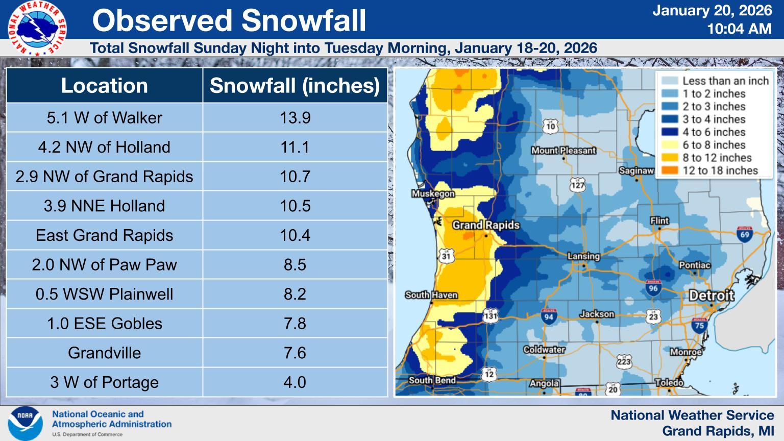
NWS reported that Holland received 10.5 inches as of 6 p.m. Tuesday, and Hemlock Crossing and Pigeon Creek reported a total snow depth of 8-11 inches on the ground.
The new weather system is expected to drop an additional 3-8 inches — with some areas expected to receive 9-12 inches — by the time the storm warning expires at 10 a.m. Wednesday.
The heaviest bands of snowfall will be near the lakeshore, with snowfall rates of 1-2 inches per hour.
Visibility and road conditions may change rapidly over short distances because of lake-effect snow reducing visibility, making travel difficult.
Hazardous road conditions already have proven dangerous to Ottawa County motorists, after a stretch of I-196 in Zeeland Township was closed midday Monday after than 100 vehicles were involved in a massive pileup.
Authorities received an outpouring of calls about crashes, slide-offs, and several jack-knifed semi-trucks in the area, which made international headlines as of Tuesday morning.
At least nine people received injuries warranting transport to the hospital for treatment. The highway was closed for nearly eight hours.
Another round of accumulating snow will move in on Wednesday night, according to the NWS. That additional snowfall is expected to bring another 2-4 inches into Thursday, Jan. 22.
Please consider becoming a monthly donor!
Follow along for more weather updates at Bill Steffen's daily weather report on Substack.
— Sarah Leach is the executive editor of the Ottawa News Network. Contact her at sleach@ottawanewsnetwork.org. Follow her on Twitter @ONNLeach.


