
Is spring finally springing? Get Bill Steffen's weekend forecast
It will be cool Friday and Saturday, then a warmup is coming next week.
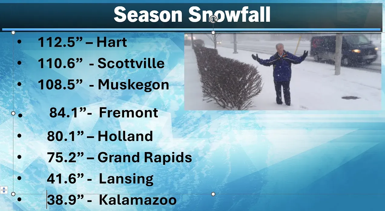
Snow cover
Hart, Scottville and Muskegon have reached the “Hundred-Inch Club.” Grand Rapids had 75.2 inches, which is within an inch of average-to-date. Muskegon is 23.5 inches above average-to-date.
Weekend outlook
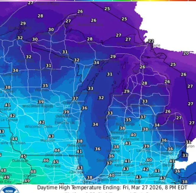
With some sunshine, we should climb to the low 40s in southern Lower Michigan. It will hold in the mid- to upper 30s near Lake Michigan. It will be cooler up north, with Ludington and Houghton Lake in the mid- to low 30s. Some places in the Upper Peninsula and northern Lower Michigan may not get out of the 20s … just 22 for a mid-afternoon temperature in Sault Ste. Marie, where there is still 31 inches of snow on the ground.
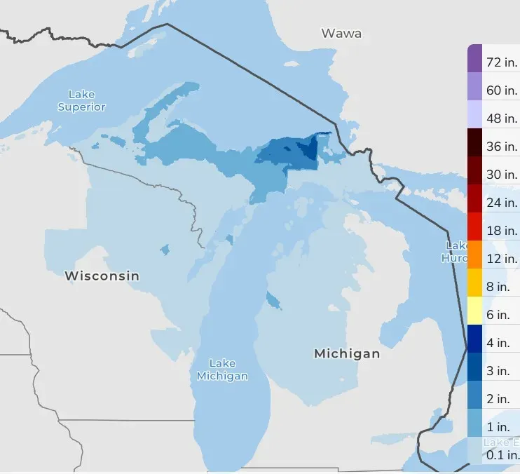
Over the next three days, there may be a few snow flurries, mainly north of Grand Rapids and maybe an inch up toward Manistee. There could be a dusting on the grass in the early morning. Roads should be mostly in good shape. In the U.P., up to 1-4 inches could fall in the darker blue areas on the map … certainly no big storms.
5-day forecast
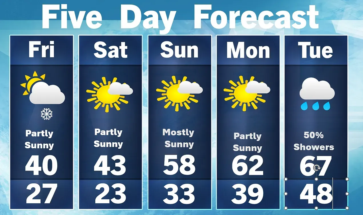
- Friday: The high temperature might reach 40 (about the best we can do today). The clouds will clear in the afternoon, and it will be breezy with a few late-night snow showers, with a low of 27 degrees.
- Saturday: Sunny to partly cloudy with a few flurries in the morning and a high of 43 degrees. It will be breezy in the afternoon and clear in the evening with a low of 23.
- Sunday: Palm Sunday looks like a nice day — warmer. It will be partly sunny and windy with a high of 58 degrees. In the evening, it will be partly cloudy and breezy with a low of 33 degrees.
- Monday: It looks dry and partly cloudy with a high of 62 degrees. Showers (and maybe thundershowers) could move in Monday night, with clouds moving in and a low of 39 degrees.
- Tuesday-Thursday: Several rounds of showers and thunderstorms will move temperatures peaking in the high 60s, but are expected to drop back down into the 40s as a cold front moves in.
The average high temperature in West Michigan climbs above 50 next week!
— Check out Bill Steffen's Substack channel.


