
Warm front to bring storms. Get Bill Steffen's weekday forecast
It will be cool Friday and Saturday, then a warmup is coming next week.
There could also be some significant rain on Monday night, March 30, and again on Thursday night.
The updated Severe Weather Outlook Map for today and into tonight. There is now a level 2, Slight Risk Area that runs from eastern Iowa to Lake Michigan. The Marginal Risk Area (in dark green on the map), level 1 - covers all of lower Michigan.
The most likely time for any severe weather in lower Michigan would be in the evening or overnight and again Tuesday afternoon/evening.
Counting today and tomorrow, we’ll end up with 12 days this month that have reached at least 60 degrees in Grand Rapids, following a colder-than-average winter (from November through early February).
Check out the Grand Rapids National Weather Service forecast discussion, which covers everything from the chance of severe weather to the chance of freezing rain to the chance of a little snow (and wind) on Easter Sunday. Here’s the link.
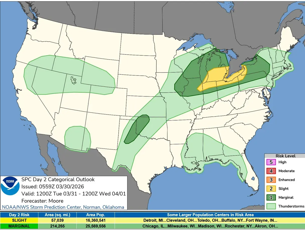
The above image is the Severe Weather Outlook Map for Tuesday/Tuesday night. There is a level 2 risk area (in yellow on the map above), for southern Lower Michigan, northern Indiana, northern Ohio and small parts of northeast Illinois, northwest Pennsylvania and western New York.
SPC says it remains unclear whether or not discrete storms can develop within the diffuse warm frontal zone ahead of any convective lines/clusters.
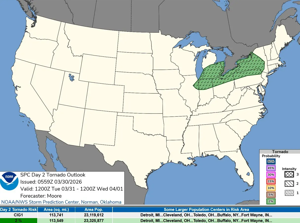
SPC has now added a 2% tornado risk to southern Lower Michigan (in dark green on the map above. This is not a high risk, but the worth our continued monitoring as storms push into West Michigan.
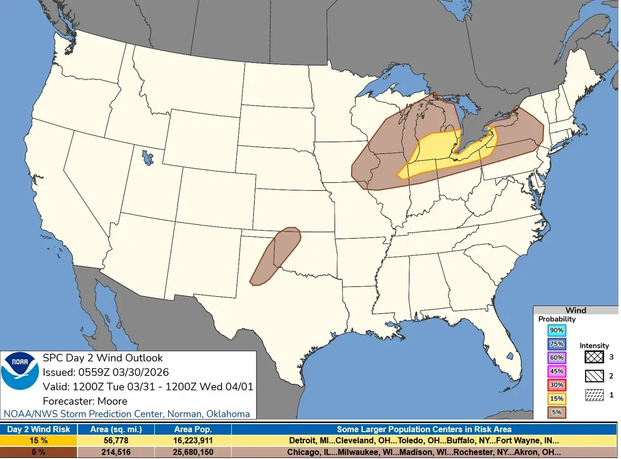
The wind outlook has been increased to a 15% chance of a severe report within 25 miles of a given point.
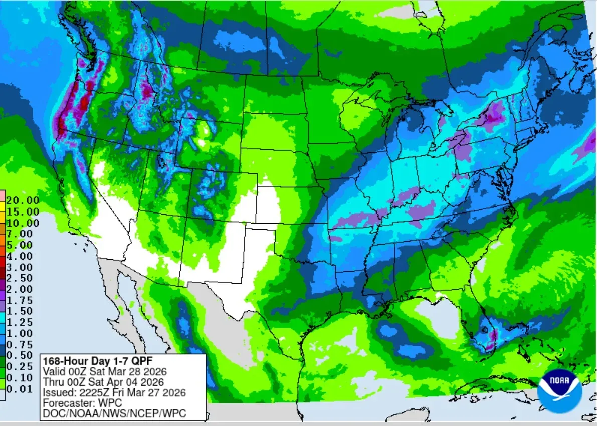
Here's the Total Rainfall Outlook for the next six days combined. Note the heavier rain from northeast Texas to New England. There may be a little residual La Niña going on here, with a tendency for systems to move through the Ohio Valley during the winter months. Lower Michigan is on the north end of this area of heavier rainfall.
5-day forecast
- Monday: The weather looks dry for most of today. We’ll warm to the low-mid 60s today (a bit cooler near Lake Michigan). Tonight, thunderstorms will roll in late and could have strong wind gusts, hail and heavy downpours.
- Tuesday: Very windy with showers and thunderstorms, with the heaviest rain late in the day. The high will be in the mid- to high 50s, and the low will be in the low 30s.
- Wednesday: The cool air returns with a high in the high 40s and the low in the low 30s. Skies will be partly cloudy, but rain will return on Wednesday night.
- Thursday: Temperatures will rebound into the high 50s, and windy conditions will bring back the rain.
- Friday: Sun and clouds, with a high of 48 degrees. It will turn breezy in the evening with a couple of showers and thunderstorms.
— Check out Bill Steffen's Substack channel.


