

Another smoky day; much-needed rain could be on the way. Get Bill Steffen's weekend forecast
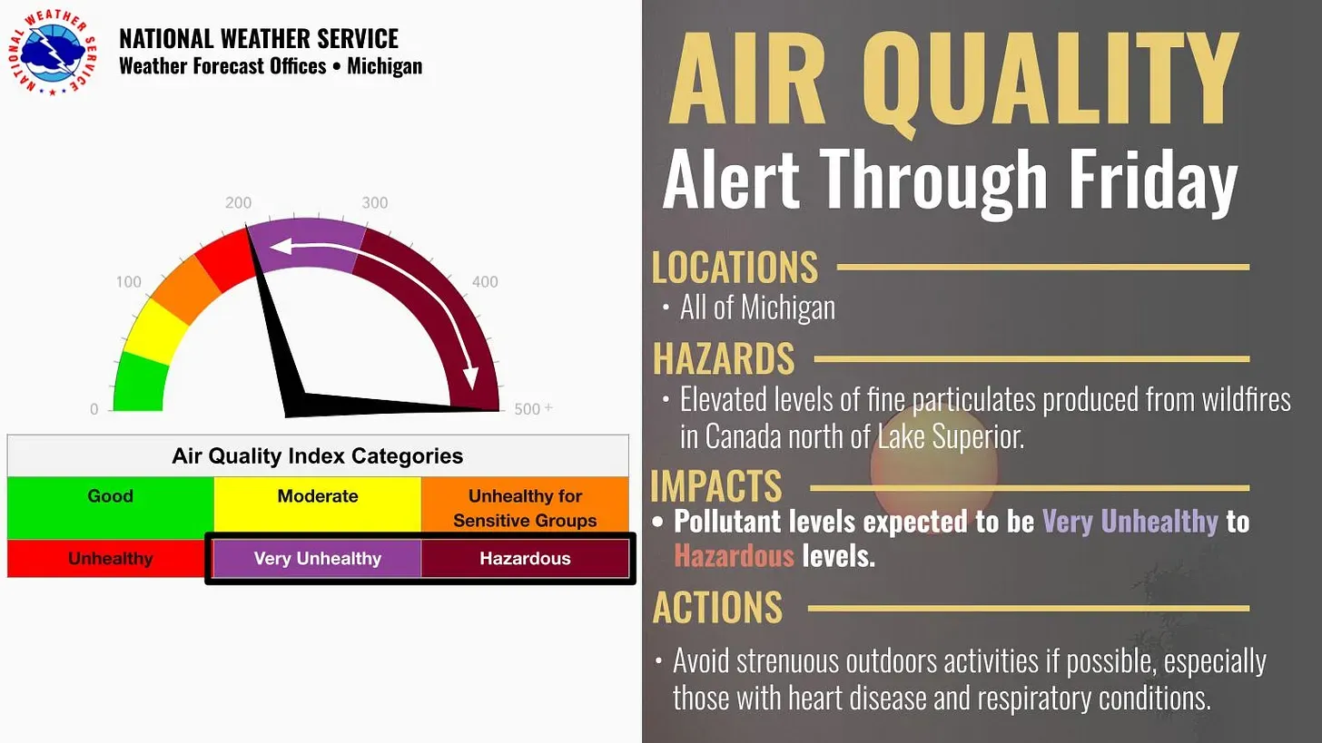
Once again, the entire state will be under an Air Quality Alert through Friday, July 18, due to elevated levels of fine particulate.

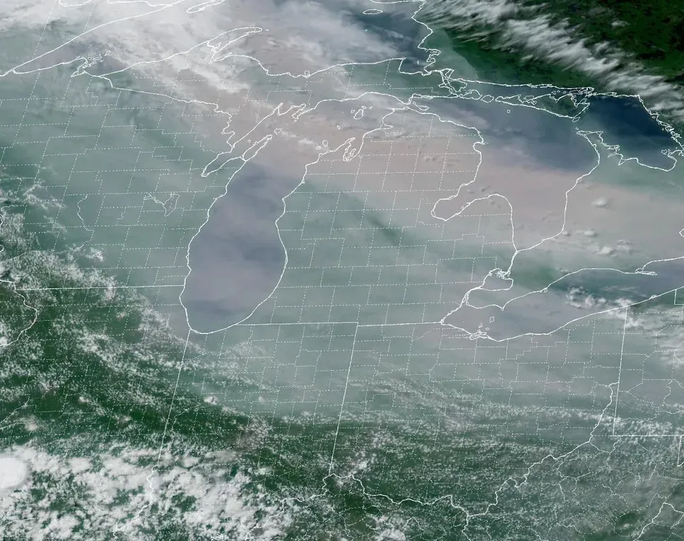
A satellite image from Thursday evening shows smoke over Michigan due to wildfires in Canada. It extended down past Chicago and Fort Wayne.
With a southwest wind developing, the smoke should retreat a bit to the northeast today. However, much of the day will still be smoky in Grand Rapids and most of West Michigan.
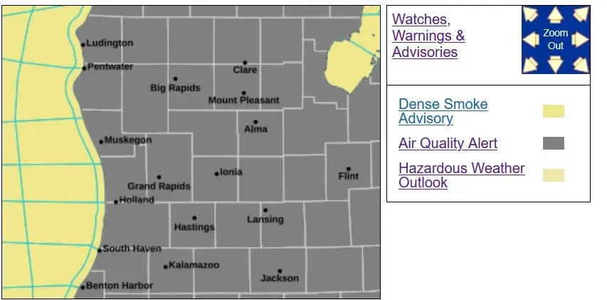
Once again, the entire state will be under an Air Quality Alert through Friday, July 18, due to elevated levels of fine particulate.
Concentrations on Friday will range from "very unhealthy" in southern areas to "hazardous" in the north. On Saturday, concentrations will range from "unhealthy for sensitive groups" in the south to "very unhealthy" in northern portions of the state.
The threat of increased ozone may come into play Saturday as well.
Ottawa County residents should seek cleaner air indoors and keep activity levels low. While indoors, take action to improve the indoor air quality such as closing windows and minimizing the opening of doors; if HVAC systems are not equipped with MERV-13 filters or higher, use portable air cleaners; and avoid activities that make indoor air quality worse: burning candles, using vacuums without a HEPA filter, using gas stoves more than necessary, smoking, spraying aerosol products, etc.
If residents must be outdoors for short periods of time, it is recommended that they wear an N95 or P100 respirator marked with “NIOSH.” Do not use masks for children under age 2.
For up-to-date air quality data for Michigan, visit Michigan.gov/MiAir.
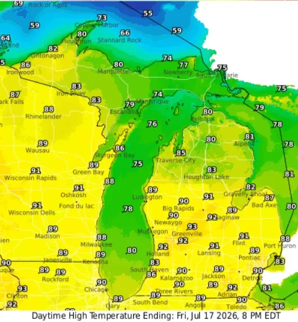
Here are forecast high temperatures for this evening. You can probably knock 3 degrees off these numbers due to the smoke, which is not factored into most of the computer models. So, maybe 90 degrees for Grand Rapids and 80 degrees for the lakeshore. Some pleasant 70s will be along the Lake Superior shoreline.
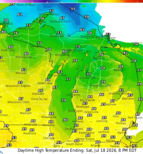
Here are Saturday’s high temperatures … a couple of degrees cooler due to a bit more cloud cover and a chance of a shower or storm. A weak cool front will be in the vicinity.
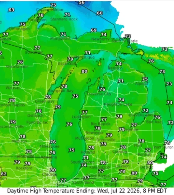
We jump ahead to Wednesday — a second cold front will keep temperatures in the 70s in West Michigan with lower humidity.
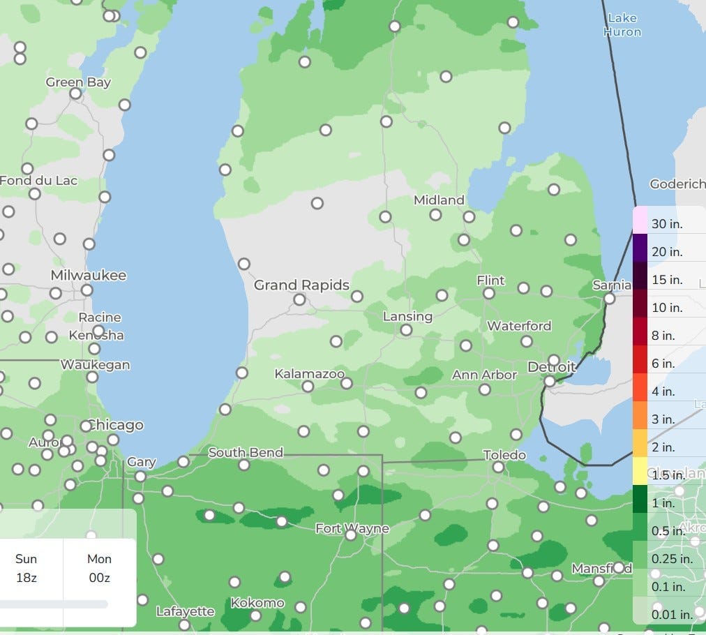
For the second day in a row, the precipitation projection model gives more rain along and south of I-94 and north of US 10. I’m still hoping for some rain at my house. Grand Rapids has now gone 12 days without measurable rain.
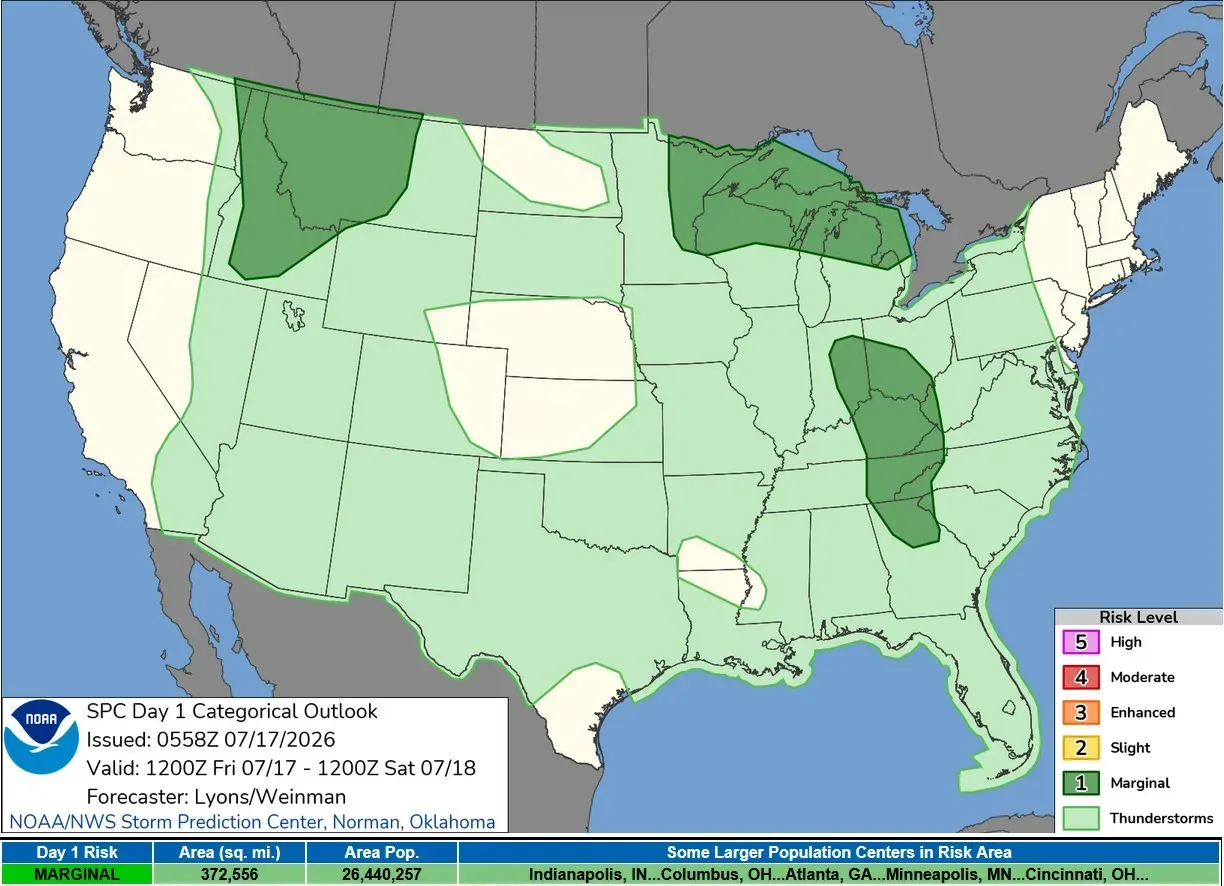
Today, there is a Marginal or Level 1 risk of a severe thunderstorm across Upper Michigan and northern Lower Michigan, generally north of a line from Ludington to the Thumb Area. This is mainly for isolated strong winds. SPC says: “One or more storm clusters may evolve Friday night and move east-southeastward across the northern Great Lakes region, potentially posing an isolated severe threat.
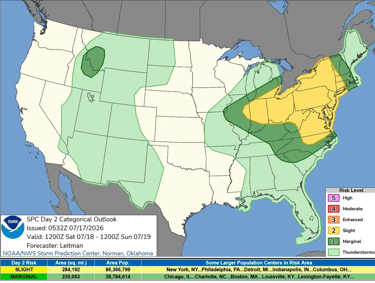
Saturday/Saturday night we have a fairly large Slight Risk Area (level 2) from Southeast Michigan and Indiana to the Atlantic Ocean. It’s a "marginal" or "Level 1" risk for much of Lower Michigan, mainly south of a line from Ludington to Alpena. Once again, this would be for scattered reports of strong thunderstorm winds.
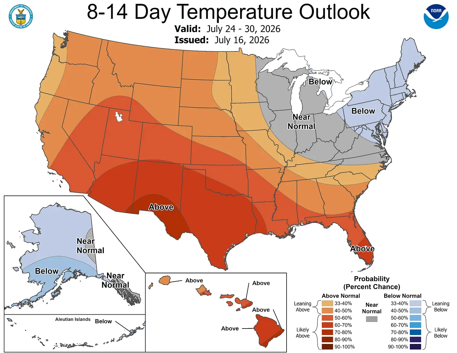
The latest 8-14 day temperature outlook has near-normal temperatures for Michigan. This is for July 24-30.
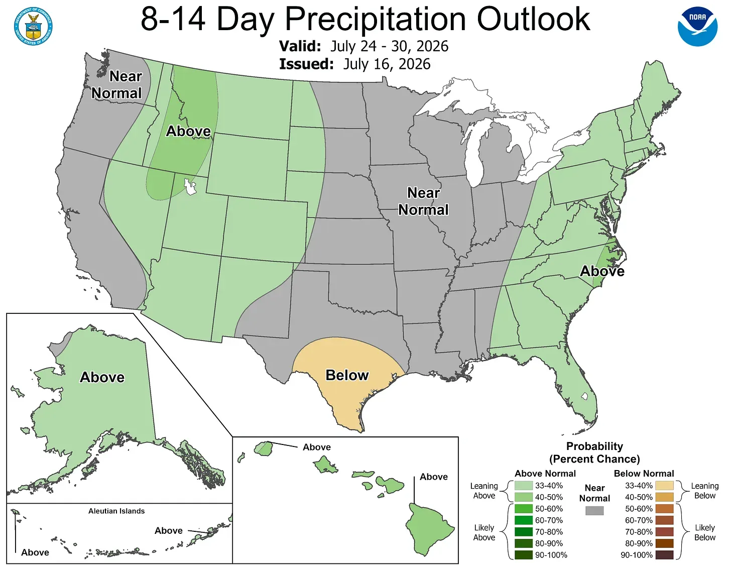
Rainfall is expected to be near average, but that might depend on some Gulf moisture getting up this far north.
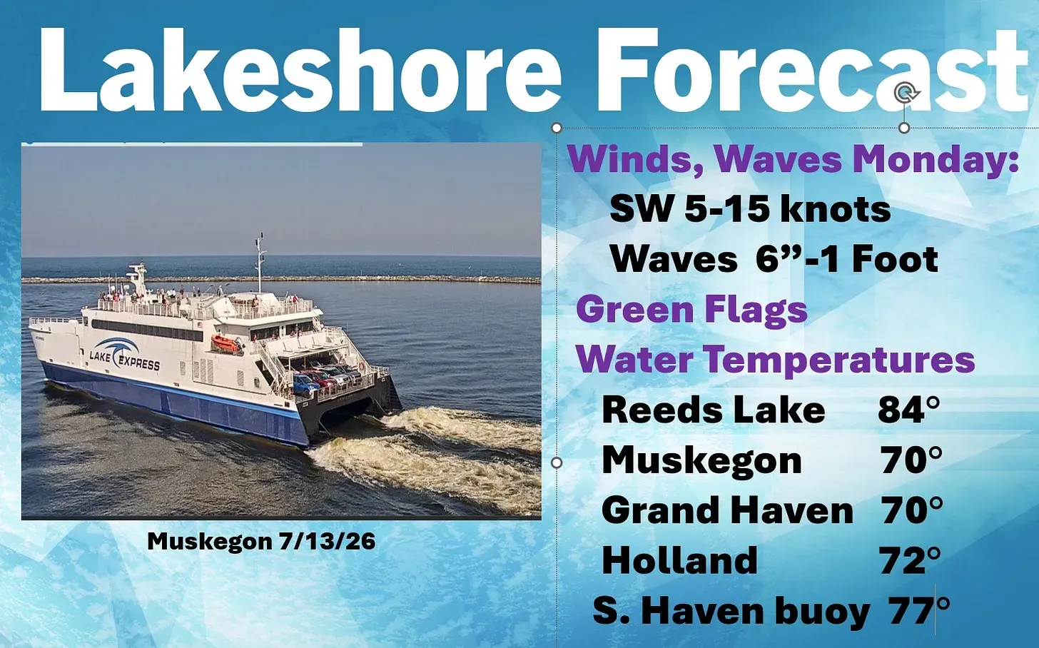
Inland lakes have warm water right now. At Lake Michigan, we may see water temperatures go up a couple of degrees.
Five-day forecast
My five-day forecast calls for warm weather, but not quite as hot as we have had this week. While we have a chance of a thunderstorm (best chance Saturday southeast of Kent County, then again on Monday), it’s not a sure thing, and we could use some rain.
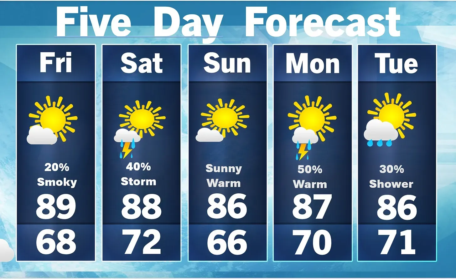
- Friday: Warm with clouds and sun; a couple of showers and a thunderstorm this afternoon; smoke from wildfires will lead to extremely poor air quality and poor visibility. High: 87 degrees. Tonight, mainly clear, warm and very humid. Low: 74 degrees.
- Saturday: Mostly sunny, breezy and humid; a stray thunderstorm in the afternoon; wildfire smoke will create unhealthy air quality and poor visibility at times. High: 83 degrees. In the evening, mainly clear and cooler. Low: 60 degrees.
- Sunday: Partly sunny and less humid; wildfire smoke will create unhealthy air quality and poor visibility at times. High: 82 degrees. In the evening, partly cloudy. Low: 65 degrees.
- Monday: Sunshine and a few clouds, breezy and humid; watch for a strong afternoon thunderstorm; wildfire smoke will reduce air quality; storms can bring damaging winds. High: 83 degrees. Breezy in the evening; mostly cloudy and humid with a couple of showers and a heavy thunderstorm, which could bring hail and damaging winds. Low: 70 degrees.
- Tuesday: A passing shower in the morning; otherwise, partly sunny and humid. High: 78 degrees. In the evening, expect partly cloudy skies, with windy and cooler conditions. Low: 58 degrees.
— Subscribe to Bill Steffen's Substack.


