
Storms to hit Midwest ahead of heat dome, Michigan storms next week. Get Bill Steffen's forecast
Storms and shower activity could be volatile next week.
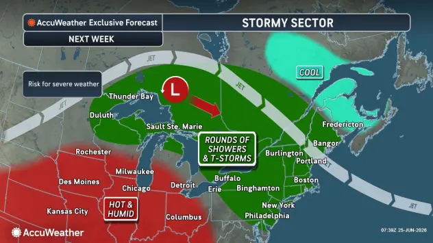
Rounds of storms will rumble and roar through portions of the eastern and central United States in the days ahead of and during a massive heat dome forecast for the end of June and the first days of July.
A pair of storms will roll from the Plains to the Great Lakes and the Ohio Valley into Friday.
As the heat dome builds over the Midwest next week, however, complexes of thunderstorms will move around its rim from the Rockies and High Plains to the northern tier of the Midwest and much of the Northeast.
Storms and shower activity could be volatile next week.
5-day forecast
- Friday: Nice with times of clouds and sun. High: 75 degrees. Tonight, clear skies with a low of 60 degrees.
- Saturday: Nice with times of clouds and sun. High: 78 degrees. Saturday night, mainly clear with a low of 60 degrees.
- Sunday: Partly sunny, with a high of 83 degrees. Sunday night, partly cloudy and humid with a couple of showers and a thunderstorm. Low: 68 degrees.
- Monday: Mostly sunny, breezy, very warm and humid. High: 89 degrees. Monday night, breezy in the evening; otherwise, mainly clear and humid. Low: 73 degrees.
- Tuesday: Breezy in the morning; otherwise, very warm and humid with partial sunshine. High: 88 degrees. Tuesday night, clear, warm and humid. Low: 71 degrees.
— Check out Bill Steffen's Substack channel.


