

Dry today; rain will move in mid-week. Get Bill Steffen's forecast
There’s a chance of a shower or thundershower sneaking into northwest lower Michigan Tuesday night, but much of lower Michigan will be dry at least until Tuesday night.

Fortunately, we don’t have any big storms going on at the moment.
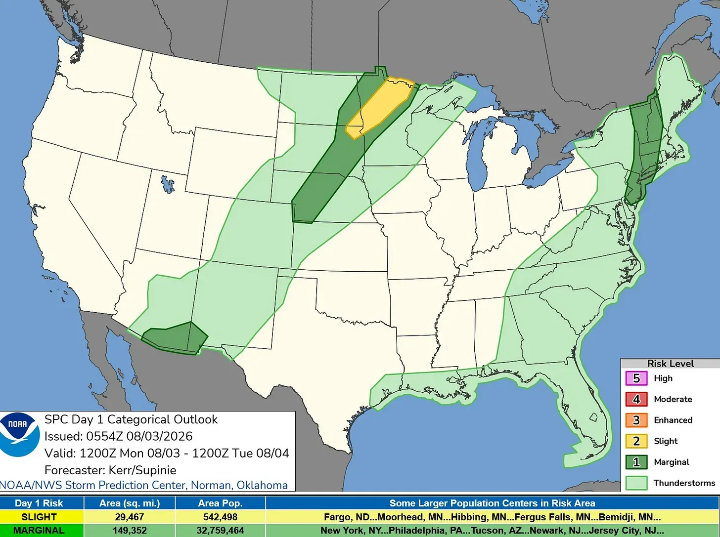
Here’s the Severe Weather Outlook Map for Monday. There’s a Slight Risk (level 2) for a portion of Minnesota and small parts of southeast North Dakota and northeast South Dakota. That’s surrounded by a Marginal Risk (level 1) in dark green on the map above.
There’s also a small Marginal Risk area in southeast Arizona and southwest New Mexico. Plus there’s a Marginal Risk for New Jersey, the NYC area, and western New England. No storms in lower Michigan today.
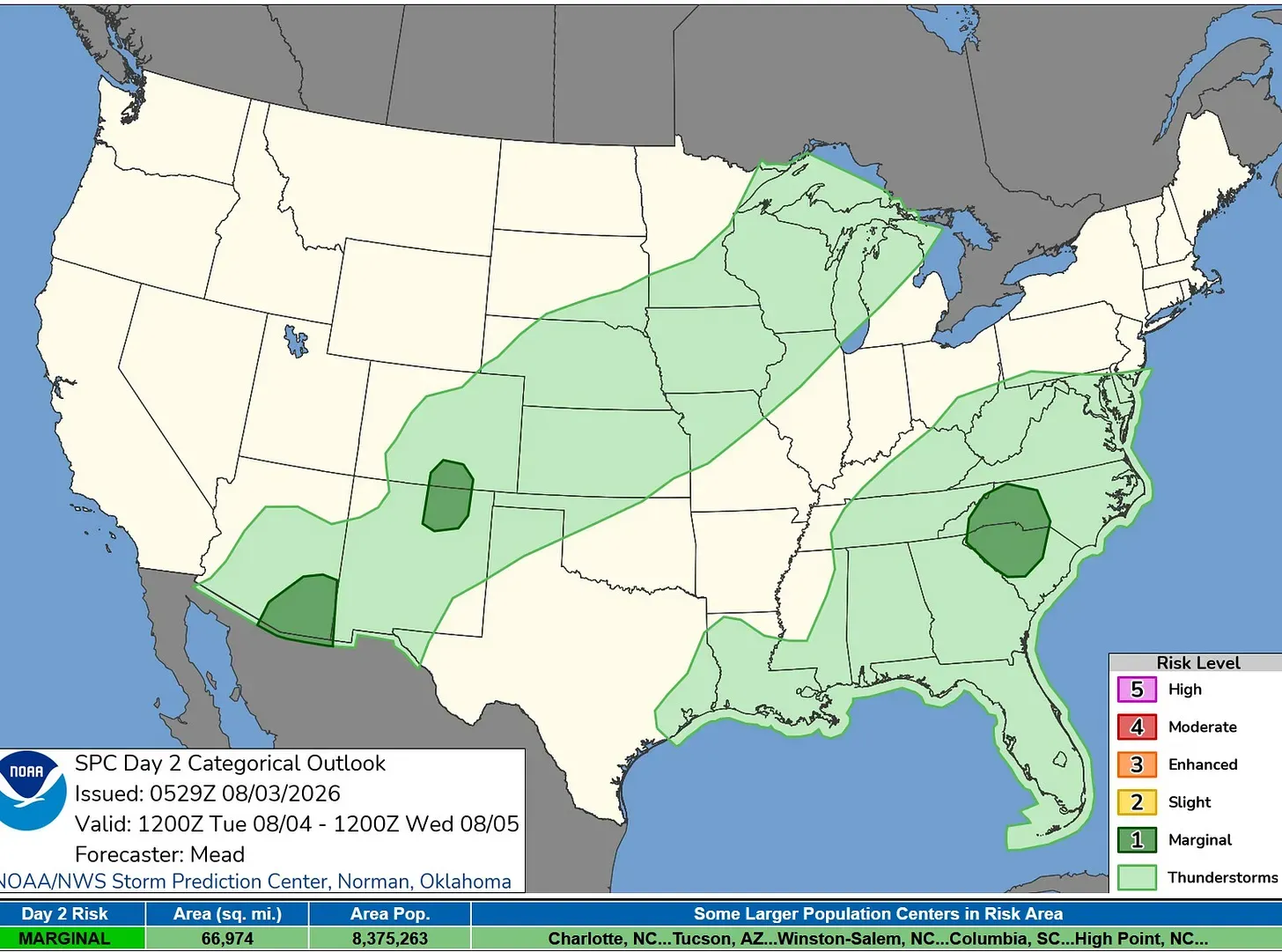
For Tuesday, there are three small Marginal Risk Areas. The first is in southeast Arizona, the second is for small sections of New Mexico and Colorado, and the third area covers the western Carolinas. I think we’ll stay dry in West Michigan on Tuesday.
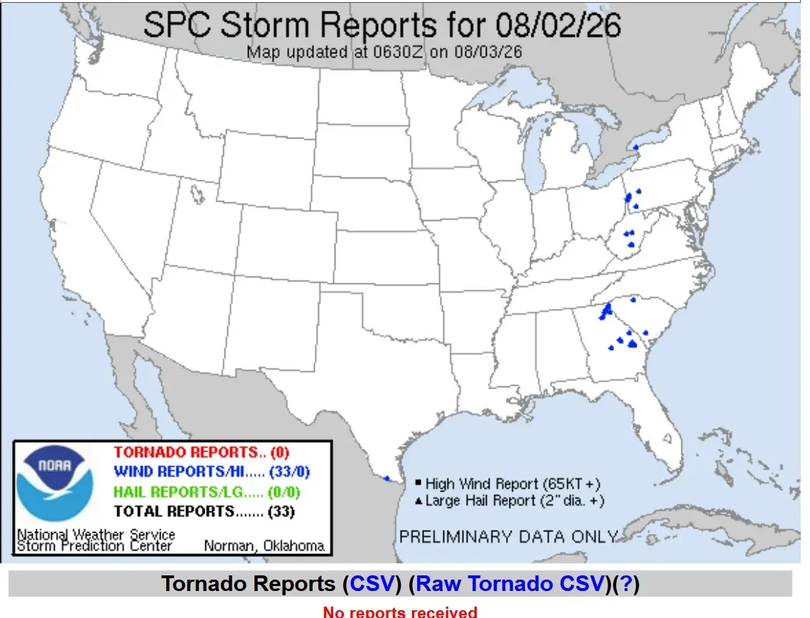
Here are storm reports from Sunday: No tornadoes and no severe criteria hail reports. There were 33 wind damage reports, mostly isolated downed trees and power lines.
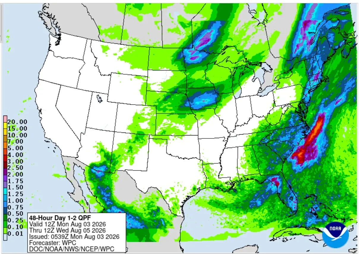
Here’s the forecast for rainfall from Monday morning through Wednesday morning. There’s a chance of a shower or thundershower sneaking into northwest lower Michigan Tuesday night, but much of lower Michigan will be dry at least until Tuesday night.
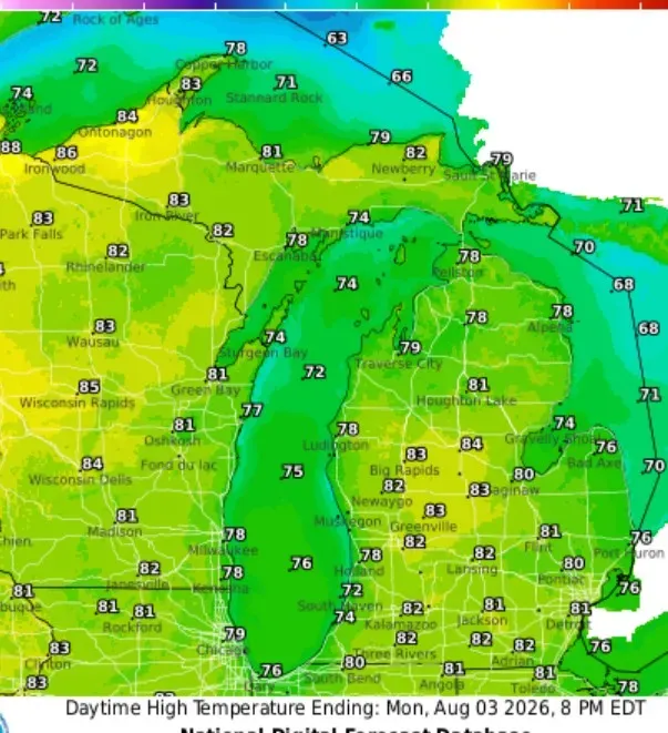
High temperatures this Monday will be mainly in the low 80s — if anything a degree or two warmer than Sunday. Winds will be a touch lighter, around 5-10 mph. Winds will start from the north early, then flip to the west off Lake Michigan during the afternoon. At Lake Michigan, look for high temperatures in the low- to mid-70s.
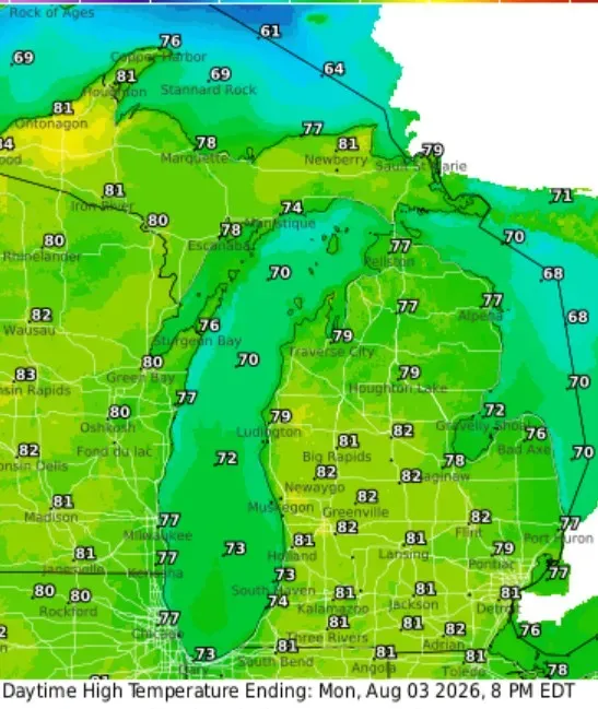
Highs will be pretty similar on Tuesday with readings mainly in the low 80s … just a touch cooler at Lake Michigan.
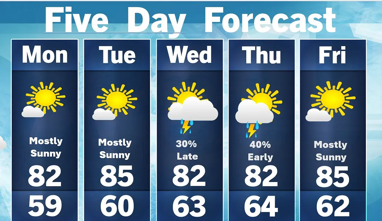
The highest probability of rain looks like Wednesday night, but anytime from Wednesday afternoon to Thursday morning we could catch a shower or thundershower. Temperatures will be close to average in the low- to mid-80s (cooler near the lake).
Five-day forecast
- Monday: Mostly sunny and pleasant. High: 77 degrees. Tonight, a crystal-clear sky with a low of 62 degrees.
- Tuesday: Some clouds, then sunny. High: 80 degrees. In the evening, clear to partly cloudy with a thunderstorm in spots late. Low: 68 degrees.
- Wednesday: Humid with times of clouds and sun; a thunderstorm in parts of the area in the afternoon. High: 74 degrees. In the evening, clouds breaking, with a thunderstorm; humid. Low: 64 degrees.
- Thursday: Times of clouds and sun with a brief shower or two; humid. High: 77 degrees. In the evening, partly cloudy with a low of 60 degrees.
- Friday: Sunny to partly cloudy and humid. High: 80 degrees. In the evening, expect mainly clear skies with a low of 63 degrees.
— Follow Bill Steffen's Substack.


