


Mild, dry week ahead. Get Bill Steffen's weekday forecast.
Michigan will stay dry with unseasonably warm highs in the 50s, climbing into the low-to-mid 60s by Saturday before cooling next week.

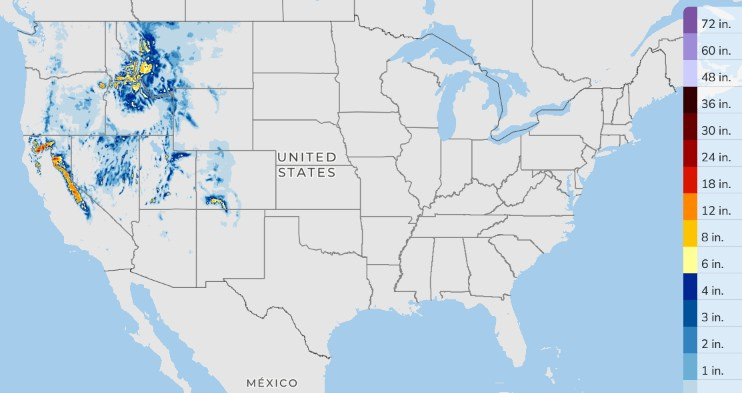
I’ll start with the three-day total snowfall forecast. This week's snowfall will be in the West, mainly in the mountains at elevations above 7,000 feet.
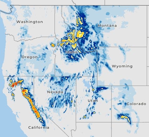
The highest mountains in California's Sierra Nevada range could see 2-3 feet of new snow.
New snow in Upper Michigan totaled 3.8 inches at Mountain Lake, 3.5 inches at Champion and 1.3 inches at Houghton. There were a few slide-offs. Marquette (NWS Office) had 1.8 inches of snow Friday. Their season snowfall total is 6.7 inches as of this early Monday morning.
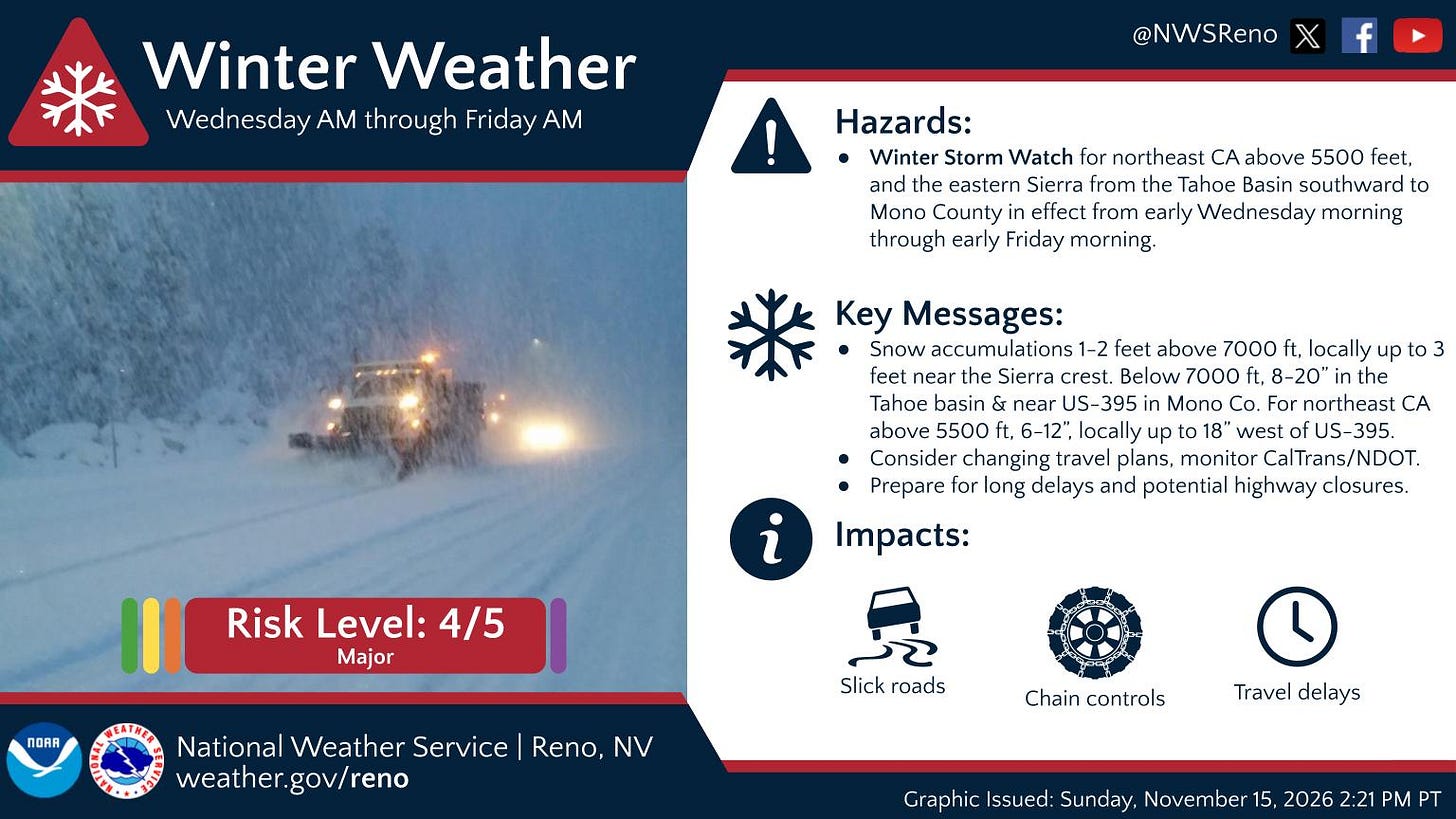
The NWS has the Sierra snow at a 4 out of 5 Risk Level. With the strong El Niño, it’s possible that parts of the West will see double the precipitation this winter as they saw last winter. This will cause local travel challenges, but it will help fill up the reservoirs.
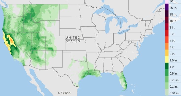
Here’s the 3-day total precipitation outlook for Monday-Wednesday. Rain is likely in the Florida Peninsula, especially along the east coast. Saturday, Leesburg set a record low maximum temperature of just 62. West Palm Beach, Florida, has had over a foot of rain this month (12.03 inches); the average to date is 1.96 inches. They were in the mid-50s Sunday morning.
Rain will also fall in southeast Texas and southern Louisiana. The bulk of the rain is out west. Showers are likely in California, with some heavy rain along the coast of northern and central California. San Diego has a chance of rain at 80% today and 90% for tonight.
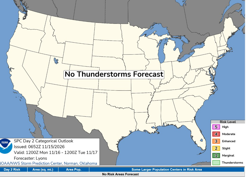
While showers are likely, SPC says no thunderstorms today in the contiguous U.S. Once again, there were no severe thunderstorm reports in the U.S. on Sunday (as I type this).
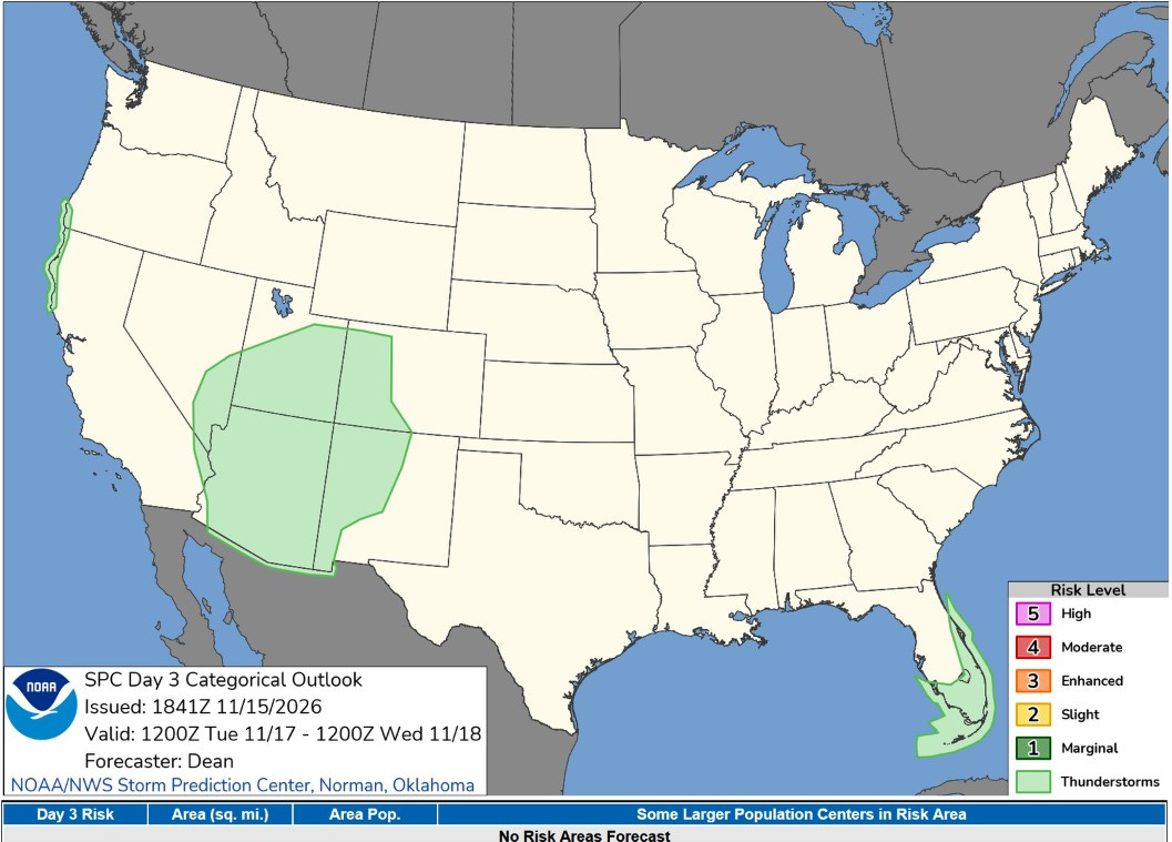
No severe thunderstorm areas are outlined for Tuesday, but a non-severe thundershower is possible in the Florida Panhandle, in the Southwest, and along the coast of northern California and far southwest Oregon.
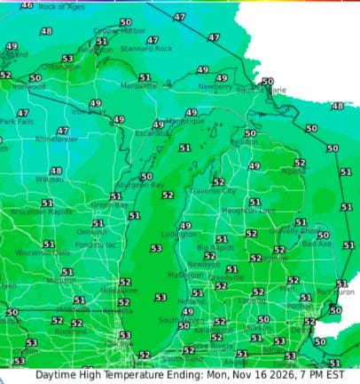
Here are high temperatures for this Monday. Readings will likely be in the low 50s this afternoon under partly cloudy skies. The lakeshore should hold in the upper 40s with similar temperatures statewide. Winds will be south to southwest at 5-15 mph. No rain not only today, but it looks like no rain until next weekend.
A few scattered patches of fog are possible during the early morning.
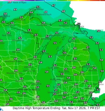
We’ll be a few degrees warmer on Tuesday. With full sun, we should reach the mid-50s inland and near 50 at Lake Michigan. Again, temperatures will be similar statewide.
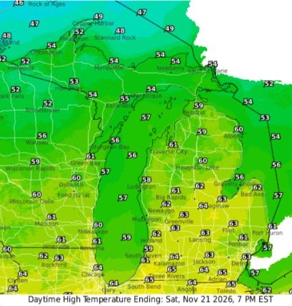
Here’s the forecast high temperatures for Saturday. It’ll be an unseasonably warm day with highs in the low-mid 60s (mid-50s at Lake Michigan). Average high temperatures are in the mid-40s, so statewide the day should be 10-20 degrees warmer than average. Cooler weather will follow for early next week.
Five-day forecast
- Monday: Today, sunny to partly cloudy. High: 53 degrees. Tonight, clear, with a low of 43 degrees.
- Tuesday: Mostly sunny and breezy; a nice afternoon for outdoor activities. High: 53 degrees. In the evening, expect partly cloudy skies, with a low of 44 degrees.
- Wednesday: Partly sunny and windy; a great day to be outside, with a high of 56 degrees. In the evening, partly cloudy and windy, with a low of 46 degrees.
- Thursday: Very windy; a shower in spots in the morning; otherwise, mostly cloudy. High: 57 degrees. In the evening, clear, with a low of 46 degrees.
- Friday: Mostly sunny, with a high of 58 degrees. In the evening, partly cloudy, with a low of 46 degrees.
— Subscribe to Bill Steffen's Substack.


