

Dry, cool as fall takes hold. Get Bill Steffen's weekday forecast.
Today will be a cool day, with afternoon temperatures mainly in the upper 40s and a north-northwest wind at 10-20 mph.

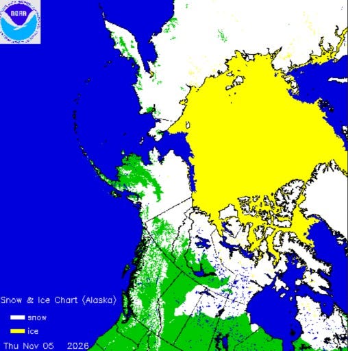
Here’s a map showing current snow and ice cover. Siberia is +90% snow-covered and there’s snow on the ground across much of Alaska, the Yukon, northern Nunavut, and northern Quebec.
You can’t see it on this map, but some places in Colorado picked up some significant snow: Leadville 9 inches, Redstone 8 inches and Skyway 6 inches. Marquette had about a half inch of snowfall Thursday.
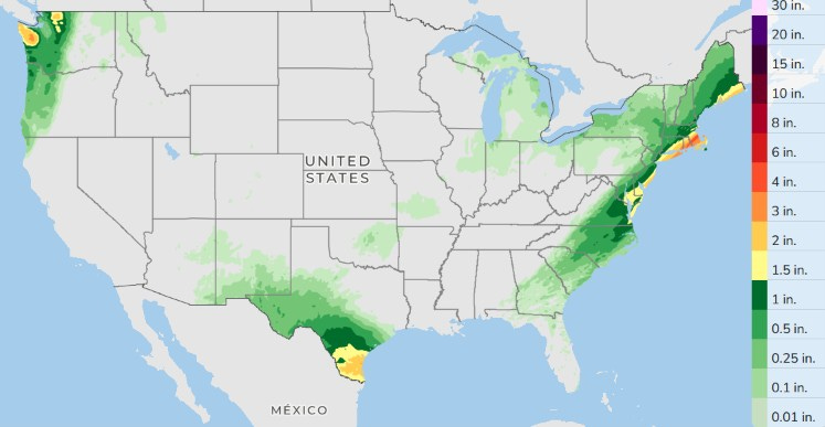
Here’s forecast rainfall in the U.S. over the next three days, with the rain concentrated along the East Coast, southwest Texas and the Pacific Northwest Coast.
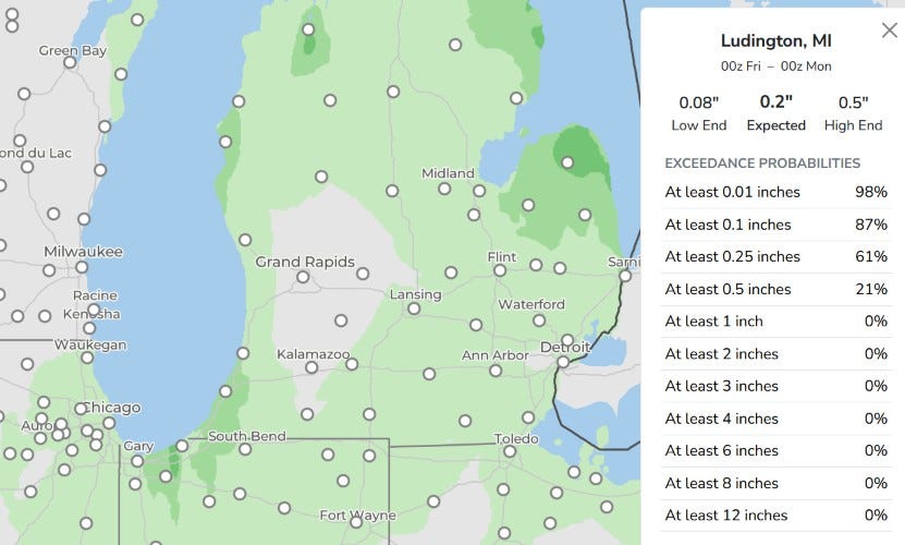
Here’s that same map zoomed in. Maybe a trace sprinkle in G.R. today. There will be some lake-effect showers along the lake. You can see a little darker green south of South Haven and in western Oceana and Mason counties (also, in the Thumb Area and downwind from Traverse Bay). A query for Ludington shows a little less than 1/4” of rain is expected. We should stay dry on Saturday and early next week.
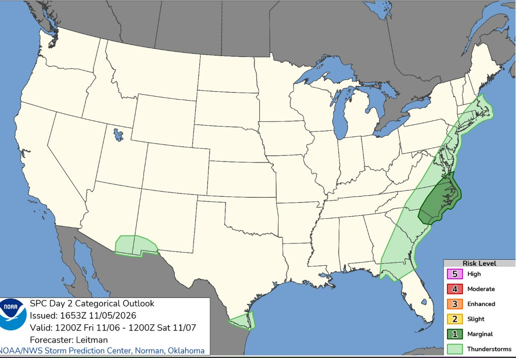
Today there is a level 1 (Marginal) risk of a severe storm from southeast Virginia to eastern South Carolina, with an isolated non-severe storm in the light green areas on the map, including far South Texas and SE Arizona and SW New Mexico.
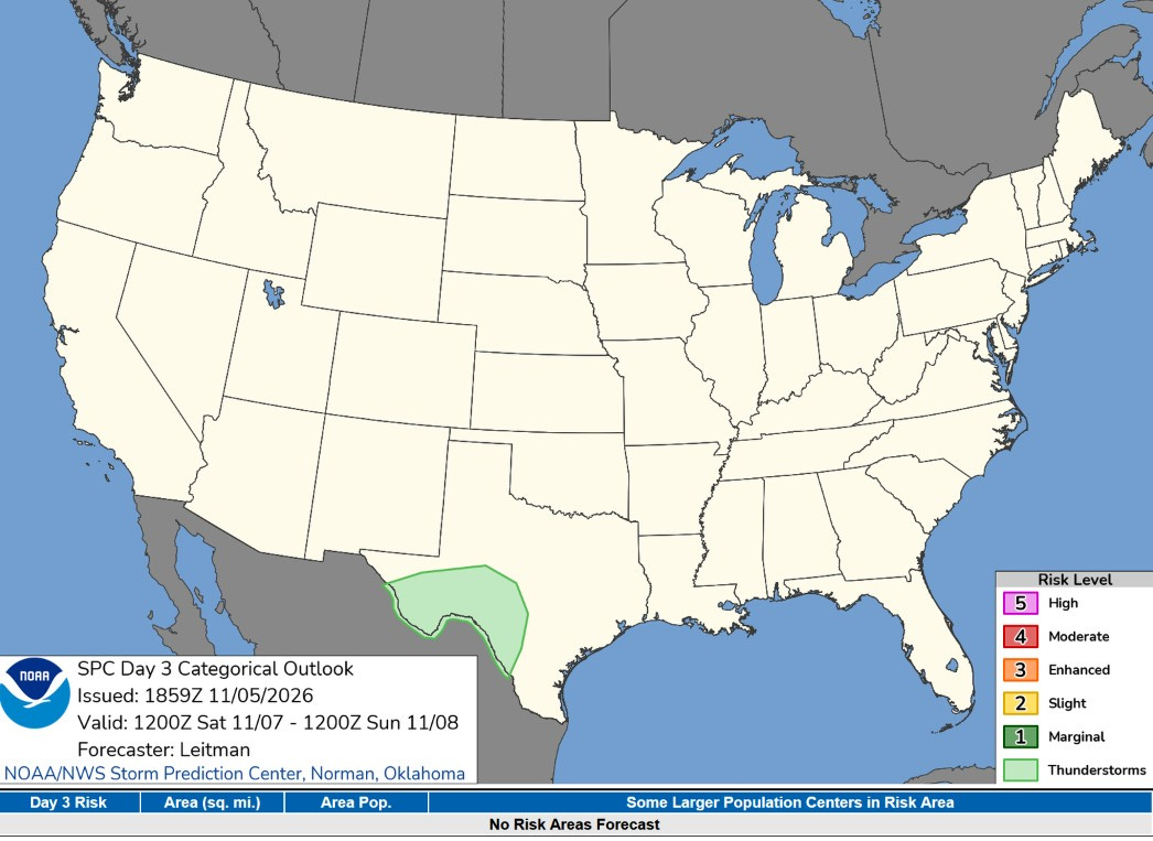
This is the Severe Weather Outlook Map for Saturday … only a chance of a non-severe storm in Southwest Texas.
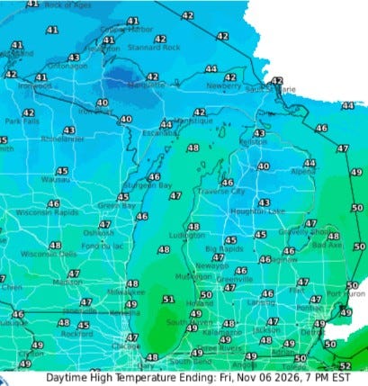
Today will be a cool day, with afternoon temperatures mainly in the upper 40s and a north-northwest wind at 10-20 mph. Gale warnings are out for Lake Michigan for waves up to 5-10 feet possible (15-25 knots at the lakeshore).
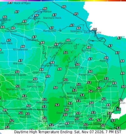
We’ll be several degrees warmer on Saturday, which will be partly to mostly sunny. The wind won’t be quite as strong as today. Look for highs in the mid-50s.
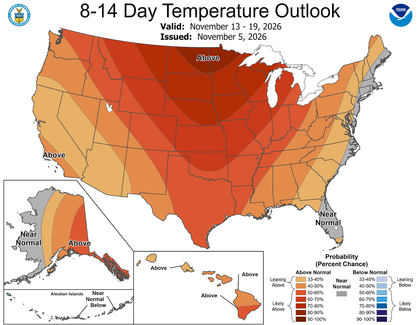
No change to the 8-14 day outlook. The really cold air stays in northern Alaska and northern Canada during the middle of November.
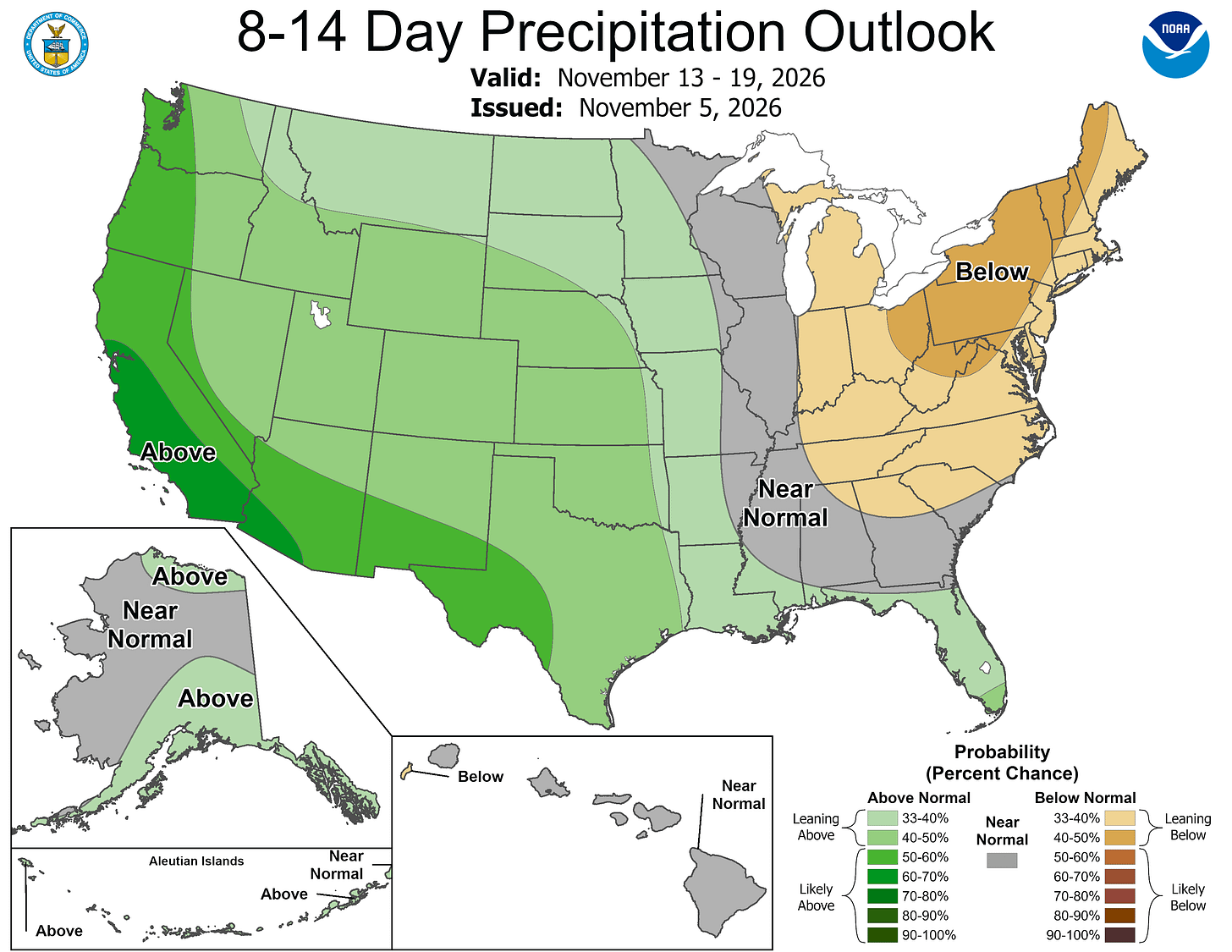
And once again, the Climate Prediction Center has all of Lower Michigan in below-average rainfall.
Five-day forecast
- Friday: Cloudy and breezy with a brief shower or two. High: 48 degrees. Tonight, mostly cloudy with a brief shower or two. Low: 42 degrees.
- Saturday: Times of clouds and sun. High: 49 degrees. In the evening, clouds breaking, with a low of 43 degrees.
- Sunday: Partly sunny, breezy and not as cool. High: 59 degrees. In the evening, mainly clear, with a low of 42 degrees.
- Monday: Partly sunny, with a high of 56 degrees. In the evening, clear and a steady breeze, with a low of 49 degrees.
- Tuesday: A steady morning breeze; otherwise, partly sunny, with a high of 57 degrees. In the evening, increasing cloudiness, with a low of 42 degrees.
— Subscribe to Bill Steffen's Substack.


