

Warm October fades: What to expect for Halloween, November. Get Bill Steffen's weekday forecast.
Expect mild trick-or-treating temperatures in the 50s this Saturday with a slight (30%) chance of light showers. Don't forget to set clocks back one hour at 2 a.m. Sunday for daylight saving time.

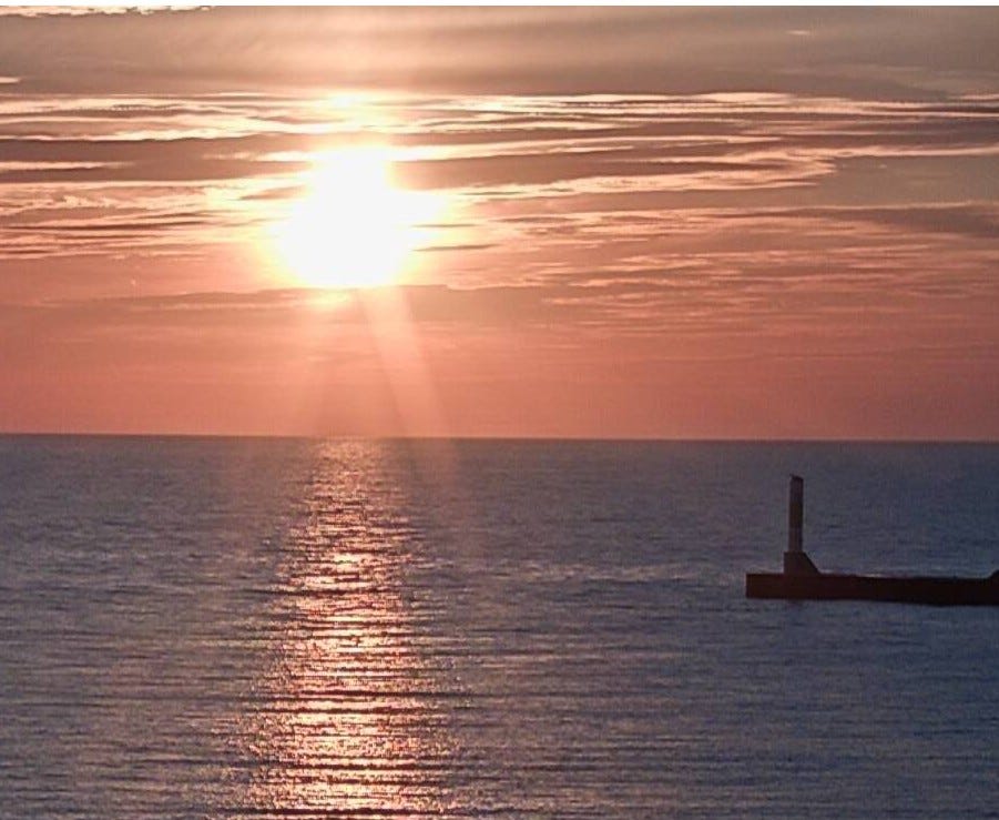
Here’s sunset at the Muskegon Channel Saturday evening. Sunset today (Monday) in Grand Rapids is at 6:42 p.m. and sunrise at 8:09 a.m. We’re down to 10 hours and 33 minutes of daylight. We’ll go down to nine hours of daylight on the Winter Solstice, which is at 3:50 pm on Dec. 21.
So far, the month of October is the third sunniest ever in Grand Rapids (74%). This is the third October in a row with well above average sunshine, after a very cloudy and dismal October in 2023 (data from Andy Schut). This month is running 4.1 degrees warmer than average (warm, but not a top ten warmest October. We still have had barely a quarter inch of rain (0.27 inches) since Oct. 2.
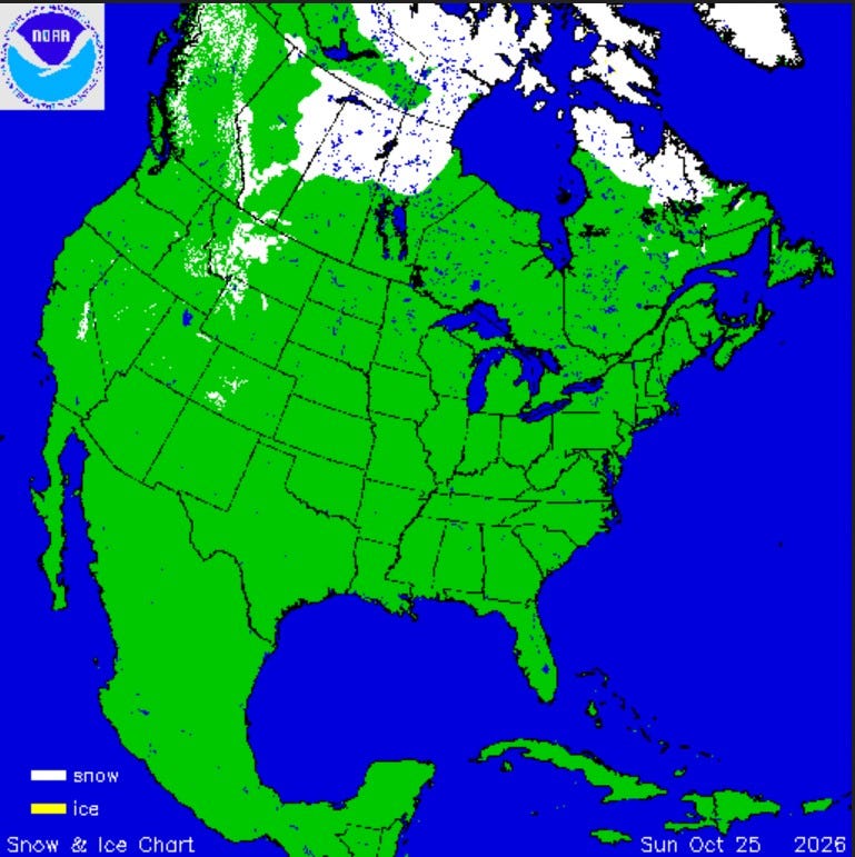
Here’s current North American snow and ice cover. You can see snow in the western mountains … the Sierra Nevada of California, the Uinta Mountains of northeast Utah, the mountains of Colorado, Wyoming and Montana. There’s also snow in northern Alberta, Saskatchewan and Manitoba and also far northern Quebec.
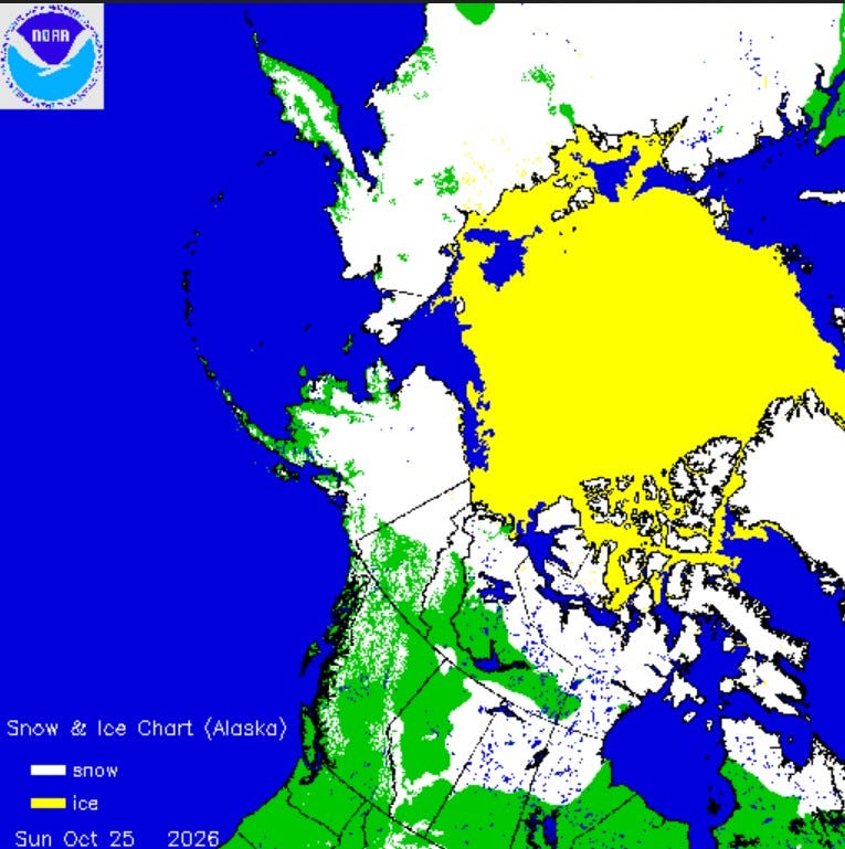
Here’s a look at the Arctic. Most of Alaska and Siberia have snow on the ground as does the northern Yukon and Nunavut.
The air that sits over that snow can get cold given the now low sun angle and long nights. There’s no sign of any significantly colder-than-average air moving south into the Great Lakes. Given the strong El Niño, odds are we’re in for a relatively mild winter with below to even much below-average snowfall.
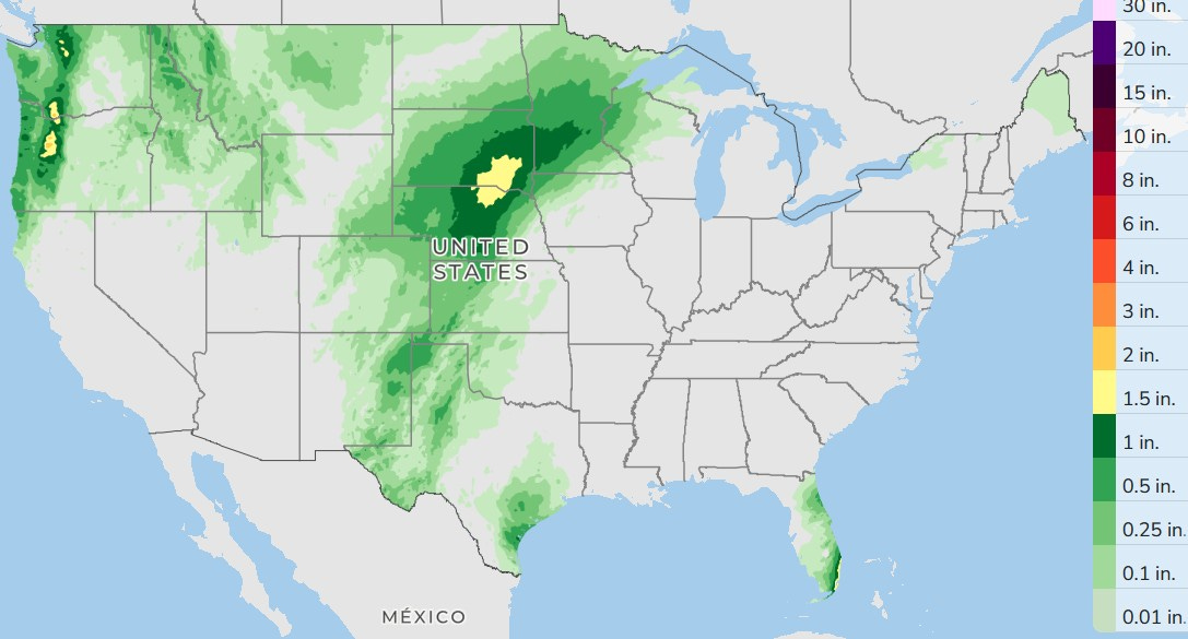
Here’s the three-day total rainfall. Lower Michigan stays dry today and tomorrow. We’ll see showers and a few thundershowers in the Plains and the Florida Peninsula. The Pacific Northwest will see some significant rain. The rain has moved out of Arizona.
The Colorado River has had well above average flow for the past 5.5 weeks. The water level of Lake Powell, a big reservoir on the Colorado River, is up 9.32 feet since September 14. That’s a lot. It still is 19.55 feet below the water level of one year ago (Oct. 25), but El Niño is usually a wet pattern for the Southwest U.S., so it’s likely reservoir levels will continue to climb during the winter.
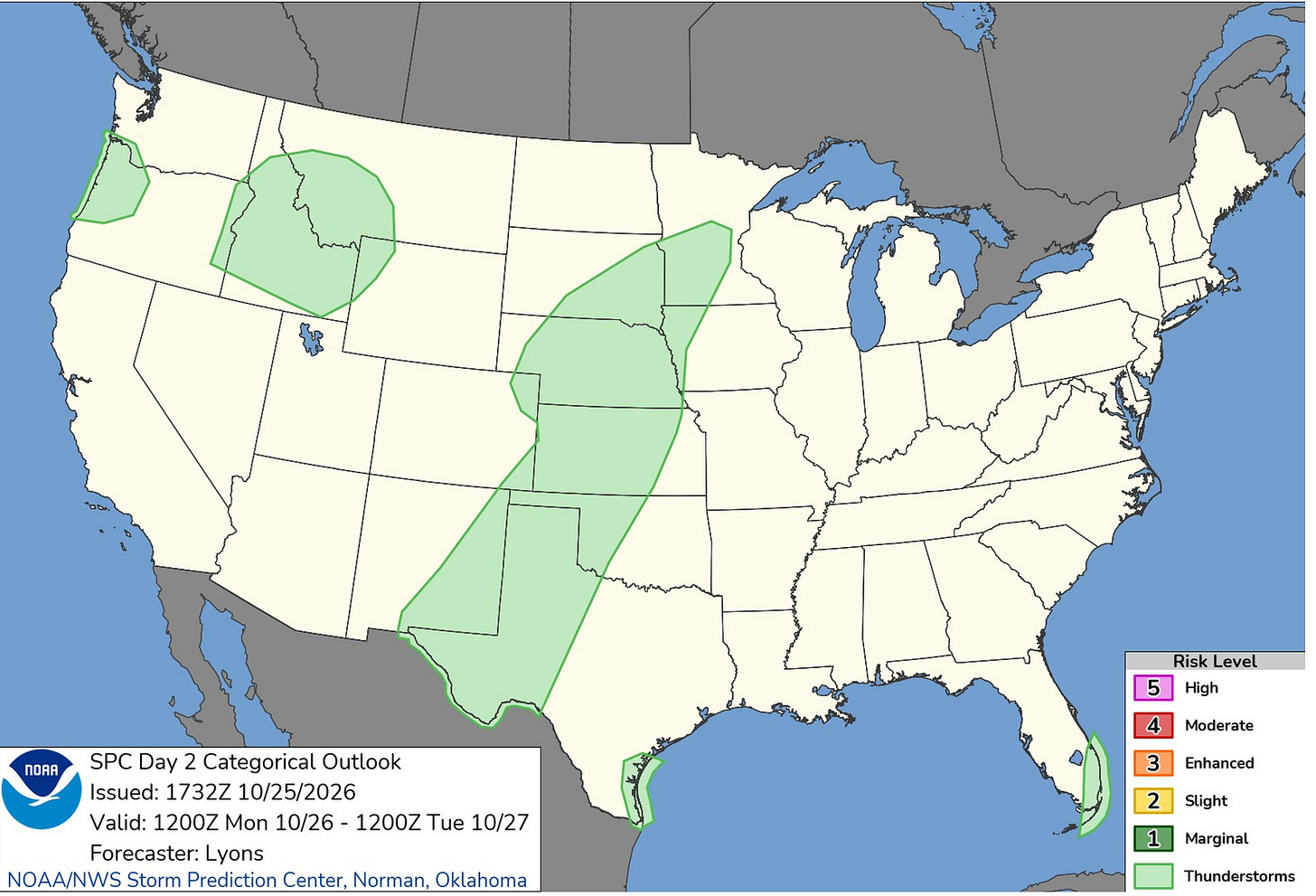
There were (as I type this) no severe weather reports in the U.S. on Sunday. Today (Monday), there are five areas outlined by the Storm Prediction Center for possible “General Thunderstorms.” Those are not severe. No storms in Michigan today.
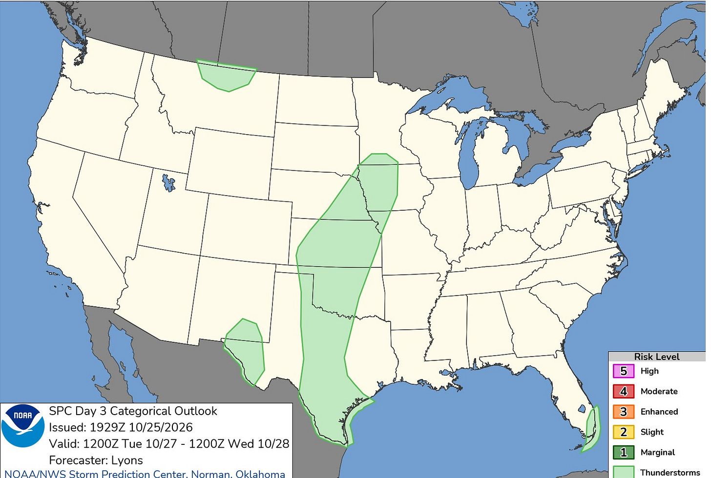
For Tuesday, there are no severe weather areas outlined. There will be a few non-severe storms in the Plains, north-central Montana and far southeast Florida. West Palm Beach, Florida, has had 8.87 inches of rain this month, nearly 4 inches above average.
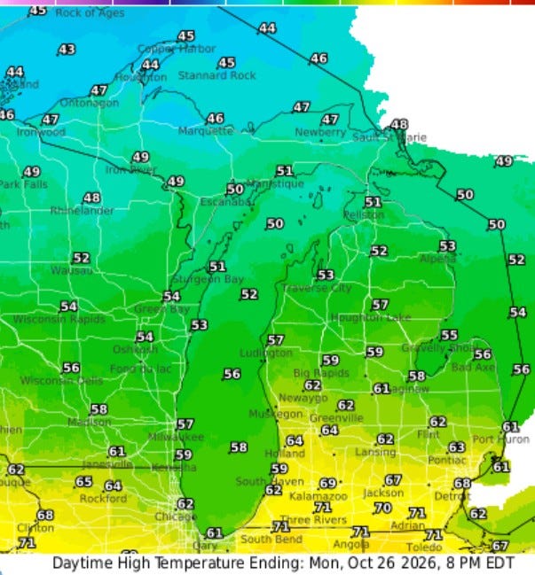
Today high temperatures will range from the low 70s south of I-94 to the mid-60s near I-96 to the mid-upper 50s at Lake Michigan to the 40s in Upper Michigan. Winds will turn to the northeast at 5-10 mph.
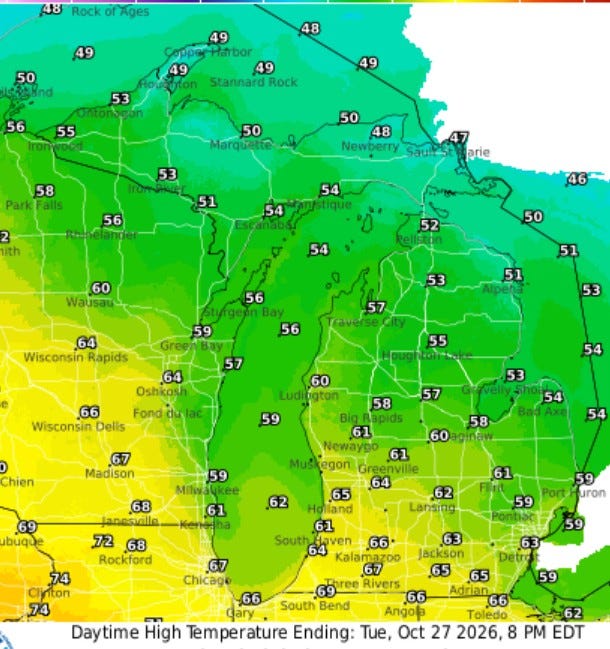
Here are high temperatures for tomorrow (Tuesday) … ranging from the upper 60s at the Indiana border to the upper 50s for Big Rapids and Mt. Pleasant. We’ll see partly to occasionally mostly cloudy skies and it should stay dry.
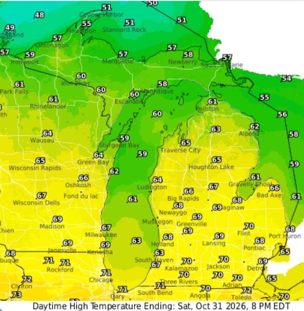
Here are afternoon high temperatures for Saturday (Halloween). We’ll see readings approach 70 south of I-94, low-mid 60s near Lake Michigan, and mid-upper 50s in the U.P. Temperatures will be in the low-mid 50s while the kids are trick-or-treating.
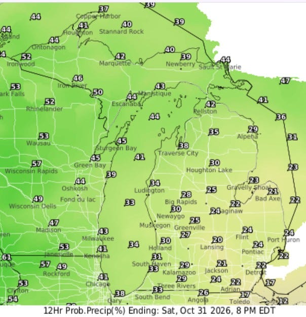
This is the percent chance of measurable rain on Halloween (Saturday). It’s about 30% in West Michigan and 40-50% in Upper Michigan. If we get rain, it would likely be light showers. The chance of rain will be higher later Saturday night and Sunday.
Remember, this weekend is the time change. We “fall back” an hour at 2 a.m. Sunday morning.
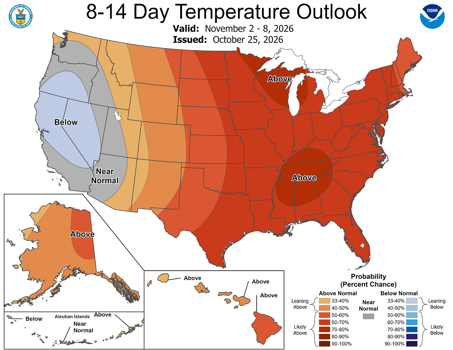
The same pattern keeps repeating. The latest 8-14 day outlook calls for above average temperatures in the eastern and central U.S. with near-to-below average temperatures in the West.
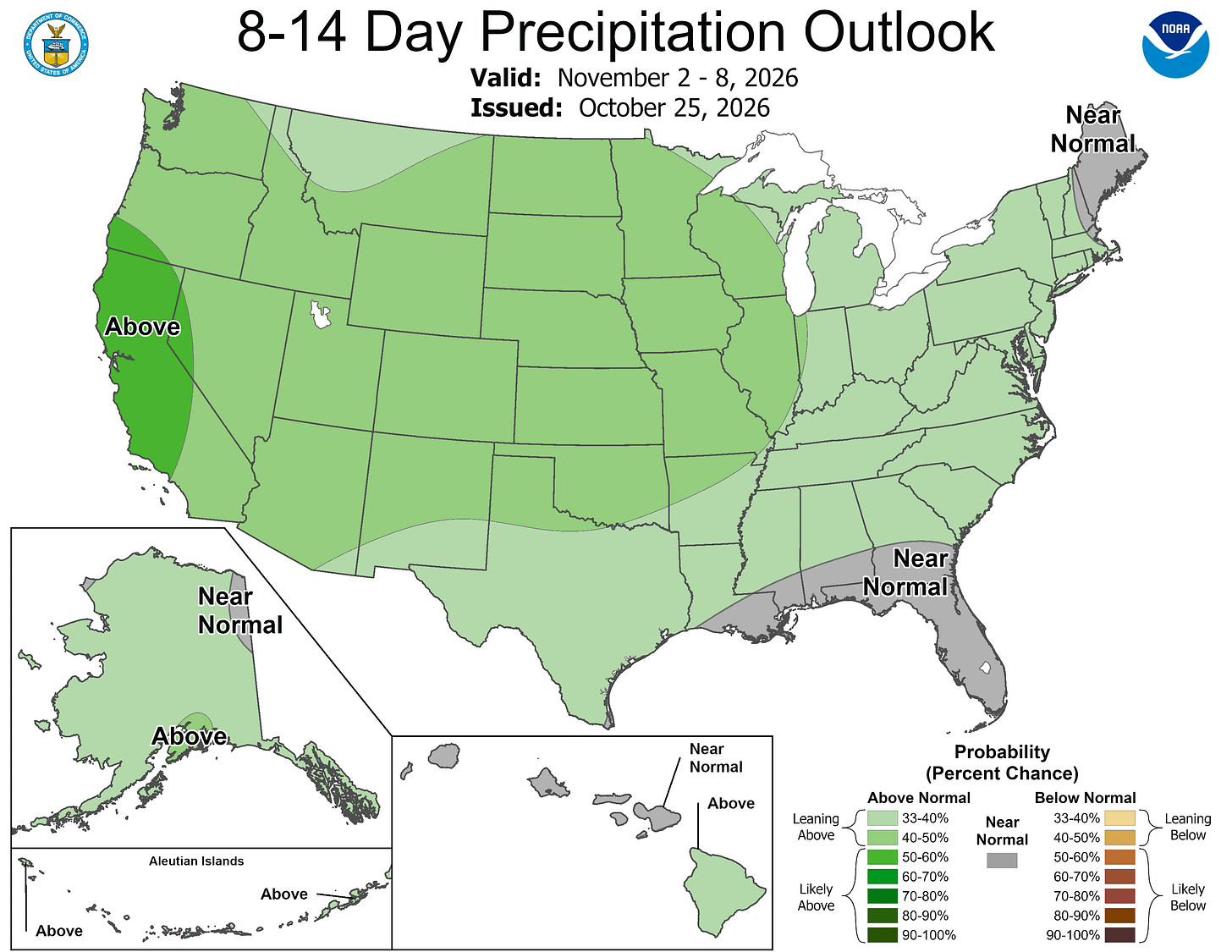
Much of the contiguous U.S. should see a little above average rainfall in the first week of November. Plan on a cloudier and wetter pattern that we’ve had for most of October.
Five-day forecast
- Monday: Cloudy, with a high of 64 degrees. Tonight, mostly cloudy with a low of 44 degrees.
- Tuesday: Cloudy, with a high of 65 degrees. In the evening, partly to mostly cloudy. Low: 52 degrees.
- Wednesday: Mostly sunny, with a high of 67 degrees. In the evening, increasing cloudiness. Low: 55 degrees.
- Thursday: Cloudy with a shower in spots; breezy in the morning. High: 64 degrees. In the evening, partly cloudy. Low: 48 degrees.
- Friday: Clouds followed by a brightening sky. High: 63 degrees. In the evening, partly cloudy with a couple of showers. Low: 48 degrees.
— Subscribe to Bill Steffen's Substack.


