

Blustery Friday brings lake-effect rain ahead of sunny weekend: Get Bill Steffen's weekend forecast.
A sharp drop in temperatures, gusty winds, and hazardous conditions along Lake Michigan highlight a cool weekend outlook for West Michigan, with gale warnings in effect and scattered frost on the horizon.

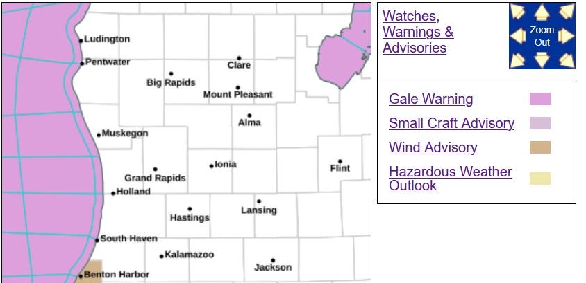
That pink/purple color indicates a Gale Warning today for Lake Michigan. There could be gusts up to 50 mph at the shore or over the open water. Inland areas could see gusts up to 40 mph. Waves on Lake Michigan could increase to 8-13 feet, with the highest waves in Berrien Co. and northern Indiana.
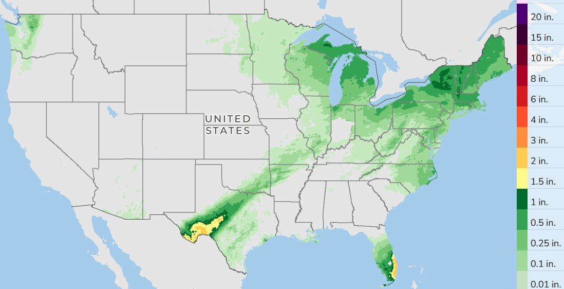
Here’s a wide view of forecast rainfall for the U.S. This does include rain that fell yesterday (Friday) evening and overnight. I had 0.36 inch at my house. There will still be some heavy rain and local flooding in a band of storms in Texas and heavy rain is possible along the east coast of the Florida Peninsula. It’ll be rainy Saturday in parts of the Northeast.
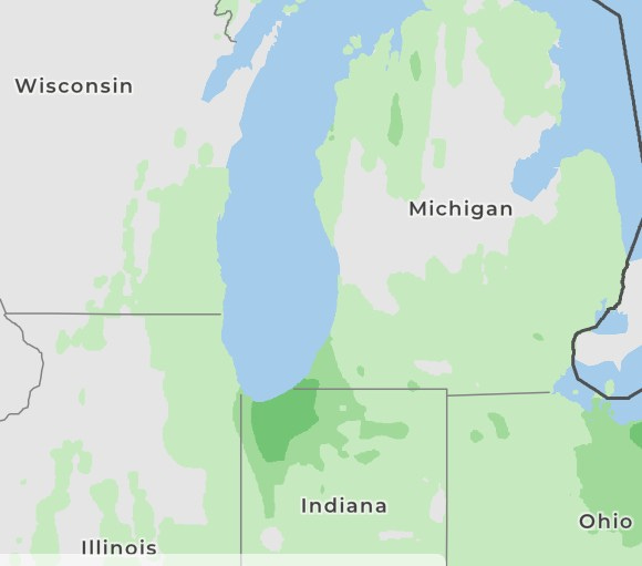
Here’s rainfall during the day today. There will be some lake-effect showers and possibly a lake-effect thunderstorm, as cold air comes over the relatively warmer waters of Lake Michigan. The water temperature at the Holland Channel is 61.5 degrees as I type this.
With a more northerly wind, the most significant showers will be in Berrien County and in northwest Indiana.
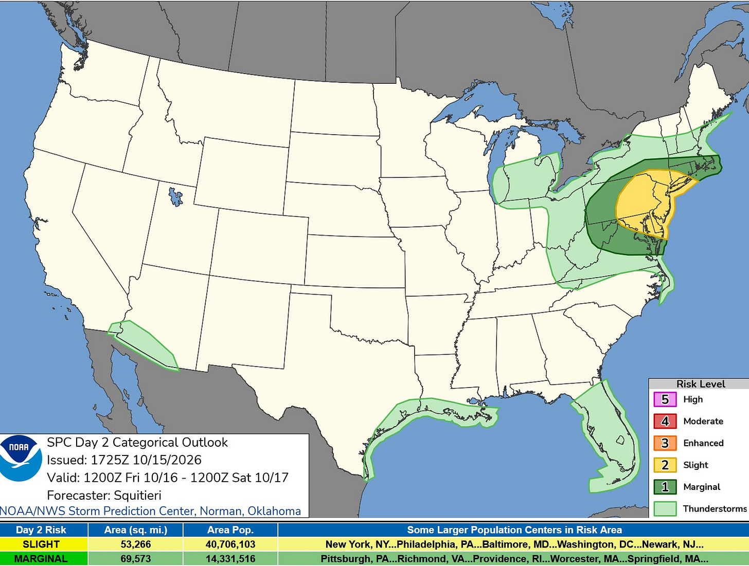
Here’s the Severe Weather Outlook Map for this Friday from the Storm Prediction Center. There is a level 2 Slight Risk in yellow on the map above. It covers all of New Jersey and Delaware and parts of Pennsylvania, New York and Connecticut.
Note the light green over southern and central Lower Michigan. You could see a flash of lightning or hear a rumble of thunder today in a few of these showers.
Non-severe storms are possible in southern Arizona, along the Gulf Coast of Texas and Louisiana, and in the Florida Peninsula.
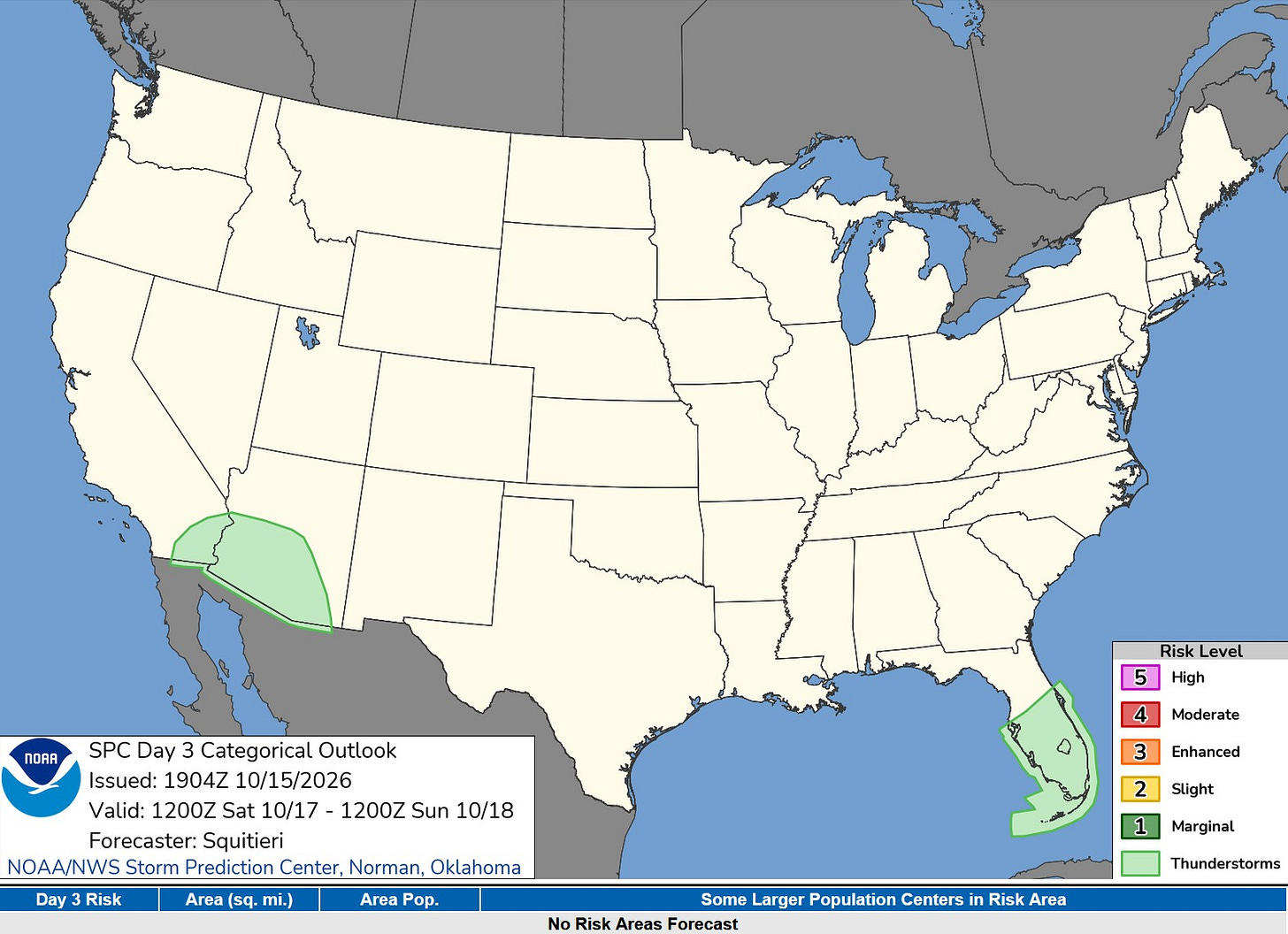
This is the Severe Weather Outlook Map for Saturday. No risk areas are outlined. Non-severe thunderstorms are possible in southern Arizona and southeast California and also in the Florida Peninsula.
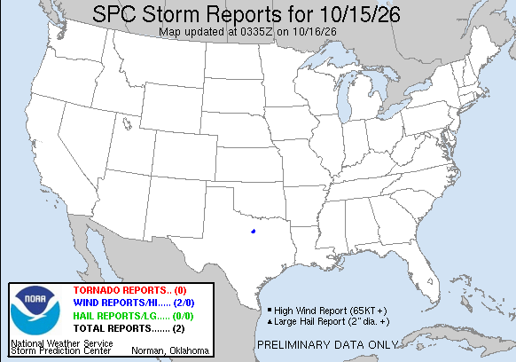
There were only two severe weather reports in the U.S. on Thursday, both in Parker County, Texas. A roof and porch were taken off, along with tree damage near Brock, Texas, and power lines were toppled at Weatherford, Texas.
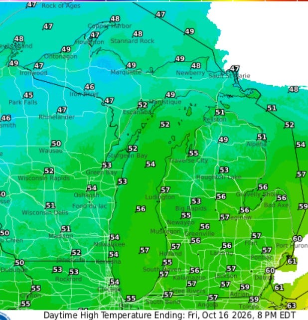
Here are high temperatures for this Friday. These will occur in the early morning, with readings falling to the mid- to upper 40s by evening. Winds will be brisk, generally 15-25 mph with gusts to 40 mph possible inland and 50 mph at Lake Michigan. It’ll be a good day to stay off the piers and breakwaters.
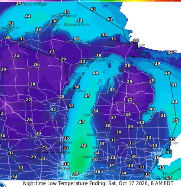
Here’s the forecast low temperatures for early Saturday morning. Most readings will bottom out in the low-mid 30s with some upper 20s in the usual cold spots like Big Rapids and Baldwin. It’ll hold in the low 40s from Muskegon south along the lakeshore. Scattered frost is likely, esp. north of Grand Rapids.
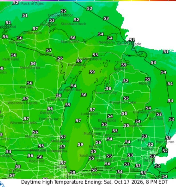
The weekend looks mostly sunny. Temperatures will bounce up to the mid-50s in the afternoon. Winds won’t be as strong as Friday (generally west at 10-15 mph). Sunday should be a good 5 degrees warmer.
Five-day forecast
- Friday: Mostly cloudy and breezy with rain tapering to a couple of showers; the chilliest day since spring; gusty winds can blow around unsecured objects. High: 58 degrees. Tonight, partly sunny, with a low of 54 degrees.
- Saturday: Partly sunny, with a high of 54 degrees. In the evening, clear. Low: 48 degrees.
- Sunday: Stiff winds with plenty of sunshine. High: 61 degrees. In the evening, clear and a steady breeze. Low: 47 degrees.
- Monday: Plenty of sunshine. High: 62 degrees. In the evening, partly cloudy, with a low of 44 degrees.
- Tuesday: Comfortable with more sun than clouds. High: 64 degrees. In the evening, clear, with a low of 45 degrees.
— Subscribe to Bill Steffen's Substack.


