

Warm start, but big weekend chill is on the horizon. Get Bill Steffen's weekday forecast.
Saturday looks to be the warmest day of the month of October. Chance of rain will return on Monday.

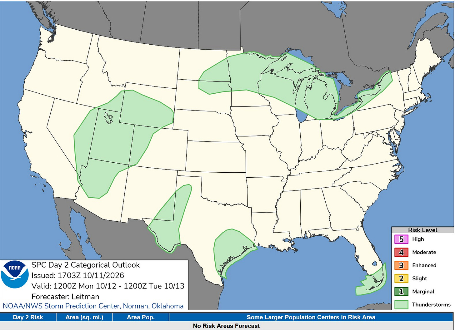
This is the Severe Weather Outlook Map for today and tonight. The light green areas (including Lower Michigan) have a chance of a non-severe thunderstorm. The most likely time for a thunderstorm would be overnight into early Tuesday.
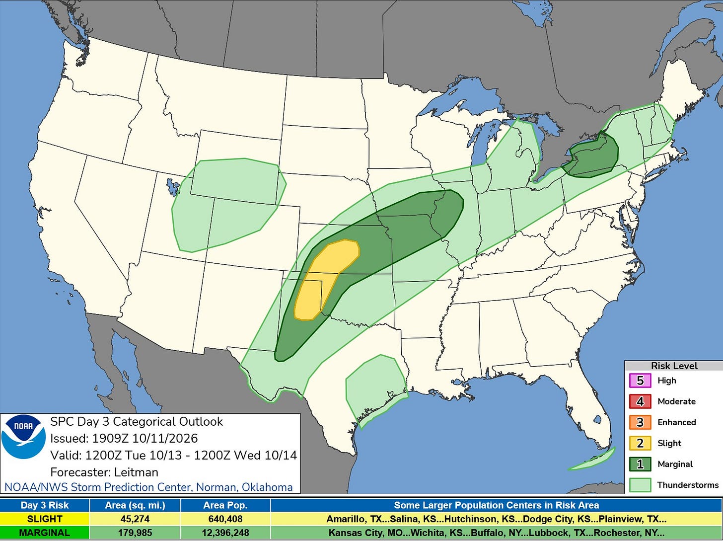
Here’s the Severe Weather Outlook Map for Tuesday. There’s a level 2 Slight Risk Area from northeast Texas up into central Kansas. That’s surrounded by a level 1 Marginal Risk Area (in dark green on the map) that comes up into Illinois. There is still a chance of a thunderstorm in most of Lower Michigan. The showers and any thundershowers will be spotty and total rainfall is expected trend toward the lighter side.
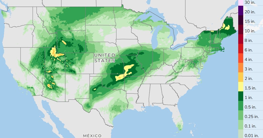
Here’s the three-day total forecast rainfall. There’s one more day of rain from the remains of Hurricane Rachel in the west. The remains of Hurricane Isaias will move through New England. In the central U.S., a slow-moving front will provide the focus for showers and thunderstorms.
A few showers and isolated thundershowers are likely in Lower Michigan
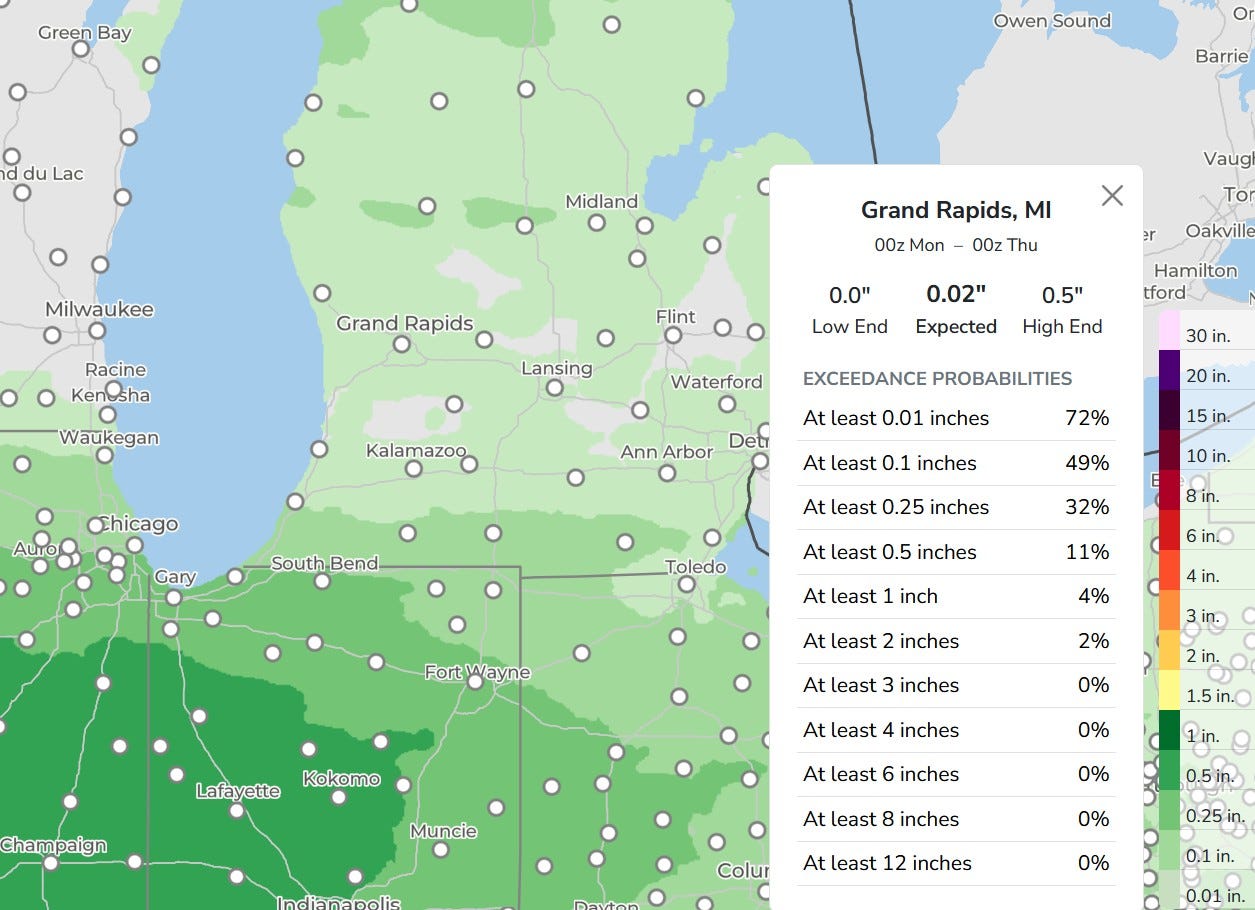
Here’s a zoomed-in map of 3-day total rainfall. Grand Rapids gets only .02 inch, but the high end is 0.5 inch. That means some places could get 1/2 inch while quite a few areas may get only 1/10 inch or less. This model gives G.R. a one-third chance of 1/4 inch.
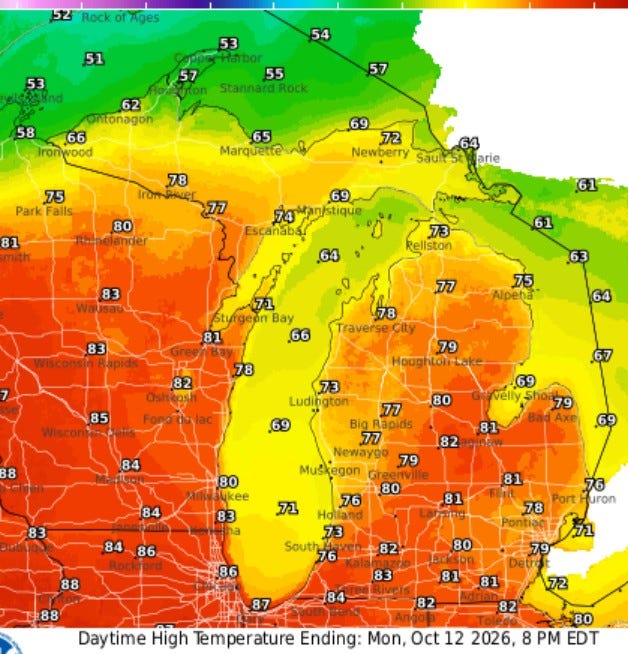
Here are high temperatures for this Monday … low 80s from Grand Rapids to the south … cooler up north, just 50s in the Keweenaw. Chicago reaches a sizzlin’ 86. It was warm, but not unbearable for the Chicago Marathon on Sunday (I know some people who went down for that.
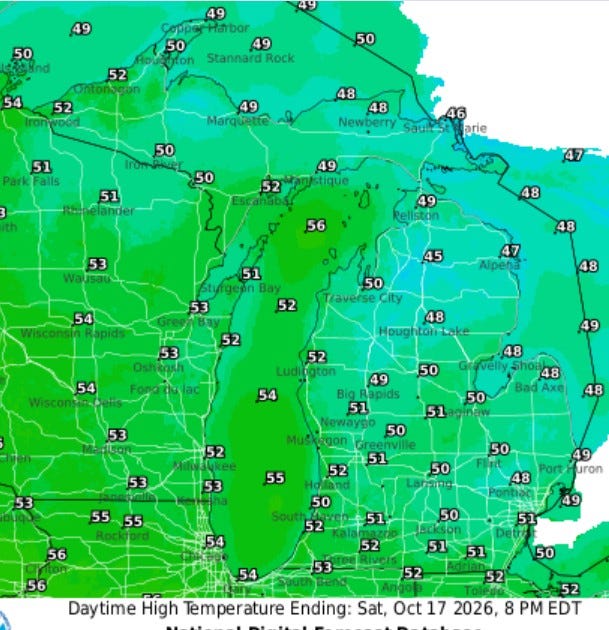
Now … this is Saturday … with a big change coming. The computer model gives West Michigan temperatures in the low 50s here Friday evening and during most of the day on Saturday, so you’ll need a jacket if you’re headed to a football game. Some 40s are showing up in northern Lower and Upper Michigan.
But the cool air will be short-lived as relatively mild air builds back for the third week of October.
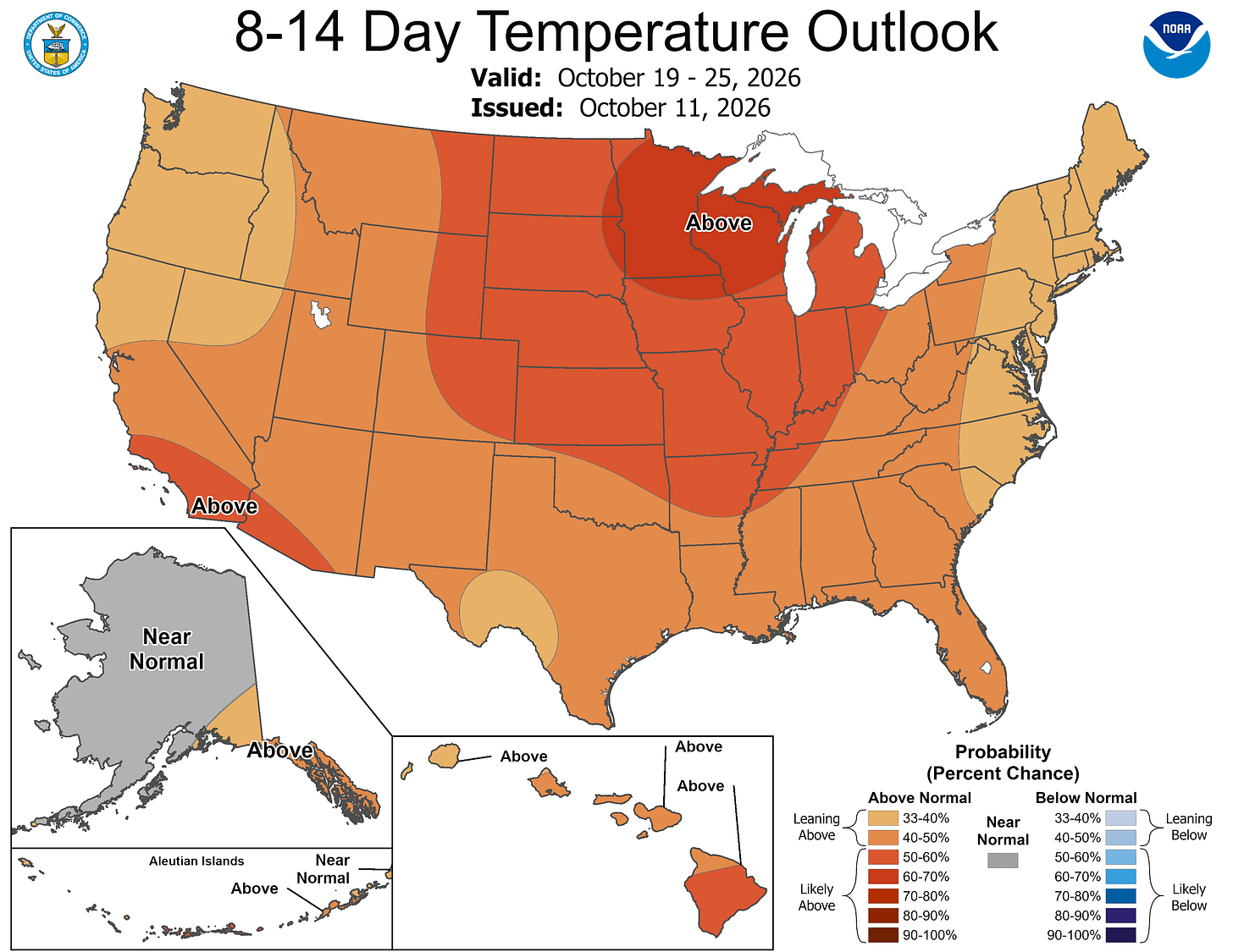
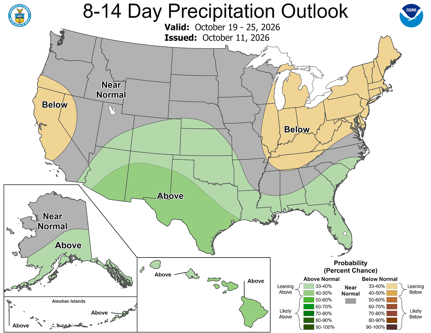
We continue with below-average rainfall. So, that means we should see some sunshine for what should be the peak of the fall colors across Lower Michigan.
It is Columbus Day and Indigenous Peoples Day. Remember it’s a federal holiday. Federal Closures: Non-essential federal government offices, federal courts, and the U.S. Postal Service (USPS) are closed, so no mail today.
Five-day forecast
- Monday: Warm with periods of clouds and sunshine, with a high of 75 degrees. Tonight, warm with shifting clouds and sun, with a low of 72 degrees.
- Tuesday: Warm with shifting clouds and sun. High: 72 degrees. In the evening, overcast with a low of 55 degrees.
- Wednesday: Less humid with intervals of clouds and sunshine. High: 64 degrees. In the evening, clear to partly cloudy with a low of 48 degrees.
- Thursday: Times of clouds and sun, with a high of 59 degrees. In the evening, periods of rain; breezy late. Low: 50 degrees.
- Friday: Very windy; times of clouds and sun with a couple of showers. High: 57 degrees. In the evening, breezy in the evening; otherwise, clear. Low: 41 degrees.
— Subscribe to Bill Steffen's Substack.


