

Fall equinox comes with cooler temps, dry conditions. Get Bill Steffen's weekend forecast.
The weather has already turned more like autumn and now the calendar is going to turn us from summer to fall. The Autumn Equinox is Tuesday at 8:04 p.m.


The weather has already turned more like autumn and now the calendar is going to turn us from summer to fall. The Autumn Equinox is Tuesday at 8:04 p.m., to be exact. The word “equinox” means equal night and on the two equinoxes, we have almost exactly 12 hours of daylight at every location on the planet.
I say “almost” because there are two factors that make the day officially a few minutes more than 12 hours. First, we measure sunrise as the very first ray that comes from the top of the sun. Sunset is when the last ray of the sun disappears from the top of the sun. So, we don’t measure sunrise and sunset from the middle of the solar disk.
Second, light from the sun bends just a bit as it enters the Earth’s atmosphere. So we gain a couple of minutes of daylight. The official Grand Rapids sunrise and sunset for Tuesday are 7:29 a.m. and 7:39 p.m. We continue to lose daylight at the rate of nearly three minutes per day.
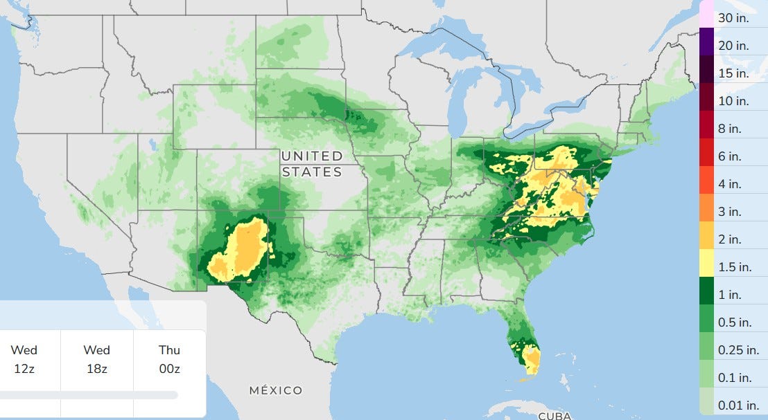
While the chance of a shower today isn’t exactly zero, it’s only about 10% and that's toward the Indiana border. This is the three-day total rainfall forecast and you can see the entire state of Michigan is dry.
Look at the rain in New Mexico. That’s a large area of 1-2.5 inches. The rain will be over three days as moisture comes north from tropical storms off the coast of Mexico. There will also be significant rain in the Mid-Atlantic and in South Florida. Fort Lauderdale added another 0.89 inch of rain on Sunday, taking them up to 17.14 inches of rain in the month of September … and that’s without a hurricane or tropical storm.
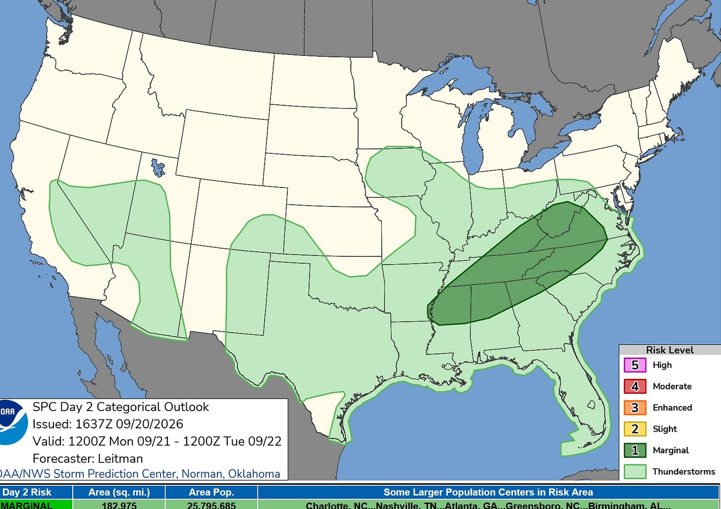
The Severe Weather Outlook Map for this Monday shows a large area of level 1 Marginal Risk from the Mississippi River to Virginia. Isolated wind damage will be the primary threat.
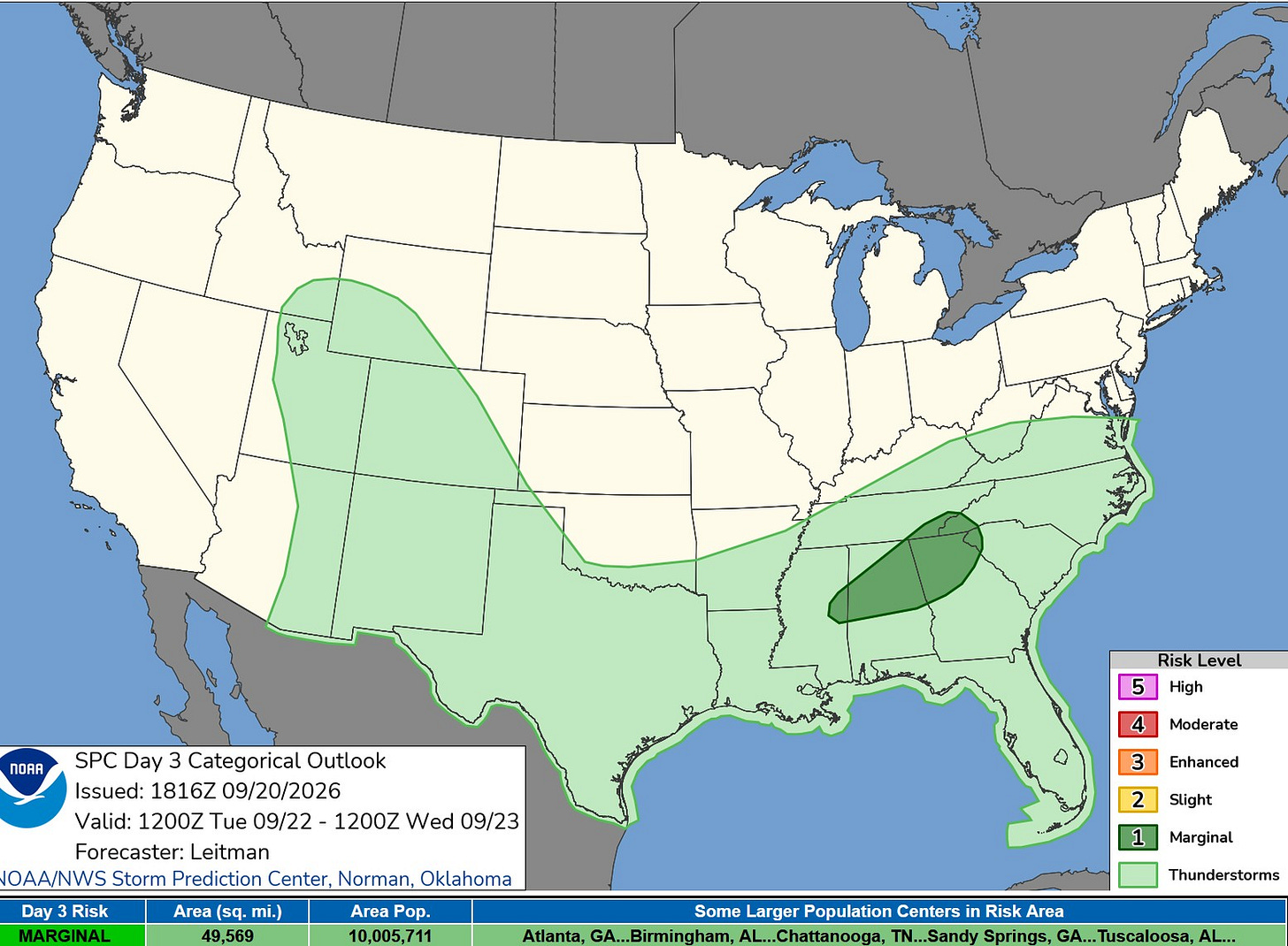
The Severe Weather Outlook Map for Tuesday shows a smaller Marginal Risk from eastern Mississippi to the western tip of the Carolinas.
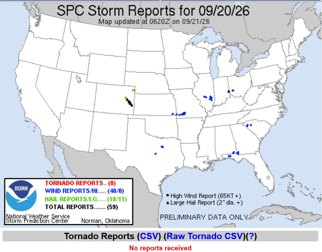
Here are severe weather reports from Sunday … mostly a few trees and power lines down. There was one severe thunderstorm in eastern Colorado that left a swath of large hail over an area more than 50 miles long, with hail at a couple of spots over three” in diameter.
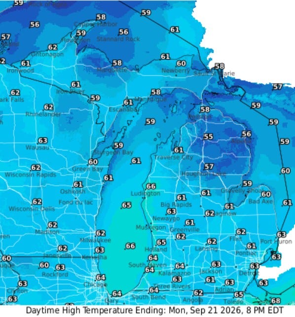
Here’s the forecast high temperatures for this Monday … mostly mid-60s in southern Lower Michigan, with some 50s in northern Lower Michigan. The map is colored blue. At some point, they will adjust the color palette on this graphic.
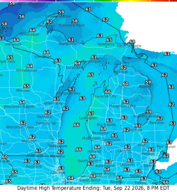
About the same tomorrow, with highs again in the 60s statewide. Winds will continue to come from the northeast and east much of this week. This will bring in noticeably drier air. You should notice lower humidity levels this week in Michigan.
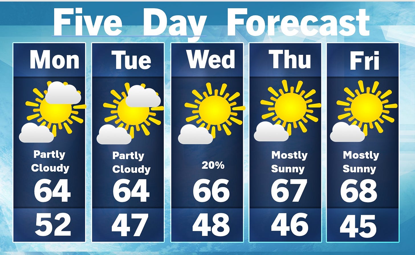
The five-day forecast shows dry weather prevailing with maybe a one in five chance of a light shower late Tuesday into early Wednesday. Highs will be a touch cooler than average in the mid-60s (average is low 70s).
Five-day forecast
- Monday: Breezy at times with more clouds than sun. High: 63 degrees. Tonight, partly cloudy and chilly. Low: 45 degrees.
- Tuesday: Breezy at times in the morning; otherwise, intervals of bright sunshine. High: 64 degrees. In the evening, overcast skies with a low of 48 degrees.
- Wednesday: A thick cloud cover with a passing shower. High: 68 degrees. In the evening, clear with a low of 49 degrees.
- Thursday: Plenty of sun with a high of 69 degrees. In the evening, clear to partly cloudy with a low of 49 degrees.
- Friday: Partly sunny with a low of 67 degrees. In the evening, expect clear skies with a low of 47 degrees.
— Subscribe to Bill Steffen's Substack.


