


Warm weekend, cold front will move in next week. Get Bill Steffen's weekday forecast.
Unseasonably warm, sunny weather in the low-to-mid 60s continues Friday and Saturday before Sunday rain ushers in a sharp cooldown. Temperatures drop into the upper 30s and 40s next week, with possible pre-Thanksgiving flurries and continued below-average precipitation.

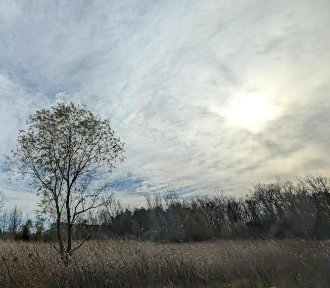
Here’s a picture of the sun shining through a band of high-level clouds Thursday. There are still a few trees that have a few leaves on them, but most of the leaves are down now.
The high temperature Thursday was 62 degrees in Grand Rapids. That was 16 degrees warmer than average. We could be a few degrees warmer than that today (Friday) and tomorrow (Saturday).
In the past few days, I’ve had a lot (several hundred) of flies on the sides of my house. It’s not an Exodus-level invasion, but still pretty crazy. Only a couple of flies made it into the house. I’ve also had two good-sized yellow jackets in the basement … and one stinkbug.
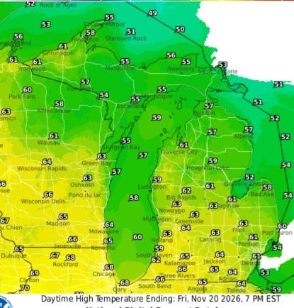
Here’s the forecast high temperatures for today (Friday). Inland areas should see highs in the mid-60s (mid-50s at Lake Michigan). The relatively warm air extends north to the U.P., where highs will be in the mid-50s to near 60 degrees.
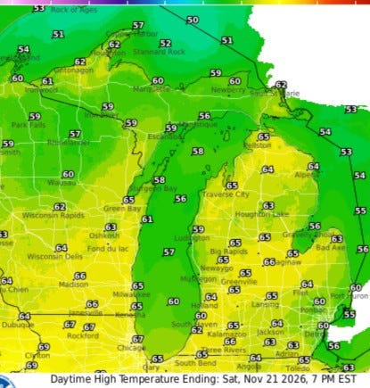
Saturday, we’ll be back in the mid-60s, 20 degrees warmer than average. Plus, we’ll be mostly sunny. Saturday will be the last mostly sunny day. Look for rain showers on Sunday with temperatures in the low to mid-50s. Then, we’ll only be around 40 degrees on Monday.
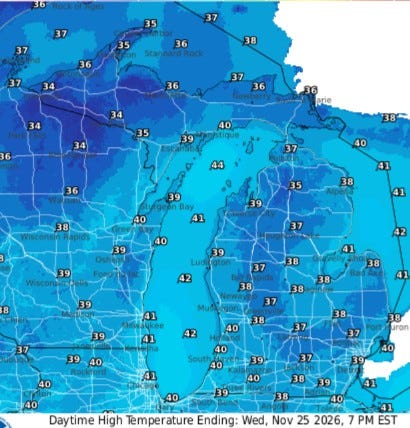
This map shows high temperatures for next Wednesday, the day before Thanksgiving. Readings should be back to the upper 30s to near 40. It’s going to be cold enough that we could be flirting with flurries.
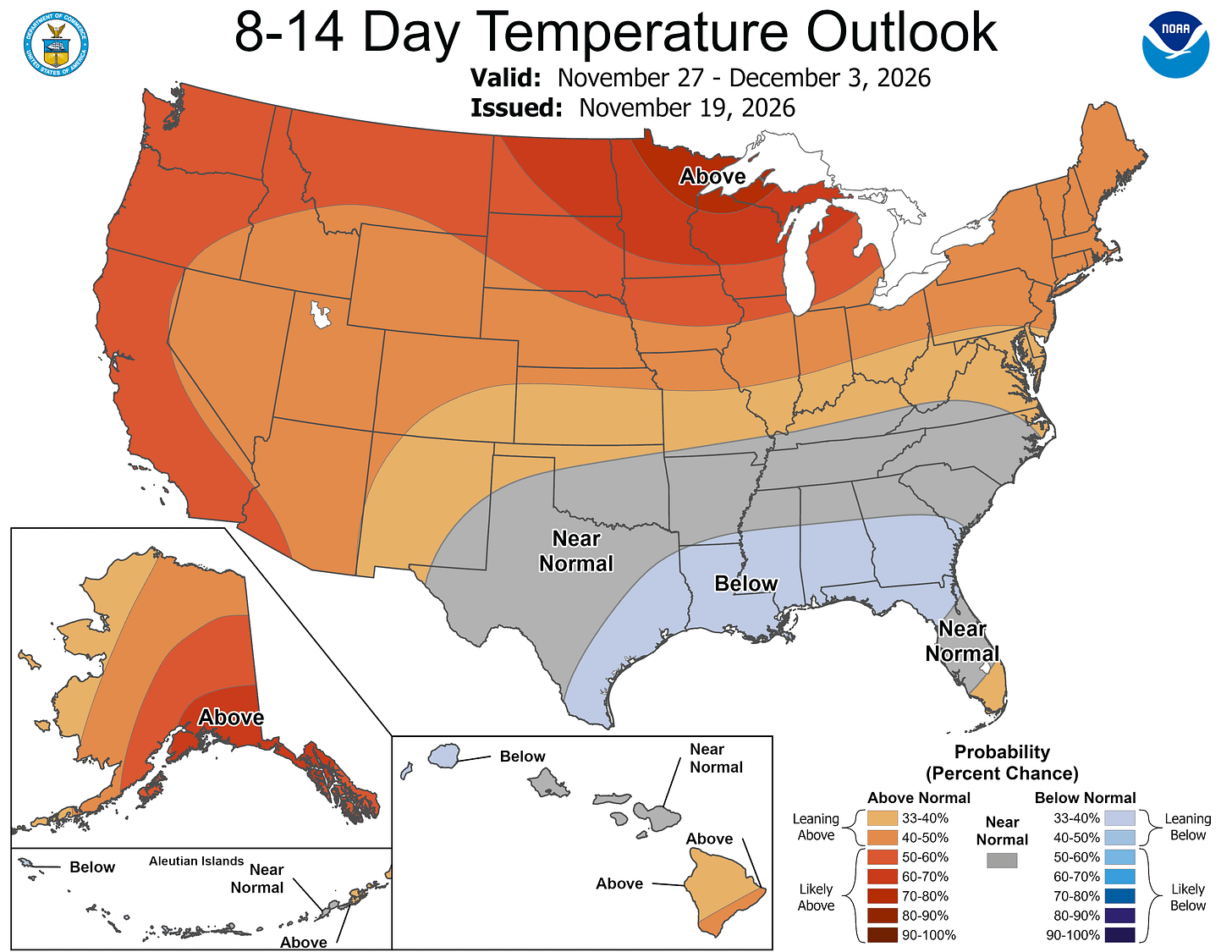
Here’s the latest 8-16 day temperature forecast for Nov. 27-Dec. 3. This is a typical El Niño pattern with above-average temperatures in the northern U.S. and below-average temperatures along the Gulf of Mexico/America.
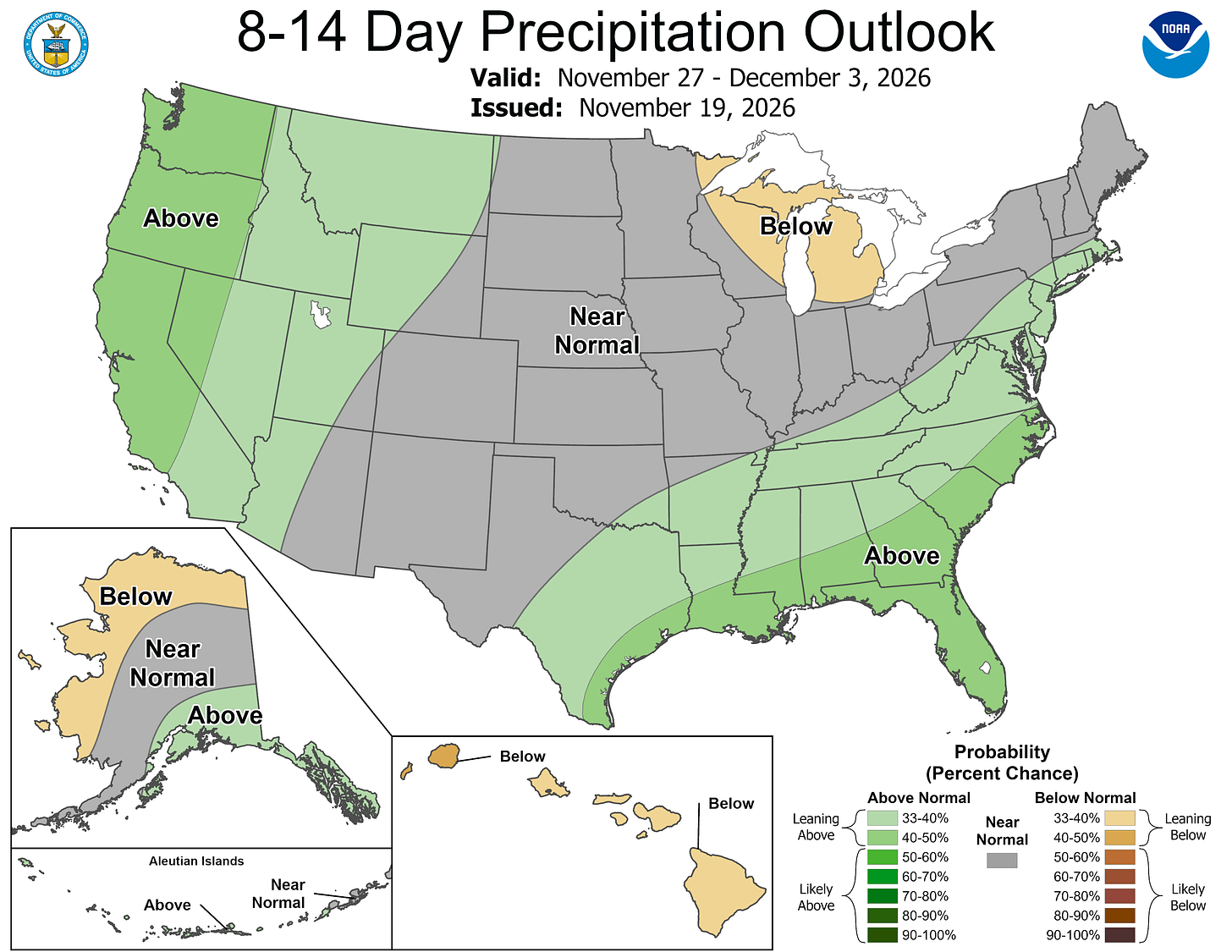
Precipitation is expected to continue to be below average in Michigan, with above-average rainfall along the West Coast and across the southern U.S.
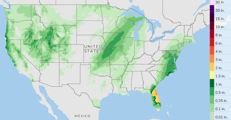
Here’s the forecast total precipitation for the next three days (Friday-Sunday). We’ll get a little rain on Sunday in Lower Michigan, with amounts ranging from 1/10th to 1/4 inch. Grand Rapids has had only 0.51” of rain this month; average to date is 1.46 inches. So, that’s just 35% of average.
Five-day forecast
- Friday: Partly sunny and warm, with the temperature approaching the record high of 65 set in 1953. High: 62 degrees. Breezy this evening; otherwise, mainly clear. Low: 48 degrees.
- Saturday: Mostly sunny, breezy and warm, with the temperature approaching the record high of 65 set in 1953. High: 63 degrees. In the evening, breezy in the evening; otherwise, becoming cloudy.
- Sunday: Cloudy with a steady breeze; a couple of afternoon showers. High: 56 degrees. In the evening, breezy in the evening with a passing shower; otherwise, mostly cloudy. Low: 38 degrees.
- Monday: Breezy in the morning; otherwise, mainly cloudy and cooler. High: 44 degrees. In the evening, mainly cloudy, with a low of 29 degrees.
- Tuesday: Chilly with sunshine and some clouds. High: 39 degrees. In the evening, clear to partly cloudy with a low of 27 degrees.
— Subscribe to Bill Steffen's Substack.


