


Dry, pleasant; frost coming. Get Bill Steffen's weekday forecast.
A colder air mass arrives by Wednesday evening, and we’ll only be in the low-mid 40s on Thursday and Friday. Friday morning we’ll likely see frost and a freeze.

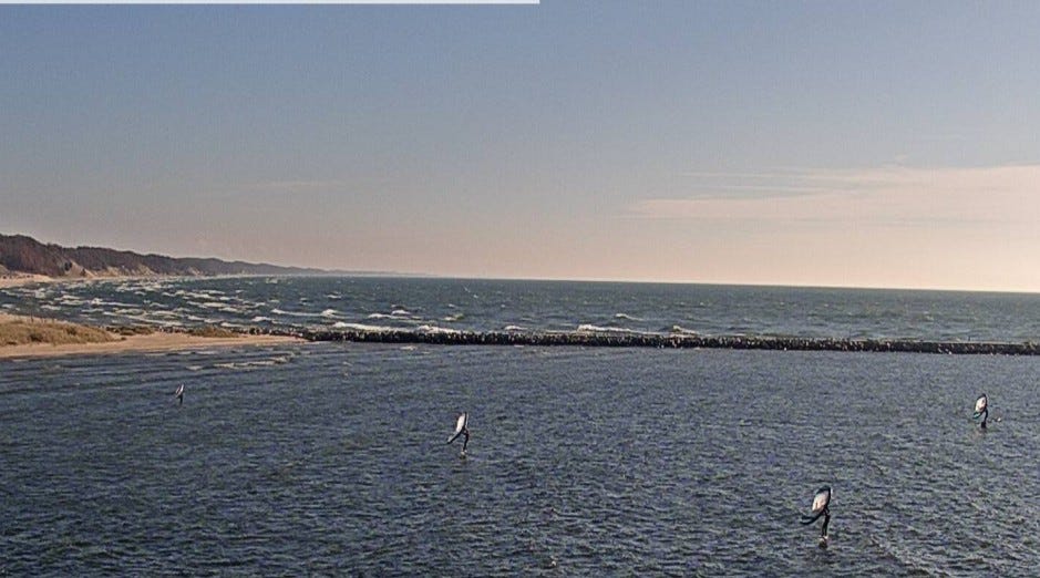
This late-afternoon picture is from the Muskegon GLERL camera at the Muskegon Channel. Four sailboarders were out on the water. They were behind the breakwater, where the waves would be smaller.
We’ve had three days in a row with a low temperature of 37 degrees. The average high temperature is now down to 50 degrees. The first week of November was 9.4 degrees warmer than average. We’ll stay mild today and tomorrow. A colder air mass arrives by Wednesday evening, and we’ll only be in the low-mid 40s on Thursday and Friday. Friday morning we’ll likely see frost and a freeze.
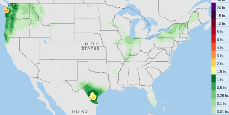
Here’s the forecasted three-day rainfall totals for Monday through Wednesday. Two areas of heavy rain are possible … one in South Texas and along the Washington coast.
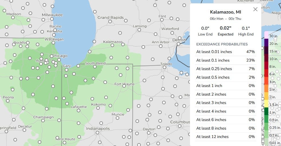
Here’s a zoomed-in look at three-day total rainfall for the southern Great Lakes areas. This rain is expected here on Wednesday, mainly in the afternoon. Monday and Tuesday will be dry. We’re looking at a few hundredths of an inch mainly south of I-94. Rain may hold off until late afternoon or evening for areas north of a line from Holland to Lansing. We’ll likely see some showers Wednesday night into Thursday.
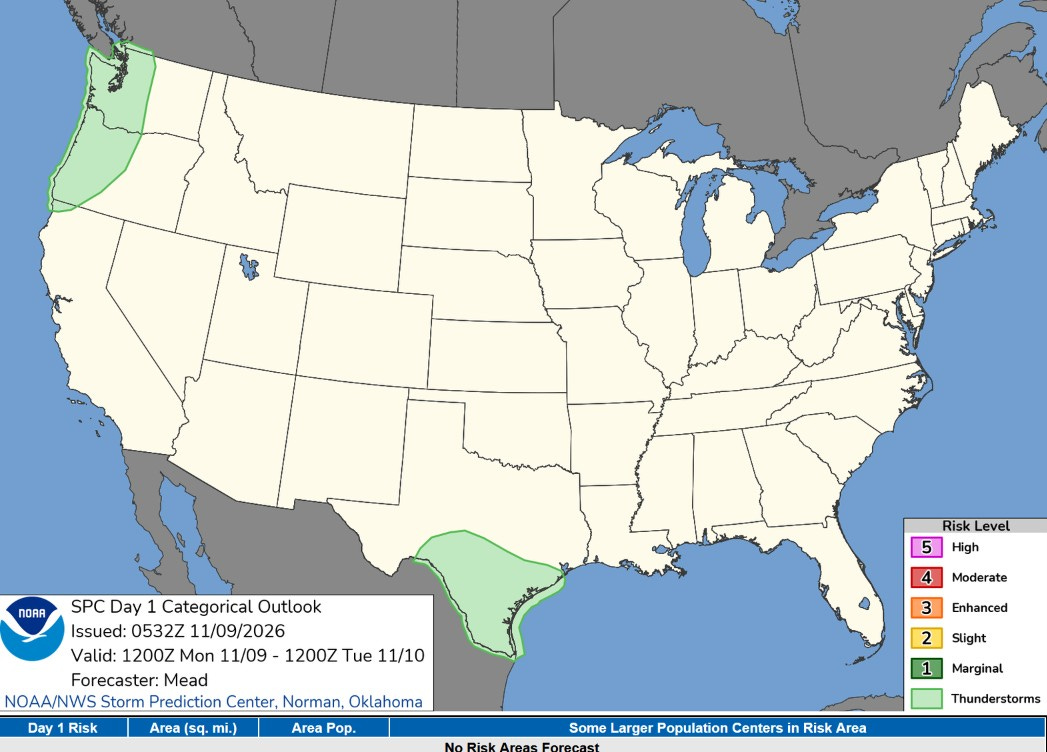
We’ve had no severe weather reports in the U.S. since Nov. 3. That’s good. Today there will be a few thundershowers in South Texas and a chance of a random flash of lightning in coastal Washington and Oregon.
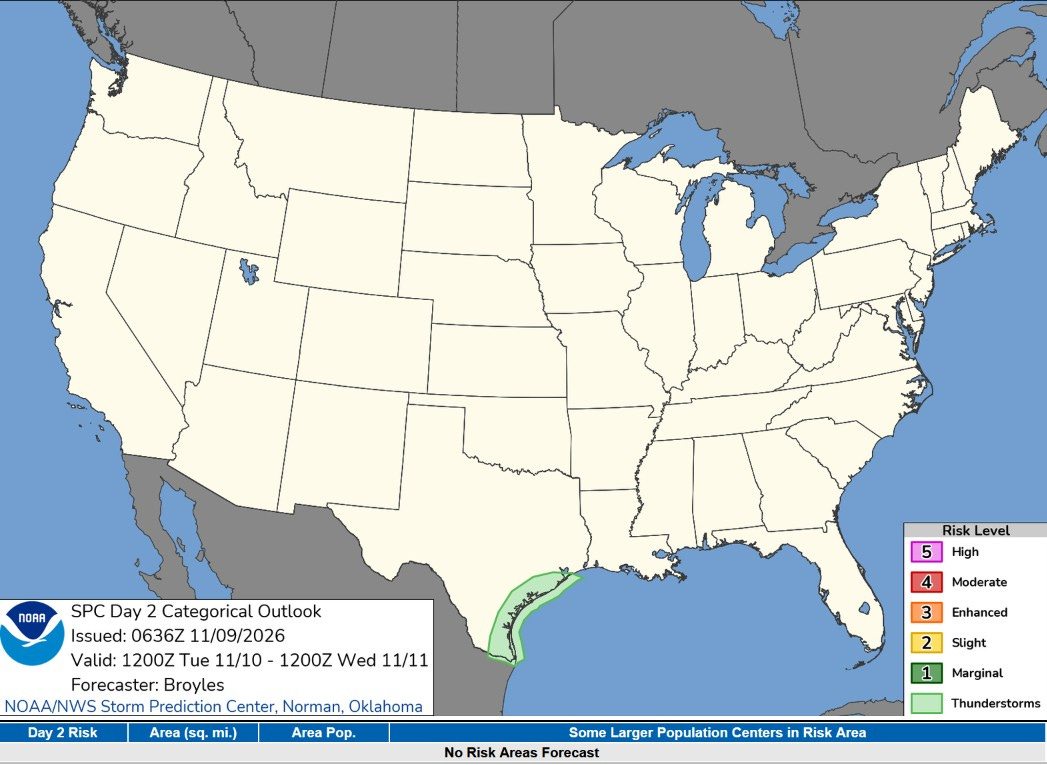
On Tuesday, there could be a random thundershower along the Texas Gulf Coast, but severe weather is not expected.
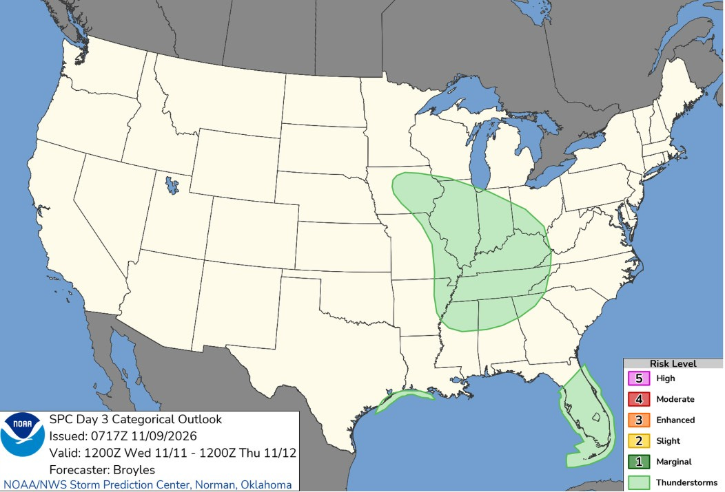
This is interesting. There’s a chance of a non-severe thunderstorm over a fairly large part of the mid-Mississippi and Ohio Valleys Wednesday afternoon. SPC says: “Thunderstorms will be possible in the afternoon from Illinois southward into western Tennessee. A strong wind gust of two will be possible along this narrow north-to-south corridor. However, no appreciable severe threat is expected.”
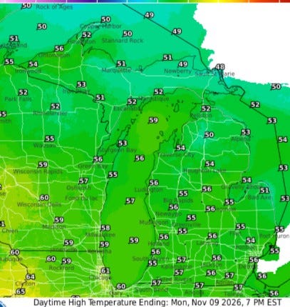
High temperatures today will be several degrees warmer than yesterday, and the wind will be a touch lighter (west at 5-15 mph this afternoon). Look for readings this afternoon in the mid-50s. Up in the U.P., temperatures will reach the low 50s, and Chicago is headed to the low 60s.
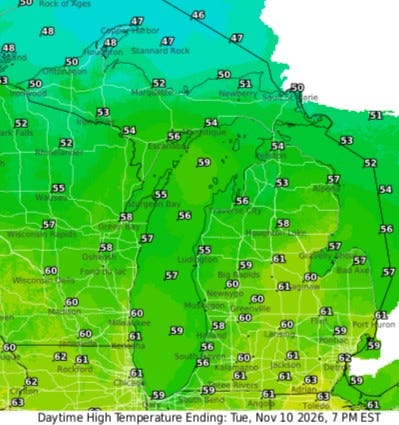
With nearly full sunshine, inland temperatures should reach 60. That’s about 10 degrees warmer than average. It’ll be a few degrees cooler near Lake Michigan. Highs will be mostly in the low-mid 50s in the U.P.
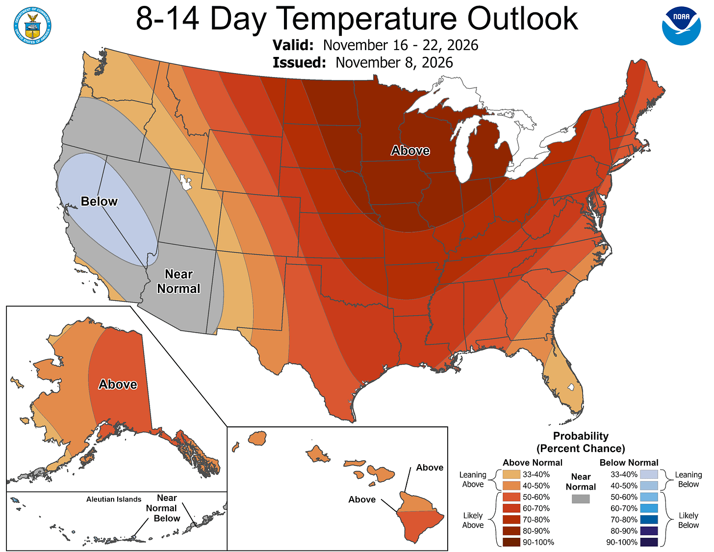
Once again, warmer-than-average air should dominate most of the contiguous U.S. during the period from Nov. 16-22. Again, over these seven days, we could see a couple of colder-than-average days … but overall the seven-day period should be warmer-than-average.
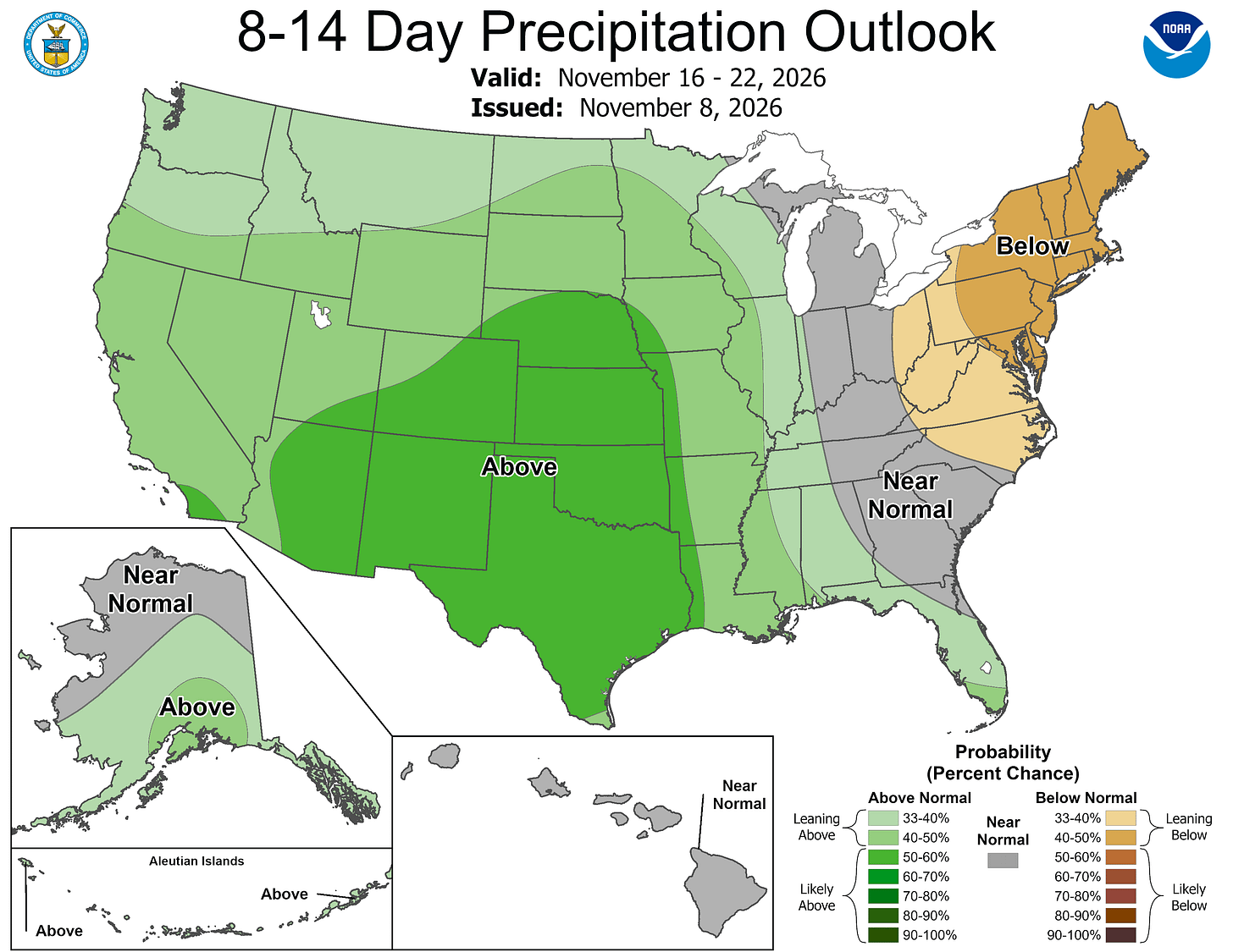
Rainfall is expected to be near average in Michigan. Dry weather will prevail in the Northeast with wetter-than-average conditions in the Central and Western U.S.
The high temperature in Grand Rapids was 47 degrees on Friday and 49 degrees on Saturday. That’s the first time we’ve had back-to-back days with high temperatures below 50 since last April 19-20.
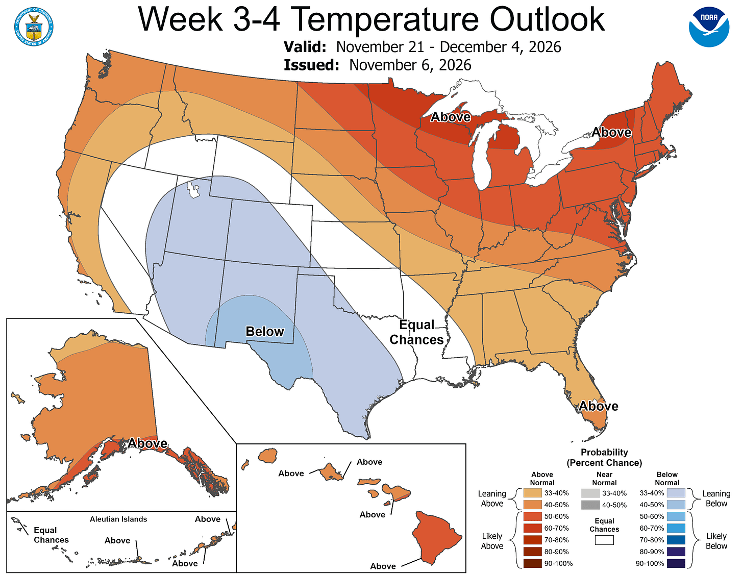
Here’s the general temperature forecast for weeks 3 and 4. That’s Nov. 21 through Dec. 4. The Climate Prediction Center writes: “The highest probabilities for above-normal temperatures extend across the Great Lakes region and the Northeast.”
That doesn’t mean there can’t be snow or a couple of colder-than-average days. It does mean that if you take the entire two-week period as a whole, it has a good chance of being warmer-than-average.
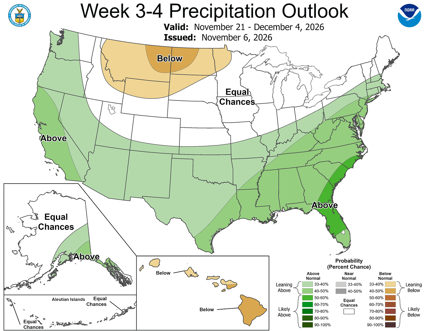
CPC says that above-average rainfall is likely in the West, South and much of the East, with dry weather (and not much snow) across the northern Rockies and Upper Midwest. The Great Lakes have an equal chance of above or below average precipitation (mostly in the form of rain.
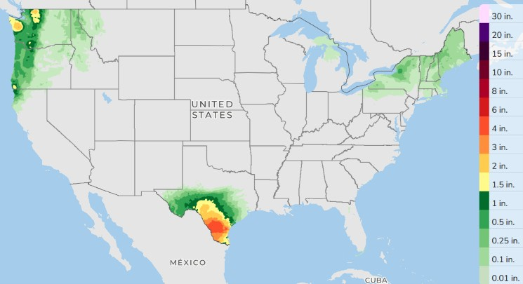
Here’s forecast rainfall over the next three days. We’ll see more heavy rain and possible flooding in South Texas. Rain will fall in coastal Washington and Oregon with lighter showers in upstate New York and New England.
Five-day forecast
- Monday: Partly sunny with a high of 55 degrees. Tonight, clear to partly cloudy. Low: 48 degrees.
- Tuesday: Mostly sunny. High: 57 degrees. In the evening, mainly clear. Low: 41 degrees.
- Wednesday: Variably cloudy with a couple of showers. High: 54 degrees. In the evening, mostly cloudy and breezy with a couple of showers. Low: 38 degrees.
- Thursday: Mostly cloudy, windy, and cooler, with a shower possible. High: 46 degrees. In the evening, mostly cloudy. Low: 31 degrees.
- Friday: Breezy with intervals of clouds and sunshine. High: 44 degrees. In the evening, partly cloudy. Low: 30 degrees.
— Subscribe to Bill Steffen's Substack.


