

El Niño outlooks, western snow, and a mild, cloudy forecast. Get Bill Steffen's weekday forecast.
As a strong El Niño sets the stage for a warm November across the northern U.S., this weekend brings a mix of early-season mountain snow out west and locally heavy rain down south.

As a strong El Niño sets the stage for a warm November across the northern U.S., this weekend brings a mix of early-season mountain snow out west and locally heavy rain down south.
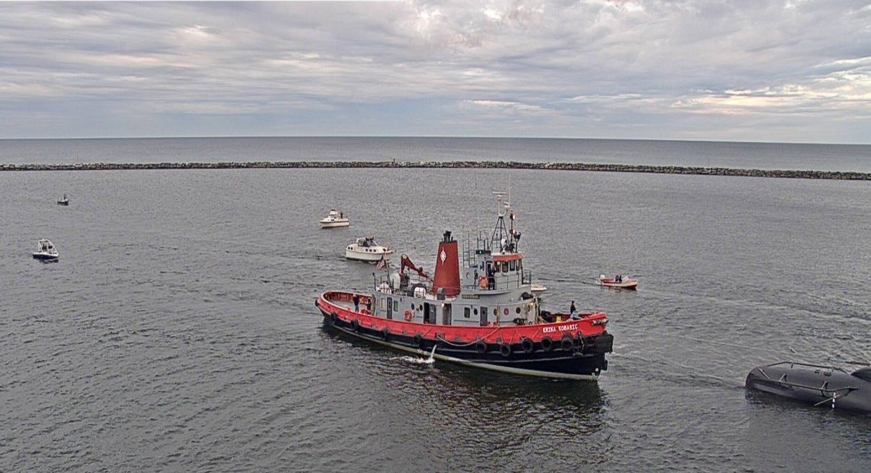
I don’t know what’s happening here. This is a picture from the GLERL camera at the Muskegon Harbor on Saturday morning. That’s a lot of boats. Anyway, we welcome the Erika Kobasic to Muskegon.
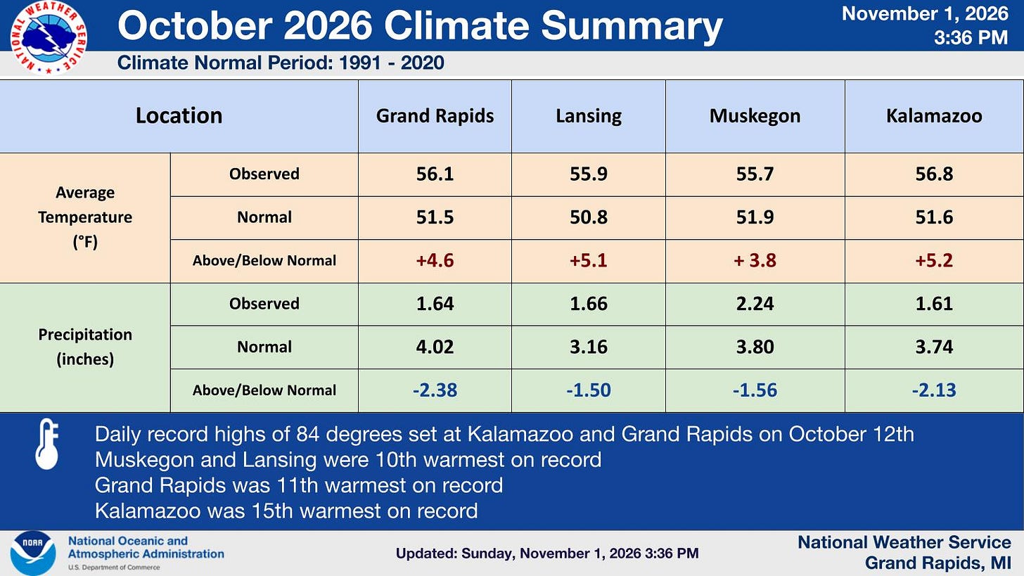
Here’s an October climate summary from the Grand Rapids National Weather Service. Grand Rapids finished 4.6 degrees warmer than average, not quite a top-ten warmest October. There was only 1.64 inches of rain and most of that fell on Oct. 1. That was just 41% of average rainfall. We have now gone half a month without measurable rain.
We tied a record high temperature (84) on Columbus Day (12th). The strong El Niño we have now encourages relatively warm air over the Great Lakes.
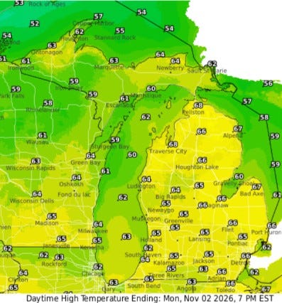
Here are the high temperatures for this Monday. We’ll reach the mid-60s … more clouds than sun … just a slight chance of a sprinkle and winds south-southeast at around 10 mph this afternoon. There’s a little better chance of a light shower overnight.
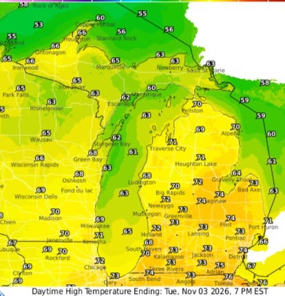
Tuesday, we could see high temperatures in the upper 60s to low 70s. Again, more clouds than sun, a mild south wind … 60s for Upper Michigan — a warm day for November.
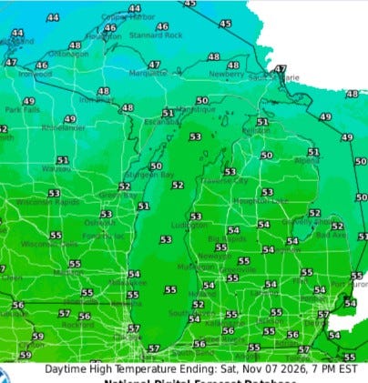
We move to Saturday. Cooler air will move into Michigan for Friday and the weekend. Afternoon highs will be in the mid-50s. That sounds cool, but average high temperatures for the first week of November are low-mid 50s. The U.P. will see highs in the 40s on Saturday.
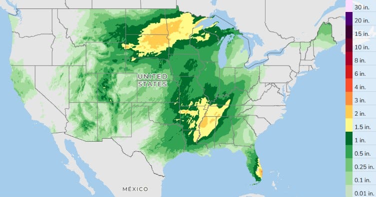
Here’s the three-day total rainfall. The Florida Peninsula will see more rain and a few thunderstorms. Look for showers and thunderstorms — some with heavy rain in the lower Mississippi Valley. The Upper Midwest will see quite a bit of rain … and there will be lingering mostly light showers in Arizona and New Mexico.
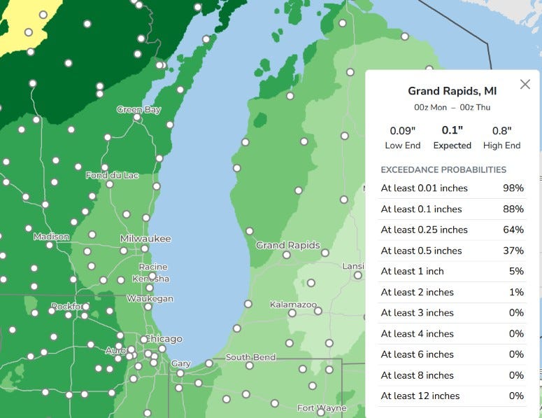
This model gives Grand Rapids just 0.1 inch of rain. That’s rounded to the nearest tenth of an inch. The real value was 0.14 inches. Note it has a low end of 0.09 inches and a high end of 0.80 inches … so a general area of mainly light rain, mainly coming on Wednesday, and a few spots getting over half an inch.
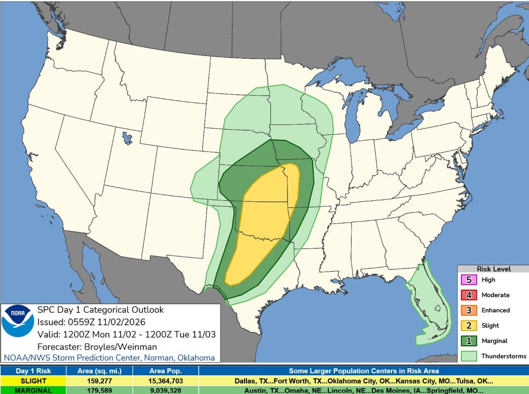
We’re going to see some severe weather in the Plains this afternoon and evening. That yellow area is a level 2 Slight Risk. SPC says: “ Severe thunderstorms with damaging wind gusts and a few tornadoes are expected across parts of the southern and central Plains from this afternoon into tonight.
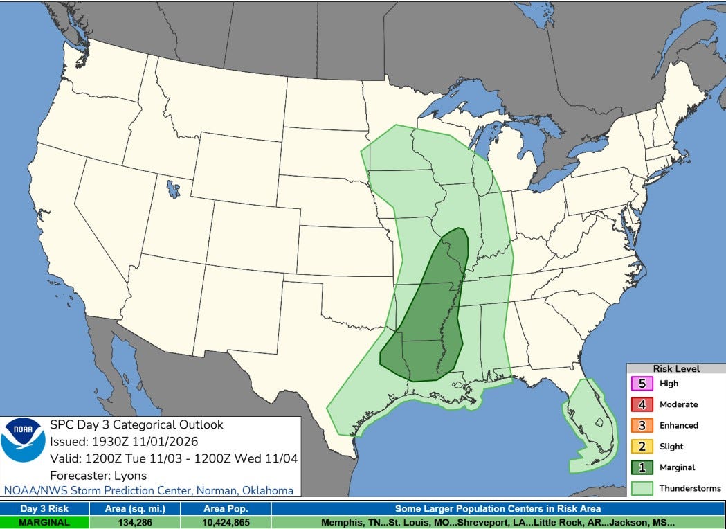
On Tuesday, there’s a level 1 Marginal Risk from Illinois to Louisiana. SPC says: “A few thunderstorms may produce damaging gusts, and a brief tornado cannot be ruled out."
Long-term weather outlook
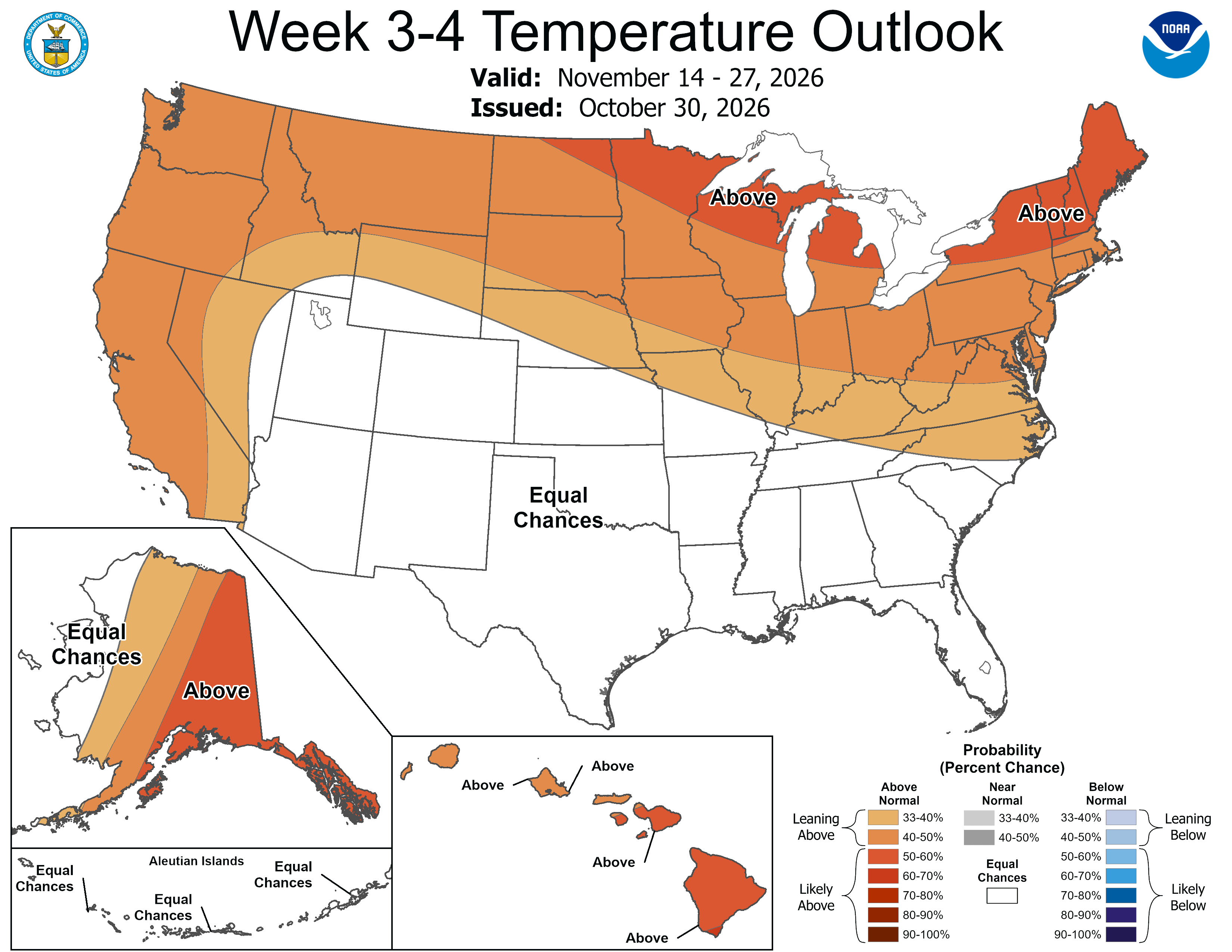
Every Friday, the Climate Prediction Center issues a general temperature and rainfall forecast for weeks 3-4. The latest outlook is for above-average temperatures across the northern and western U.S. with an equal chance of above or below average temperatures across the South. This is consistent with the usual pattern we see in November during a strong El Niño.
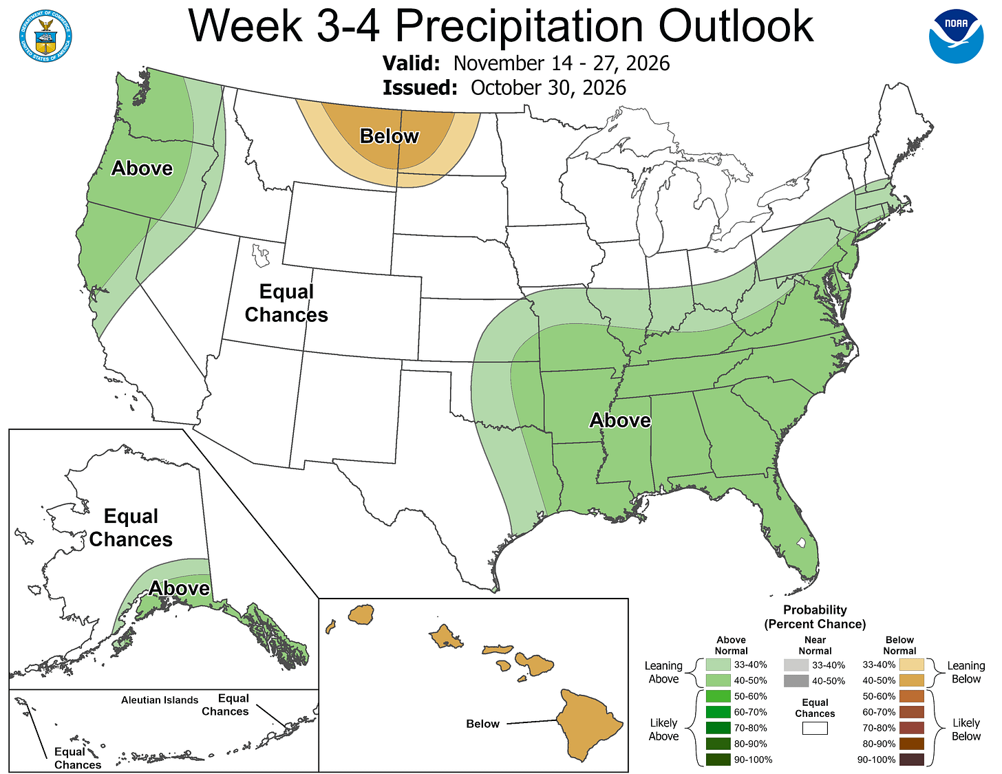
The precipitation forecast for weeks 3-4 shows above-average precipitation for much of the South, the East and the West, with below-average precipitation in eastern Montana, western North Dakota and Hawaii.
Locally, heavy rain is expected in the Midwest, centered around Sioux City, Iowa. Heavy rain will fall in the Southwest, with local totals in the higher elevations north and northeast of Phoenix forecast to get over 2 inches of rain.

Five-day forecast
- Monday: A shower in spots this morning; otherwise, a blanket of clouds. High: 65 degrees. Tonight, expect overcast and breezy with a stray shower. Low: 57 degrees.
- Tuesday: A thick cloud cover, windy and warm, with the temperature breaking the record high of 70 last reached in 2022, with a shower in spots. High: 71 degrees. In the evening, Warm with rain most of the time, turning breezy late. Low: 61 degrees.
- Wednesday: Windy with rain most of the time. High: 65 degrees. In the evening, expect overcast skies and breezy conditions with a shower, with a low of 52 degrees.
- Thursday: Cloudy, windy and cooler with a couple of showers. High: 57 degrees. In the evening, occasional rain and drizzle. Low: 44 degrees.
- Friday: Remaining cloudy with a couple of showers possible. Low: 53 degrees. In the evening, mostly cloudy skies with a low of 42 degrees.
— Subscribe to Bill Steffen's Substack.


