

NOAA: El Niño will bring milder, drier late fall, winter for Michigan
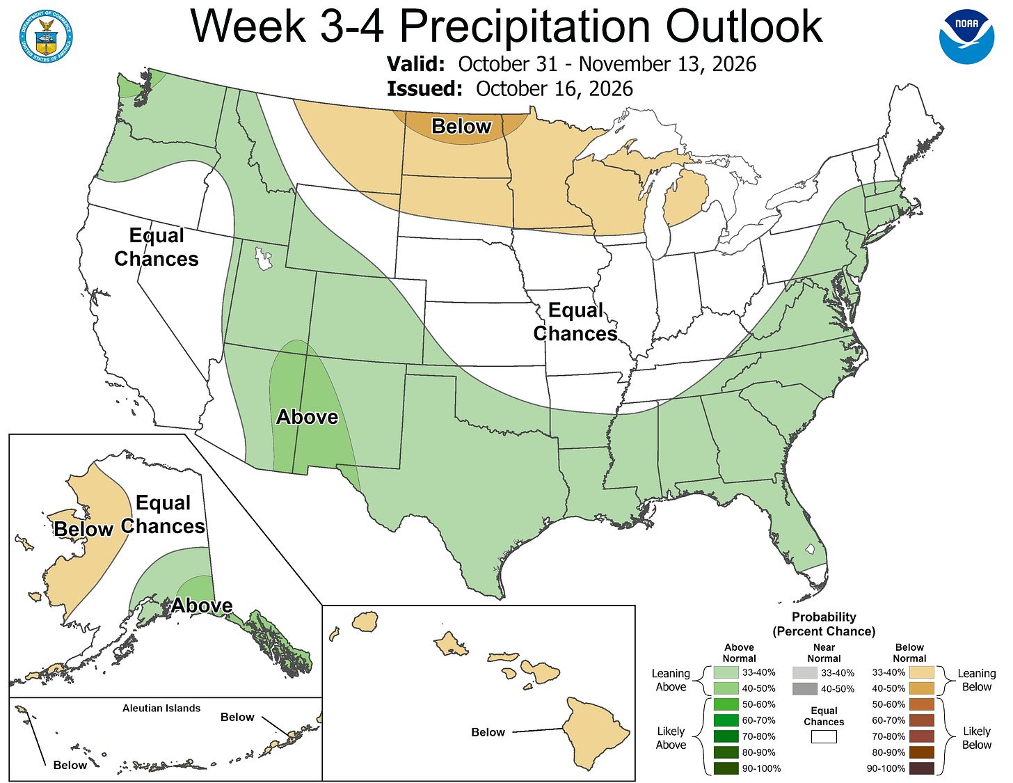
The Climate Prediction Center issued an experimental outlook for late October through mid-November that calls for above-average temperatures and below-average precipitation across Michigan.

Subfreezing morning temperatures and gusty conditions gave way to a calm, quiet weekend across Lower Michigan, while long-range forecasters point to a warmer and drier late autumn and winter ahead across the Great Lakes region.
A widespread freeze warning was issued Friday for areas north of a line from Holland to Lansing, with early morning readings dipping into the upper 20s to mid-30s.
Areas south of that line remained under a frost advisory.
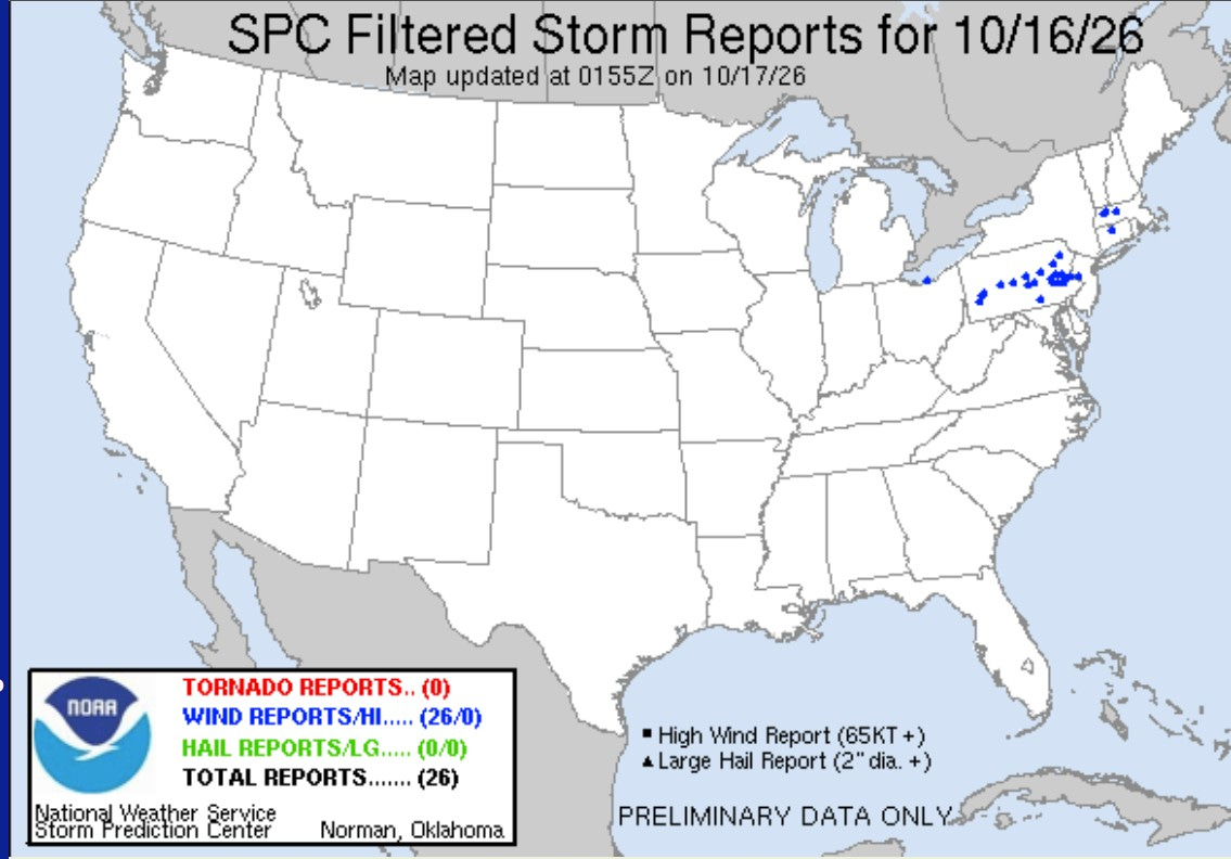
Strong winds on Friday brought down tree limbs and power lines across Western Michigan, leaving more than 4,000 customers briefly without power after peak wind gusts reached 37 mph in Grand Rapids, 43 mph in Battle Creek and South Haven, and 52 mph in Michigan City, Indiana.
Fair weather and mostly clear skies will dominate the regional weather through Sunday. High temperatures are expected to climb into the low 60s across much of the state on Sunday.
Looking further ahead, the Climate Prediction Center issued an experimental outlook for late October through mid-November that calls for above-average temperatures and below-average precipitation across Michigan.
The pattern aligns with a strong El Niño active in the Pacific, which historically brings milder conditions to northern states.
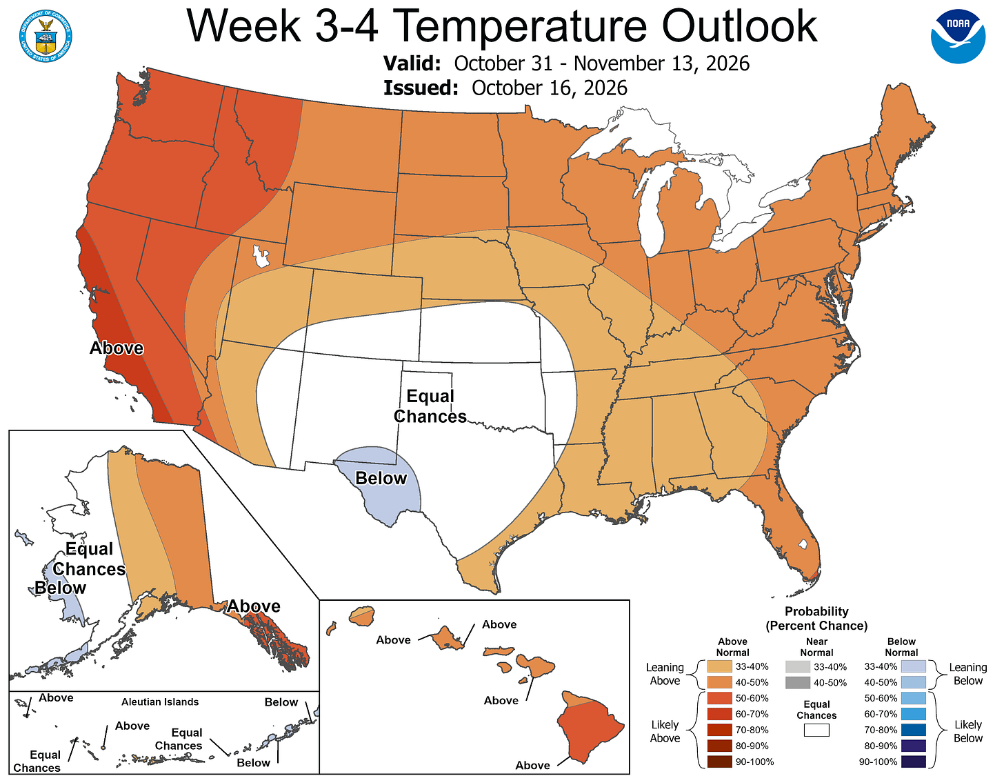
The National Oceanic and Atmospheric Administration’s official winter outlook for December through February similarly favors warmer-than-average temperatures and drier conditions across the Midwest and Great Lakes.
National Weather Service forecasters noted that strong El Niño patterns typically result in lower seasonal snow totals and reduced lake-effect snow opportunities, though individual winter storms and sudden cold-air outbreaks remain likely throughout the season.
The 3-4 week rainfall outlook shows a tilt toward below-average precipitation over most of Michigan. The typical cool season strong El Niño pattern is above average rainfall in the South and below-average precipitation in the North.
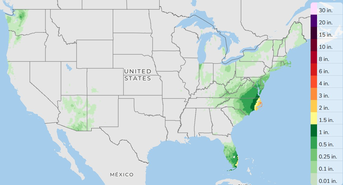
Here’s the three-day rainfall — nothing for West Michigan and for most of the country. There will be more showers and storms in South Florida and a few mainly afternoon showers in Arizona. Rain from the East Coast storm will move out of the Mid-Atlantic, and there will be a few mainly light showers in New England.
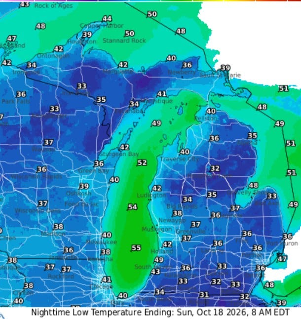
Here is the forecast for low temperatures for early Sunday morning. Readings will range from the 40s at Lake Michigan to the low 30s south of I-94, where the wind may go calm.
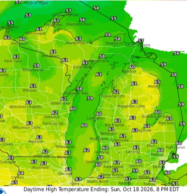
High temperatures on Sunday will be a few degrees warmer than today (Sat.). We’ll see low 60s over much of the state with mid-upper 50s at Lake Michigan. We should see lots of sun and a rather brisk southwest wind at 10-20 mph.
— Subscribe to Bill Steffen's Substack.


