

Slight warm-up; hurricane rains won't reach West Michigan. Get Bill Steffen's weekend forecast.
Saturday looks to be the warmest day of the month of October. Chance of rain will return on Monday.

Hurricane Isaias will reach its peak intensity today, then start to weaken a little bit as it reaches the Gulf Coast. It should weaken to a depression by the time it reaches northern Alabama.
The map above shows the expected track of Isaias, with the eye or center of the storm moving inland around Pensacola Beach (a place where I have been several times). Wind gusts to 100 mph are possible at the shore. The red area above is where there are Hurricane Warnings (gusts +74 mph), the blue is Tropical Storm Warnings (gusts 39-73 mph) and the yellow is a Tropical Storm Watch.
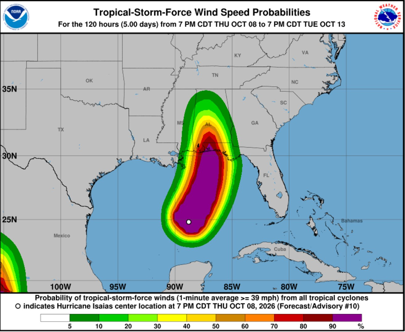
Here’s the probability of winds of 39 mph or greater. There’s a good chance of some tree and power line damage up into central Alabama.
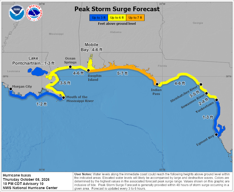
Here’s the forecast storm surge (rise in sea level due to the strong onshore winds pushing the ocean water toward shore. The greatest storm surge will be east of Dauphin Island.
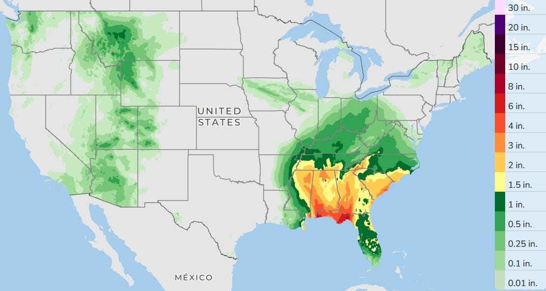
Here’s the three-day total rainfall. Lots of rain in the Southeast from Isaias. The rain in southern California, Arizona, Utah and western Colorado is from Rachel. Friday night there is a slight chance of a shower in West Michigan. The best chance of that will be in the southwest corner of the Lower Peninsula in Berrien and Cass counties.
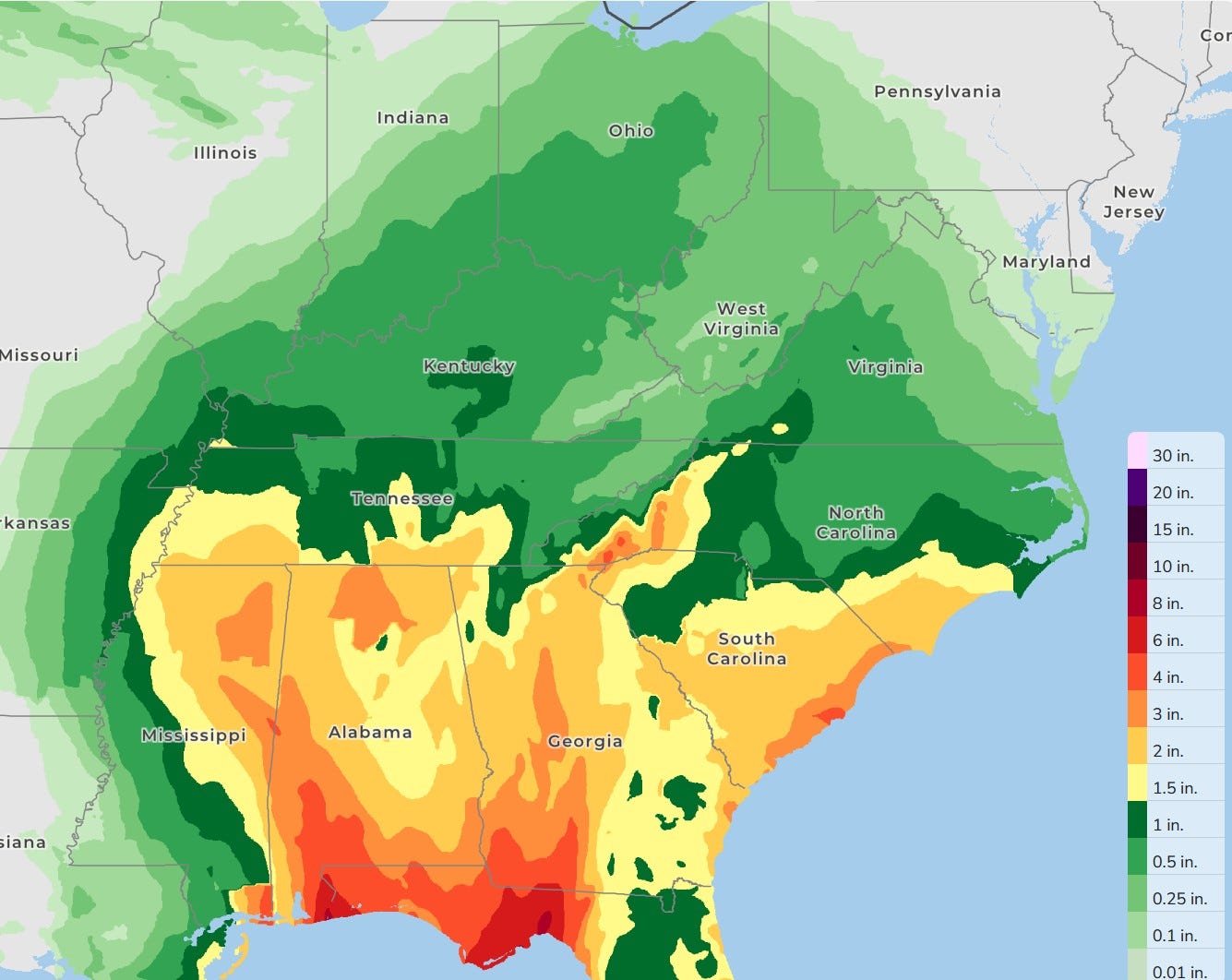
Here’s a zoomed-in look at the forecast rain from Hurricane Isaias. The dark red is more than 6 inches. Note the northern edge of the rain barely comes into Southeast Lower Michigan.
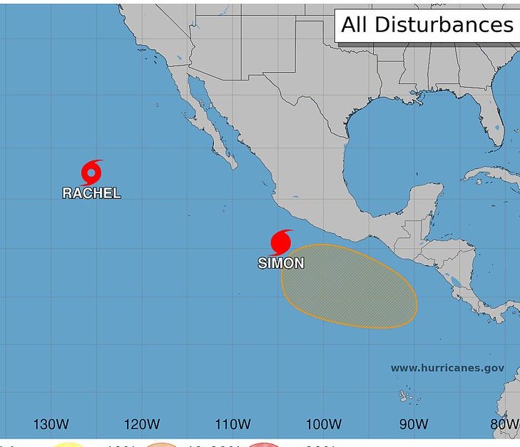
Here’s the eastern Pacific. Rachel is now a tropical storm, and Simon has intensified to hurricane status.
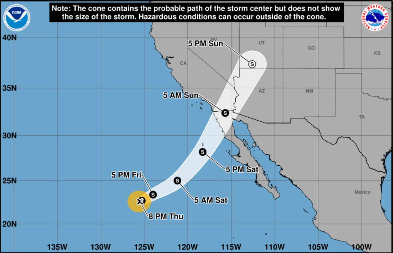
Here’s the path of Rachel. It will come onshore in the northern Baja area, then continue northeast into southern Utah on Sunday afternoon. Wind damage will be minimal, but a period of moderate to heavy rain is possible along the path and that could cause some flooding.
The San Diego National Weather Service says: “Tropical moisture will bring showers for late Saturday night through Sunday night with continuing chances for showers through Tuesday night." The remnants of Rachel will be moving at a decent clip, and that will help to minimize flooding.
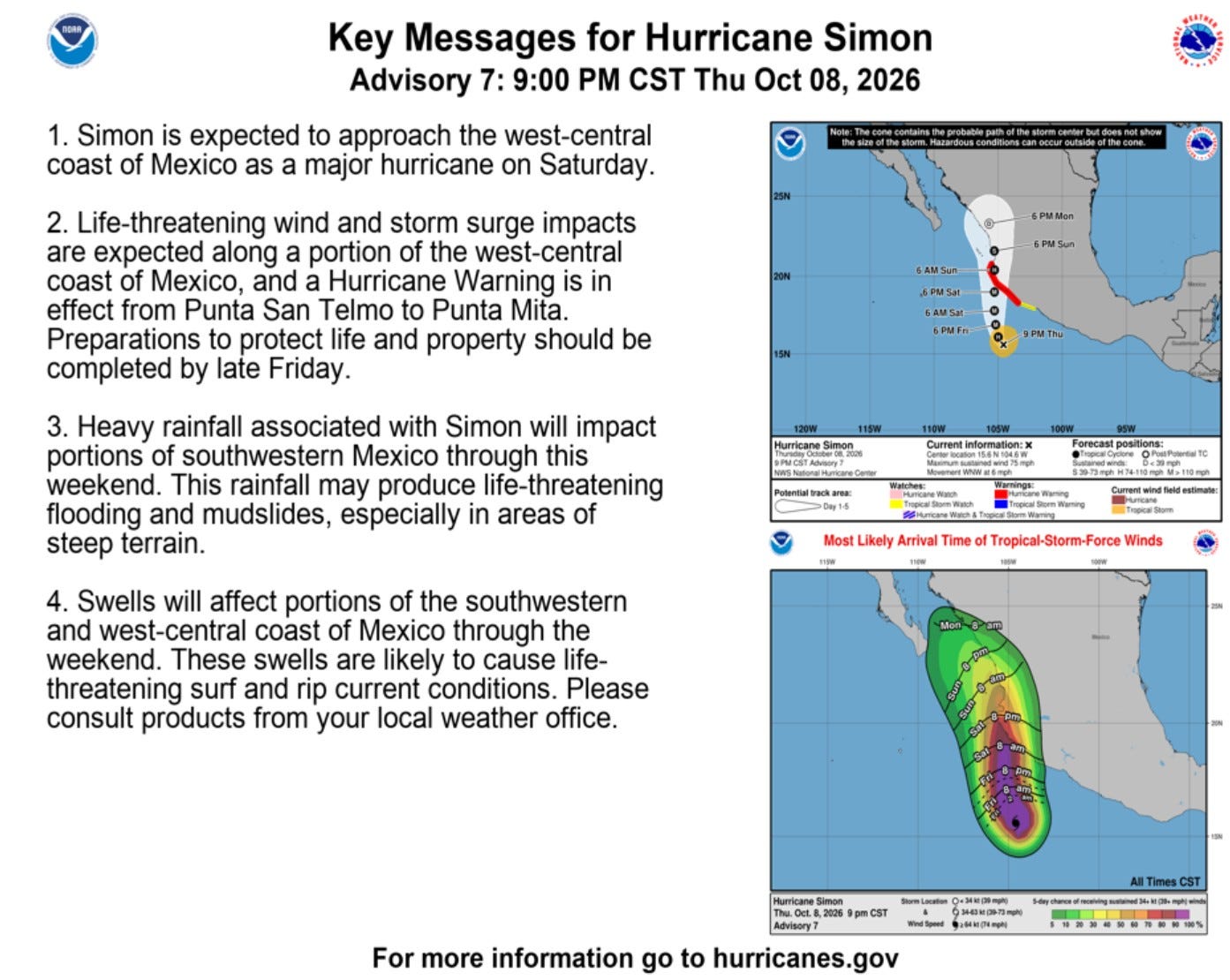
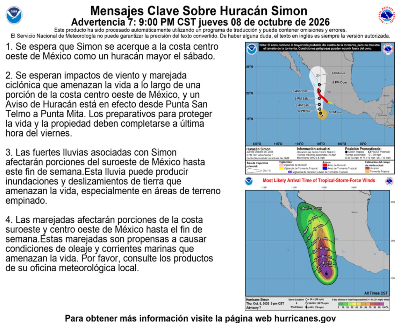
Here’s the forecast track of Hurricane Simon. The storm will weaken as it slowly moves onshore, but this is a significant storm that will cause wind damage and flooding rains along its path.
Here’s the total rainfall expected as Simon moves along the coast. 20 inch is a lot of rain. Significant flooding is likely as the storm pushes tropical air into the mountains.

There are two storms in the western Pacific. Nolo has turned northeast away from Japan. It is moving into cooler waters and should dissipate this weekend.

Typhoon Koguma is a stronger storm, but it’s no threat to land. The storm will reach peak intensity probably tonight, then start to weaken. It will also turn northeast away from Japan.
This fall, it certainly appears that Japan has some kind of hurricane deflector that turns the storms away. If that’s the case, I bet Florida would be interested in securing one.
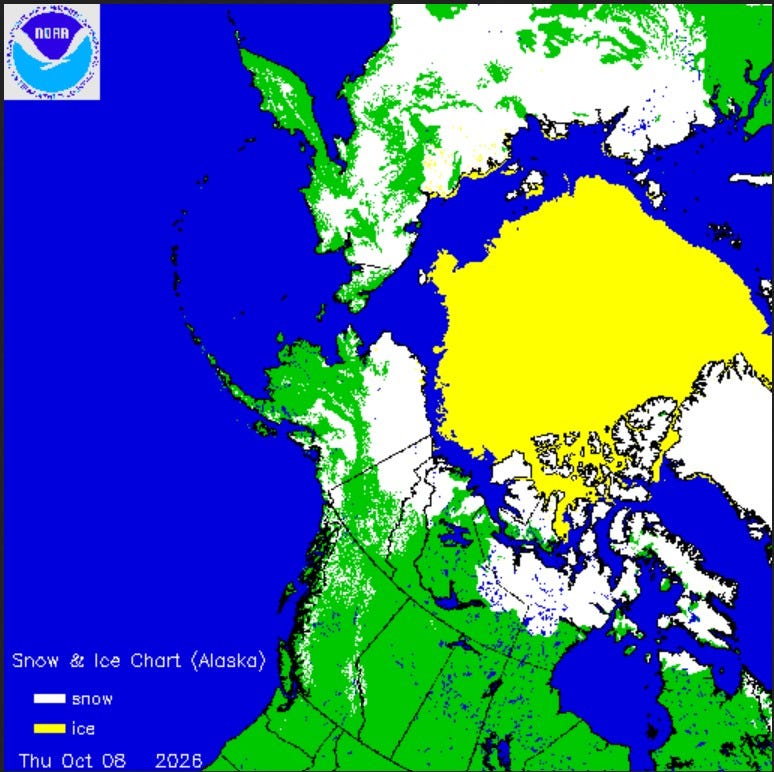
Here’s Northern Hemisphere snow and ice cover. Snow is on the ground now in a good portion of Siberia (Russia), northern Alaska, northern Yukon and northern Nunavut. There is still a large permanent North Polar ice cap.
As I type this, Barter Island, Alaska, has a temperature of +6 degrees and Fort Yukon is +9 degrees. The high temperature at the Barrow Airport was 20 degrees and the wind gusted over 30 mph.
Barrow is losing 9 minutes of daylight each day now. At solar noon today, the sun is only 13 degrees above the southern horizon.
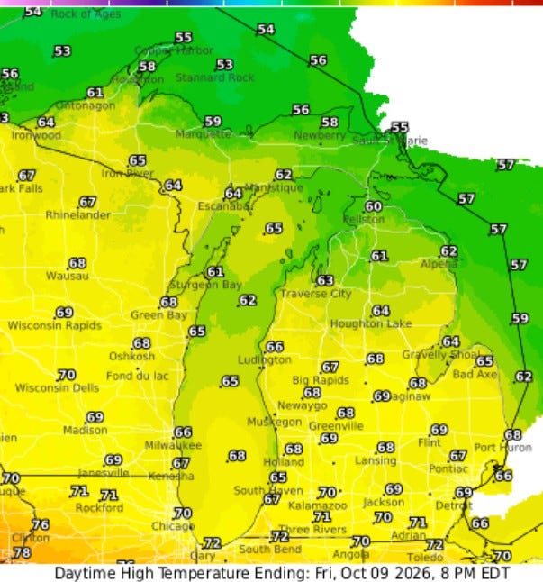
Here are expected high temperatures: Upper 60s and low 70s — another beautiful fall day.
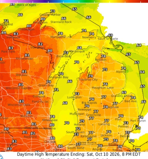
Saturday looks to be the warmest day of the month of October. I wouldn’t be surprised to see a weather station or two climb to 80 degrees. Even at Lake Michigan, it may touch 70.
We’ll have another chance of showers around Monday night. A decent cold front will pass through, and temperatures will be cooler for the middle-to-end of next week.
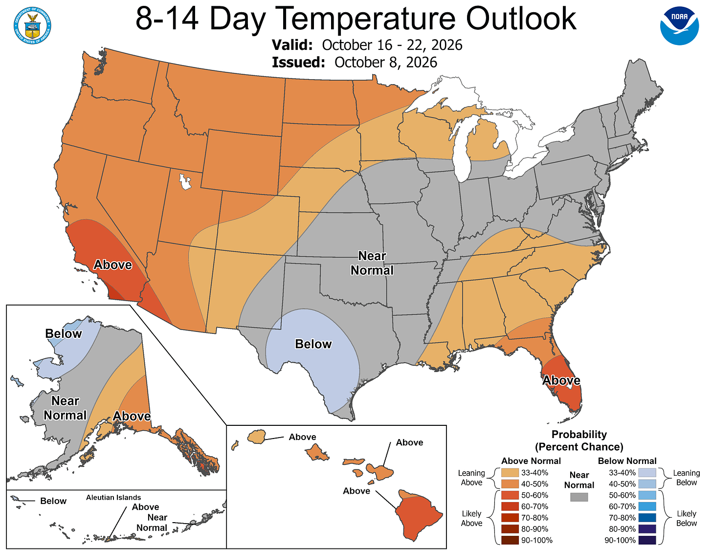
Here’s the latest 8-14 day outlook from the Climate Prediction Center. This is for Oct. 16-22. The European model has a shot of colder air arriving around Oct. 18.
Five-day forecast
- Friday: Partly sunny, with a high of 68 degrees. Tonight, mainly clear, with a low of 54 degrees.
- Saturday: Sun through high clouds and warm, with a high of 75 degrees. In the evening, mainly clear, with a low of 56 degrees.
- Sunday: Rather cloudy, with a high of 69 degrees. In the evening, mainly clear. Low: 57 degrees.
- Monday: Pleasant with periods of clouds and sunshine; breezy in the afternoon. High: 70 degrees. In the evening, a thunderstorm on the prowl in the evening; otherwise, considerable cloudiness. Low: 58 degrees.
- Tuesday: Breezy in the morning; mainly cloudy with a couple of showers, mainly early in the day. High: 63 degrees. In the evening, partly cloudy. Low: 46 degrees.
— Subscribe to Bill Steffen's Substack.


