

Sunny, mild week. Get Bill Steffen's weekday forecast.
This will be one of the sunniest Octobers ever in West Michigan.

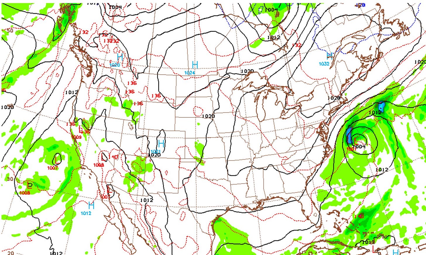
Here’s a forecast weather map for Wednesday. There’s a storm off the East Coast. The main effects are stronger northeast winds and higher waves along the coast. The low pressure is “subtropical,” but if it were to get a name, the next name on the list this year will be “Josephine.”
Then we have sunny high pressure over most of the U.S. east of the Rockies. We also have low pressure off California, with the circulation giving a southerly flow across the Southwest. This means areas of showers and perhaps an isolated thunderstorm.
So far this month, Las Vegas, Nevada, has had 1.19 inches of rain; the average is 0.18’. Flagstaff, Arizona, has had 3.64 inches this month; the average is 0.89.” As I type this, the dew point in Tucson, Arizona, is 60 degrees — a little on the humid side for the Southwest Desert.
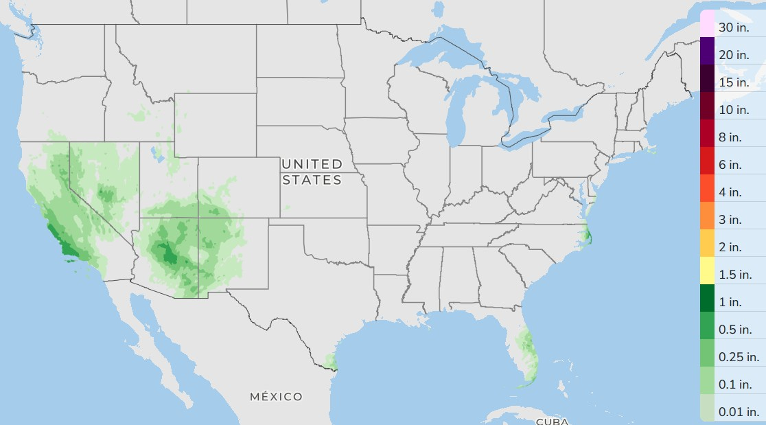
Here’s forecast rainfall for the next three days. More scattered showers for the Southwest, a few showers in Florida and in the Outer Banks of North Carolina. The Great Lakes remain sunny and mild.
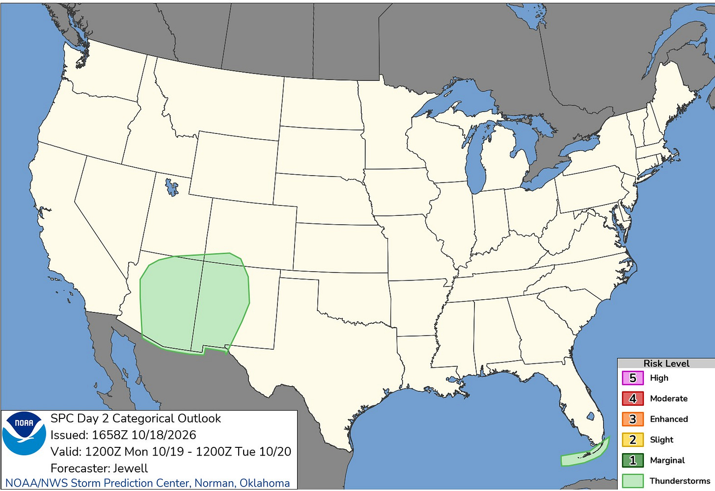
The Storm Prediction Center has only a few non-severe thunderstorms for Arizona, New Mexico and the Florida Keys. There were no severe thunderstorms anywhere in the U.S. over the weekend.
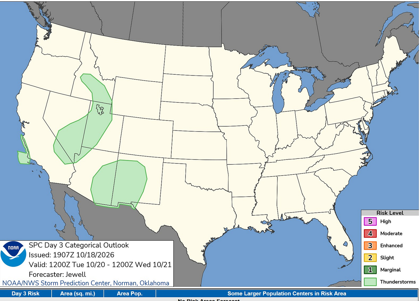
Here’s the Severe Weather Outlook Map for Tuesday. Again, severe weather is not expected — just a chance of a non-severe storm in the West where you see the light green color.
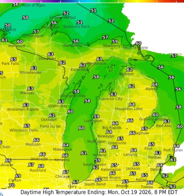
Here are the high temperatures for this Monday. We’re forecasting mid-60s for most of the area and upper 50s right at Lake Michigan. We'll see lots of sunshine and light onshore winds at only 5-10 mph.
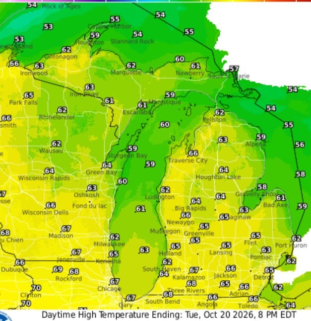
Same story on Tuesday … mostly sunny, relatively light winds with high temperatures in the mid-upper 60s. Readings will be mostly in the low 60s in northern Lower and Upper Michigan.
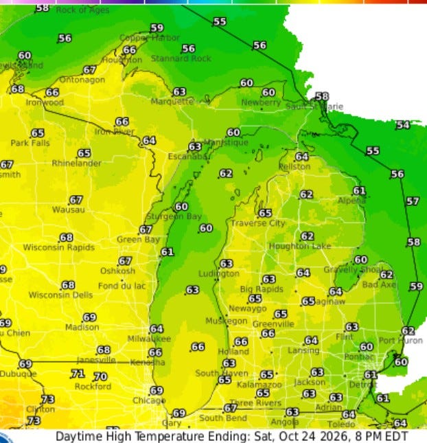
Plan on nice weather next weekend. Here’s the forecast high temperatures for next Saturday: mid-60s for much of the state.
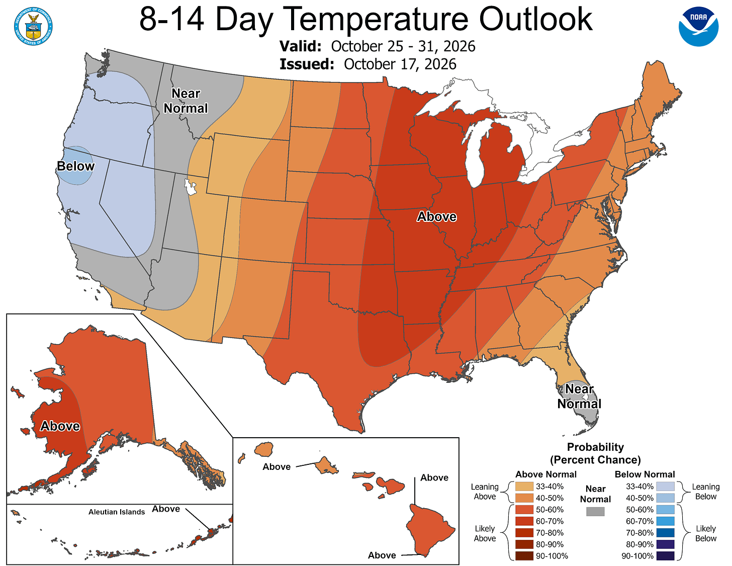
This is the 8-14 day temperature outlook for Oct. 25-31 (including Halloween). The core of the warmer-than-average air is right over the Great Lakes and Mississippi Valley. By the end of October, average high temperatures are in the mid-50s in West Michigan. We should be 5-10 degrees warmer than that.
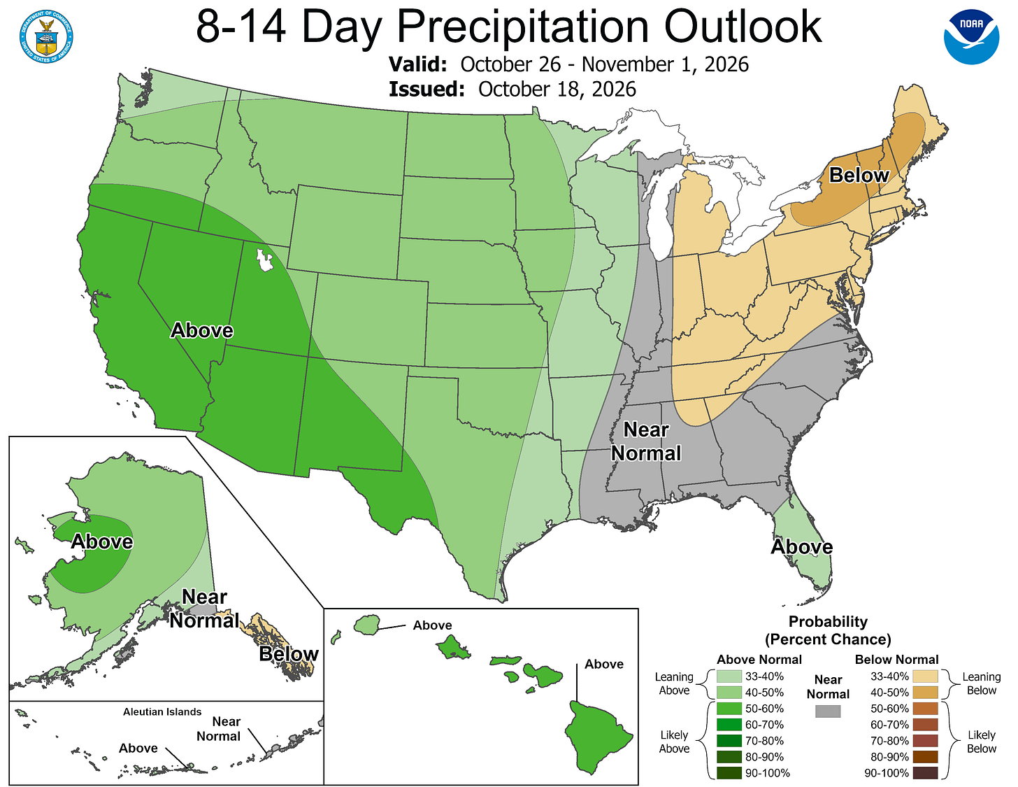
Rainfall for that last week of October is expected to be below average in Lower Michigan.
Five-day forecast
- Monday: Plenty of sunshine. High: 63 degrees. Tonight, partly cloudy. Low: 40 degrees.
- Tuesday: Comfortable with sunshine and a few clouds. High: 65 degrees. In the evening, clear, with a low of 44 degrees.
- Wednesday: Pleasant with sunshine and a few clouds. High: 66 degrees. In the evening, increasing clouds, with a low of 43 degrees.
- Thursday: Pleasant with periods of clouds and sunshine, with a high of 65 degrees. In the evening, clear, with a low of 43 degrees.
- Friday: Brilliant sunshine and nice. High: 63 degrees. In the evening, clear to partly cloudy. Low: 44 degrees.
— Subscribe to Bill Steffen's Substack.


