

Showers move in as Saturday looks cooler for Coast Guard parade. Get Bill Steffen's forecast
Look for occasional showers and a chance of an isolated thundershower from Friday night into Saturday night.

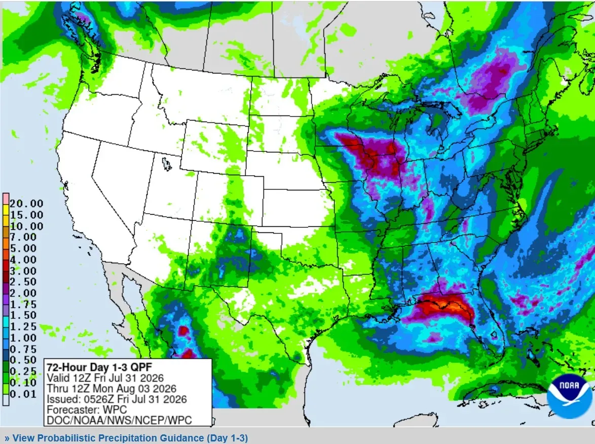
This is the three-day rainfall forecast map. Look for occasional showers and a chance of an isolated thundershower from Friday night into Saturday night.
The chance of some rain is high (over 80%), and we could see an average of 0.5-0.75 inches of rain. That looks like our only chance of rain over the next five days. Heavier rain will fall in southern Wisconsin and northern Illinois.
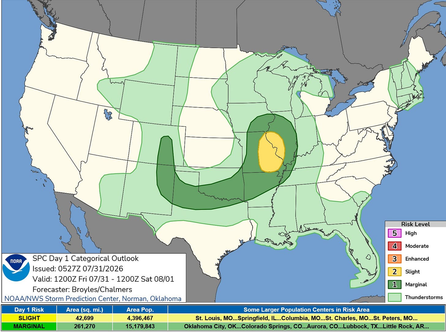
This is the Severe Weather Outlook Map for Friday and Friday night. There’s a level 2 Slight Risk in eastern Missouri and western Illinois. Areas north of Muskegon and in the southwest corner of Lower Michigan could see a thundershower sneak in Friday evening, but much or all of this Friday daytime should be dry.
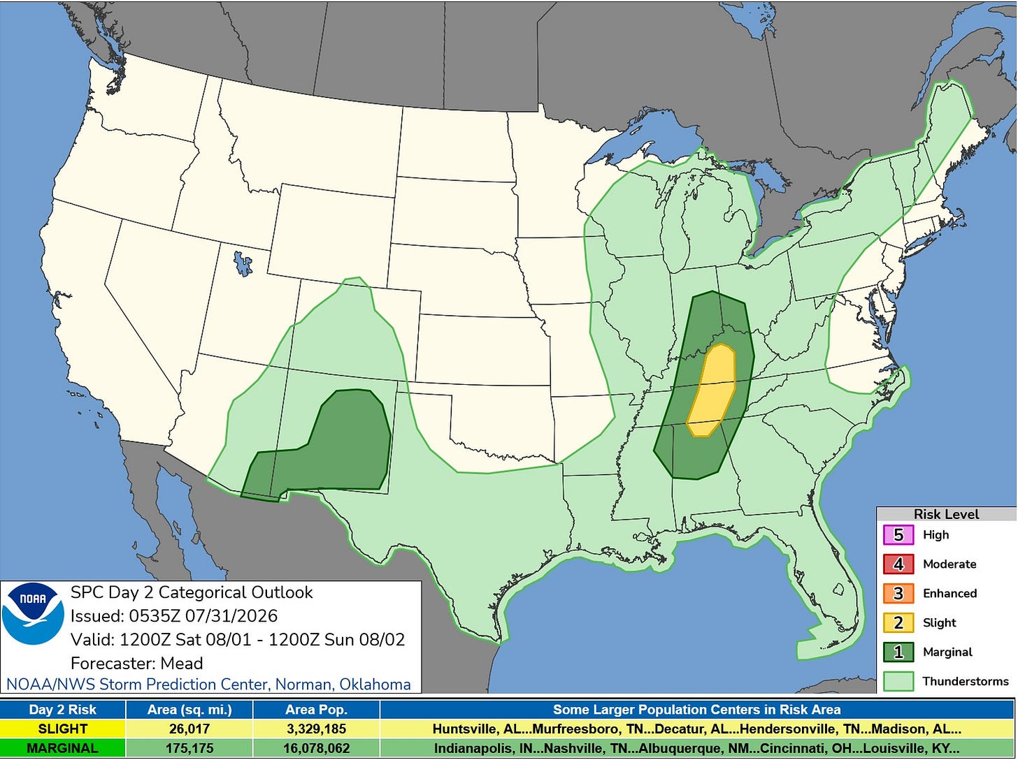
The Severe Map for Saturday and Saturday night shows light green over all of Lower Michigan. We could see a few flashes of lightning mixed in with general showers, but severe weather will likely remain off to our south.
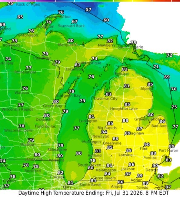
Here are high temperatures for this Friday … another warm day with inland readings in the mid-80s and lakeshore highs in the mid- to upper 70s.
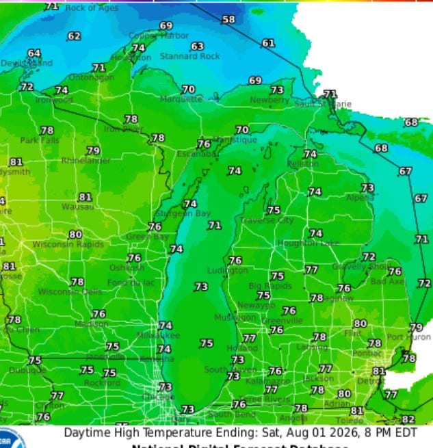
Here are high temperatures for Saturday … we cool off some … readings should be in the low- to mid-70s, though it’s possible we could hold in the 60s when it’s raining.
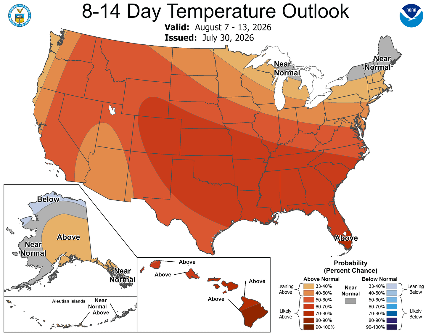
The models continue a warm forecast with above-average temperatures from coast-to-coast for the second week of August.
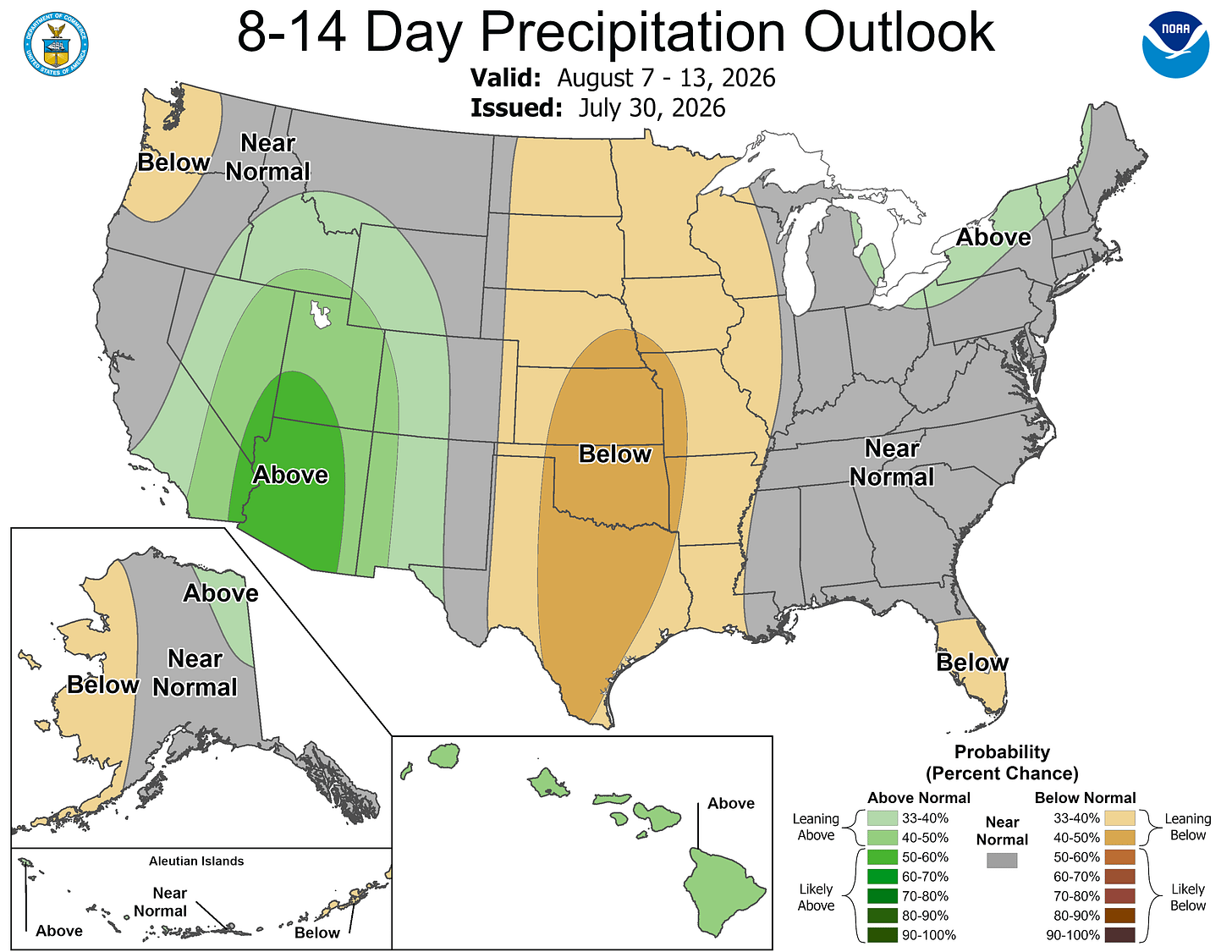
Rainfall is forecast to be near average for the second week of August, with dry weather over much of the Plains and the typical summer monsoon producing a few gusty thunderstorms in the Desert Southwest.
Five-day forecast
- Friday: Humid with clouds rolling in; a thunderstorm in spots this afternoon; thunderstorms could impact the Coast Guard Festival. High: 83 degrees. Tonight, cloudy and humid with occasional rain and a thunderstorm. Low: 68 degrees.
- Saturday: Mostly cloudy and not as warm, but humid with a couple of showers and a thunderstorm; thunderstorms could impact the festival. High: 74 degrees. In the evening, mainly clear with a low of 63 degrees.
- Sunday: Sun and some clouds. High: 80 degrees. In the evening, mostly clear with a low of 58 degrees.
- Monday: Pleasant with plenty of sun, with a high of 79 degrees. In the evening, expect clear skies with a low of 60 degrees.
- Tuesday: Plenty of sun with a high of 82 degrees. In the evening, clear with a low of 64 degrees.
— Follow Bill Steffen's Substack.


