

Chance of showers, but mostly a nice weekend. Storms return Monday. Get Bill Steffen's forecast
High temperatures will be mostly in the low 80s.

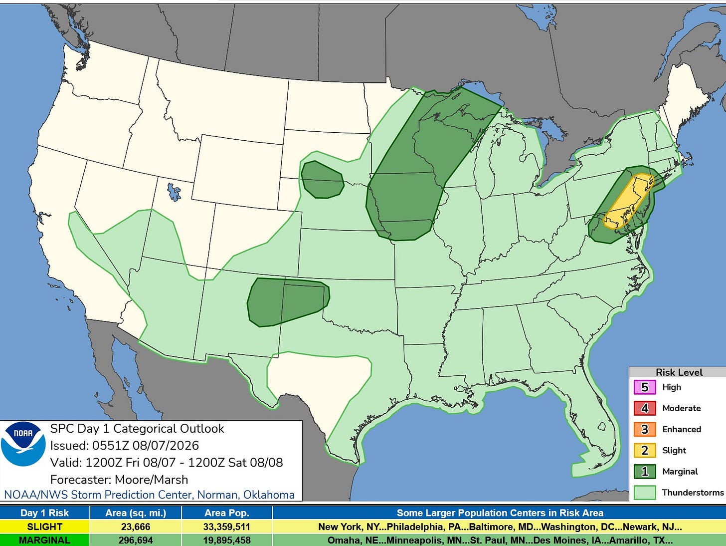
Here’s the Severe Weather Outlook Map from the Storm Prediction Center for this Friday.
The yellow color is a level 2 Slight Risk, and this evening, that will include some of the East Coast’s biggest cities.
The dark green is a level 1 Marginal Risk. There will be a Marginal Risk from Lake Superior to northern Missouri.
The light green is a “General” Thunderstorm Outlook (not severe), and that area includes all of Lower Michigan.
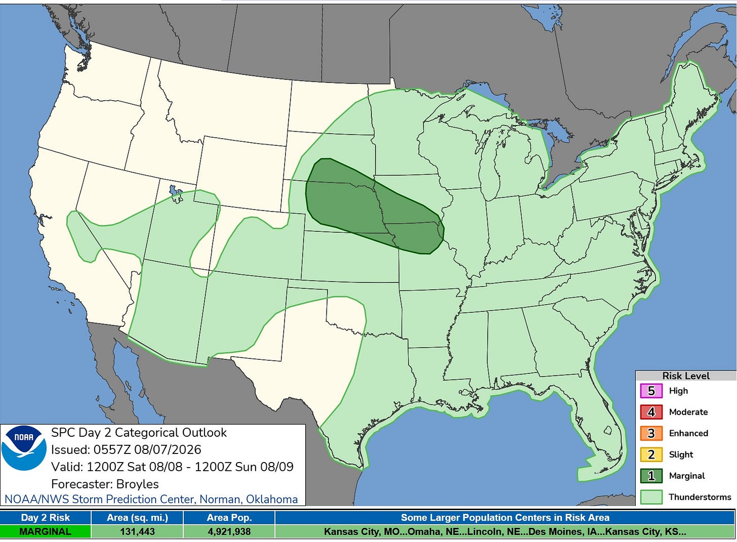
For Saturday, there is just one Marginal Risk Area from South Dakota and Nebraska to far western Illinois. All of Michigan is in the General (not severe) Thunderstorm area.
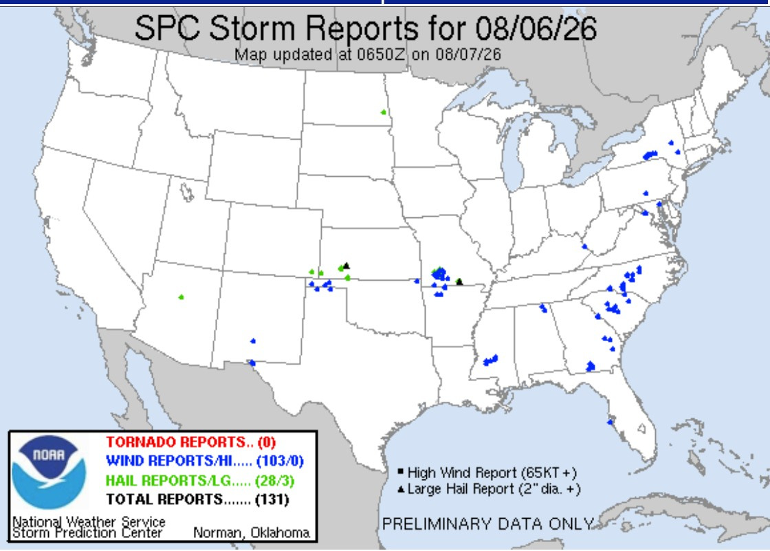
Here are storm reports for Thursday. Once again, no tornadoes. We’ve now gone 5 days without a tornado in the U.S. There were 103 reports of wind damage and 28 reports of severe hail.
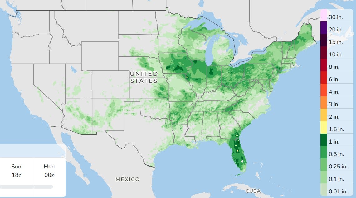
Here’s three-day total rainfall. Much of the west is dry. We have a chance of a shower or storm later today, with the best chance south and southeast of Grand Rapids.
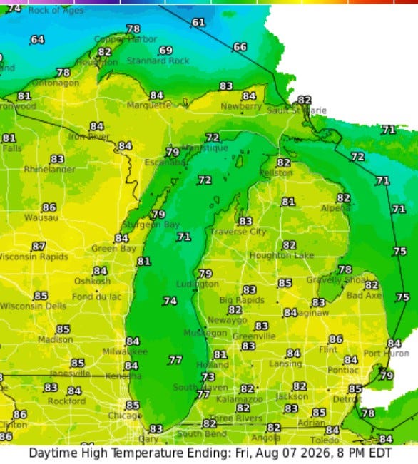
High temperatures will be mostly in the low 80s. Look for partly cloudy skies after a few patches of fog dissipate this morning. Winds will be light enough that a lake breeze should develop during the afternoon.
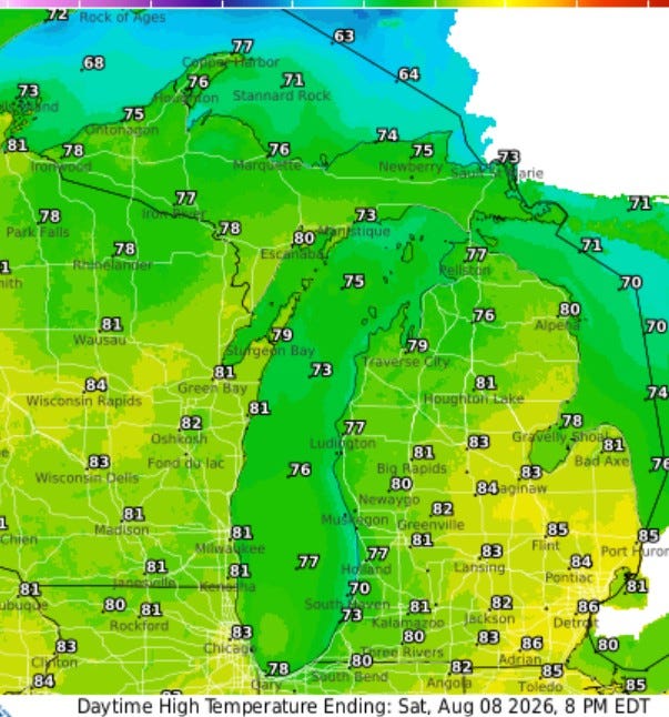
High temperatures on Saturday will be similar to today, generally low 80s, right about average for this time of year.
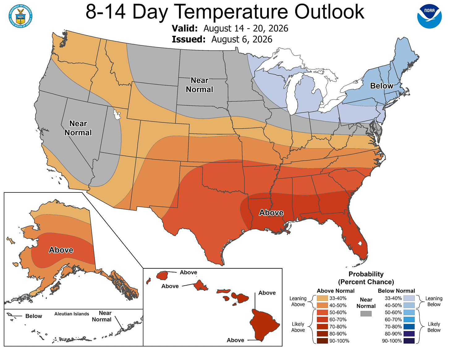
The latest 8-14 Day Outlook takes us to Aug. 20. It has warmer-than-average temperatures across the South and (slightly) cooler-than-average temperatures in the Great Lakes and Northeast. The greater-than-average contrast north to south should fuel some decent thunderstorm activity.
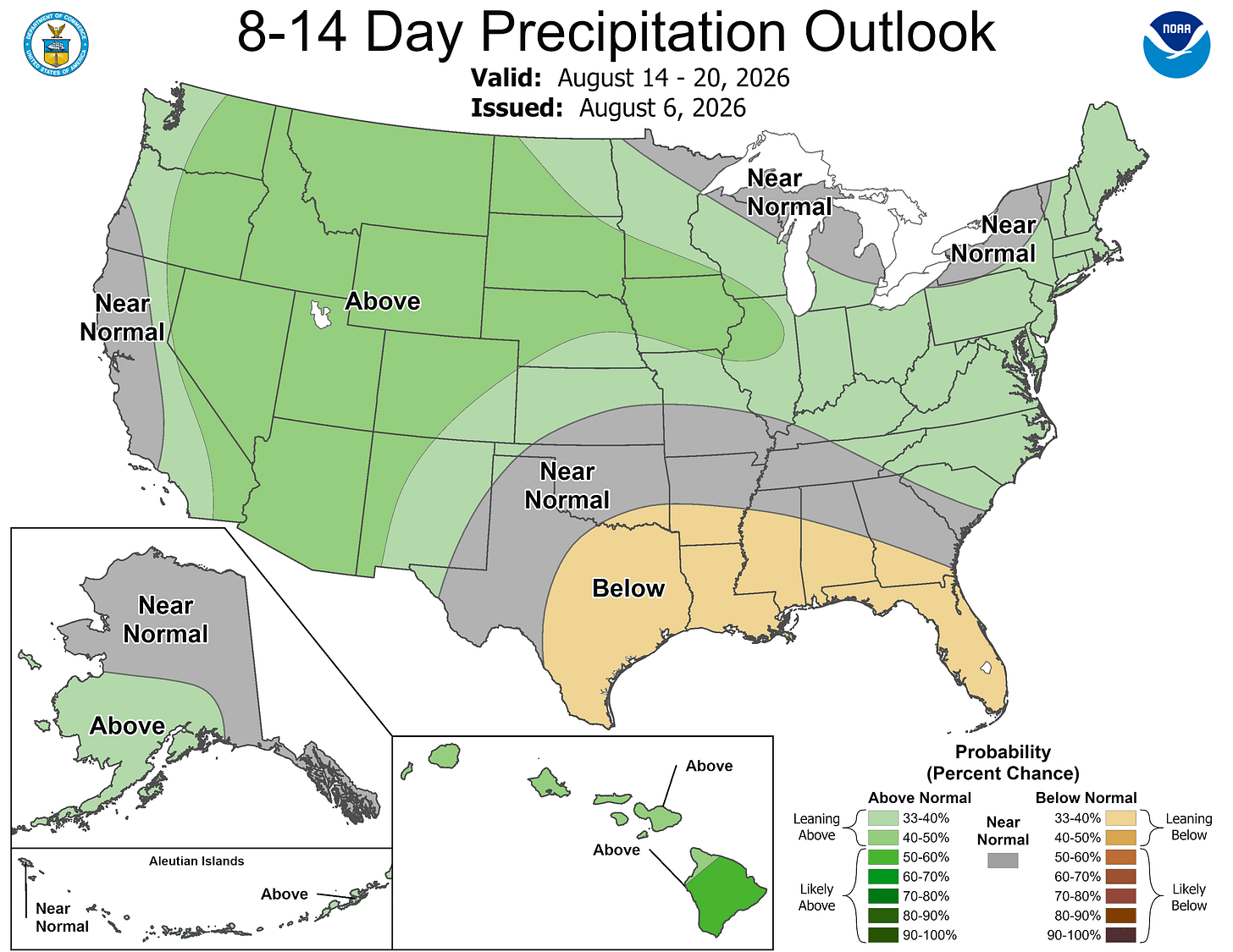
This is the corresponding rainfall forecast — near to slightly above average in Lower Michigan.
Five-day forecast
- Friday: Partly sunny and humid with a brief shower or two. High: 80 degrees. Tonight, partly cloudy and humid; a thunderstorm in spots toward dawn. Low: 68 degrees.
- Saturday: Partly sunny. High: 77 degrees. In the evening, mainly clear with a low of 62 degrees.
- Sunday: Hazy sunshine with a thunderstorm in parts of the area. High: 78 degrees. In the evening, becoming cloudy with a thunderstorm in parts of the area; humid. Low: 66 degrees.
- Monday: Mostly cloudy and humid with a couple of showers and a heavy thunderstorm; storms can bring flooding downpours and localized damaging wind gusts. High: 77 degrees. In the evening, expect a heavy thunderstorm around in the evening; otherwise, mostly cloudy; storms can bring flooding downpours and localized damaging wind gusts. Low: 65 degrees.
- Tuesday: More clouds than sun; humid with a thunderstorm in parts of the area. High: 79 degrees. In the evening, partly cloudy with a low of 63 degrees.
— Subscribe to Bill Steffen's Substack.


