

Heavy rain on Saturday. Get Bill Steffen's weekend forecast.
Rounds of heavy rain will raise the risk of flooding across the Plains and Midwest before reaching the Northeast this weekend, while bringing drought relief to some hard-hit areas, yet perhaps slowing harvest operations.

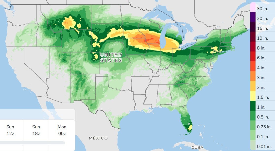
Wow, look at the large swatch of fairly heavy rain that’s expected on Saturday. Look at the scale on the right. The red in Wisconsin is over 3 inches. The orange is over 2 inches and the yellow is over 1.5 inches. This model may be overdoing it a bit, but I think much of southern Michigan may see over an inch of rain. There will be ponding of water on roads and sidewalks.
This is going to make for some very wet football games on Saturday. Most of the Friday night games should be dry, but do start on time and keep the games moving along.
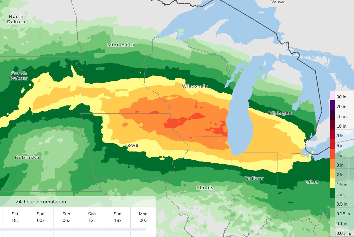
Here’s a closer view of the large area of heavy rain forecast from South Dakota to Michigan and northwest Ohio. Again, check out the scale on the right.
There won’t be much lightning with this, especially north of Grand Rapids and severe weather is unlikely.
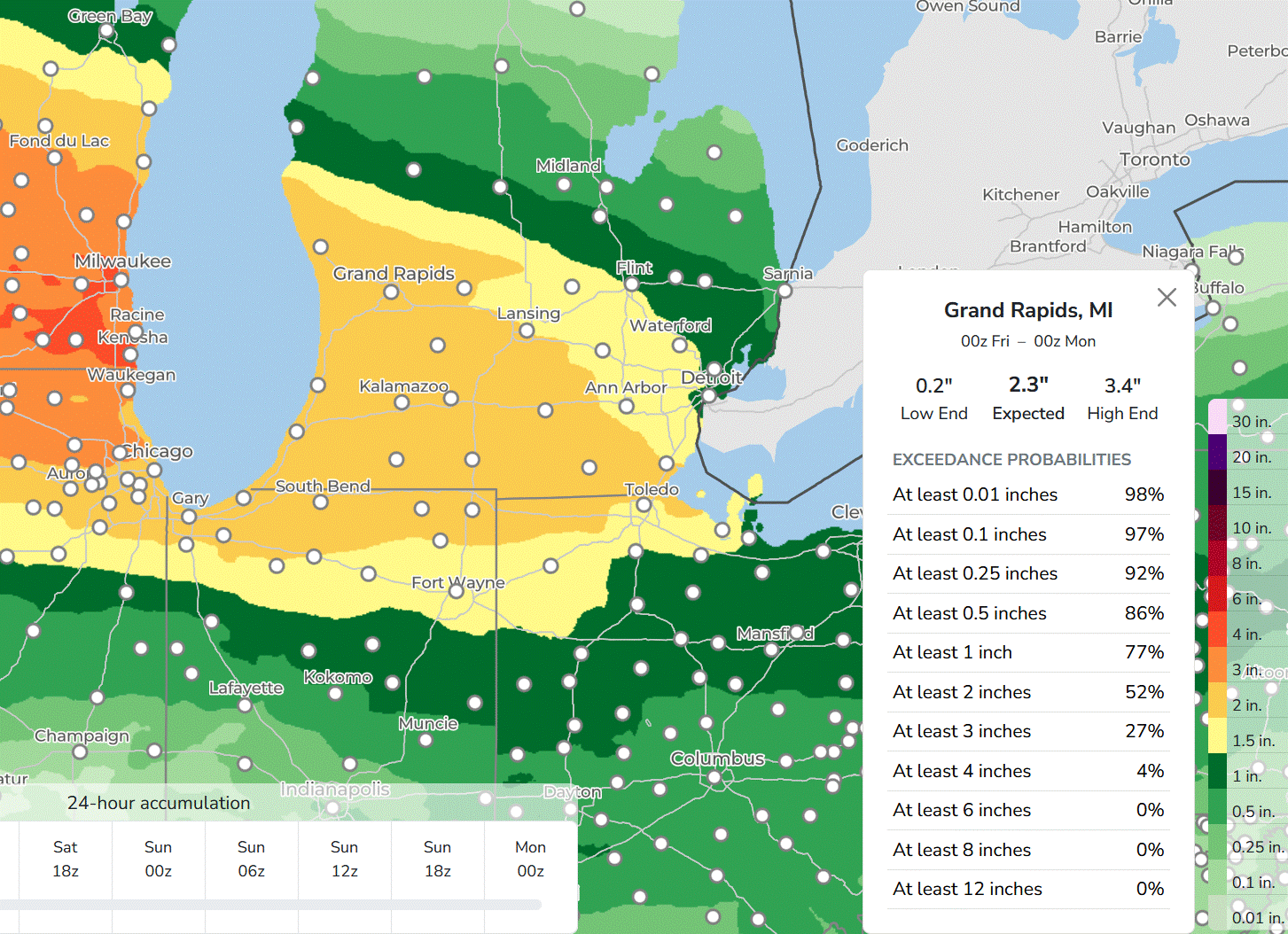
Here’s a query on Grand Rapids. It shows 2.3 inches of total rainfall ... but … remember convective, summer rainfall is quite variable. One town gets a deluge and the next town down the road gets a sprinkle.
The high end is 3.4 inches and the low end amount is 0.2 inches (less than 1/4 inch). That sounds like we don’t know … but … it shows the reality of variable summer rainfall. The map above is smoothed out a bit, while reality would show more variation.
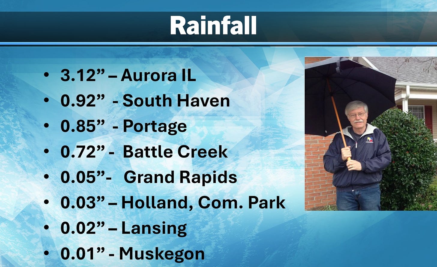
Here’s rainfall from Thursday, and you can see the variation … South Haven got almost an inch, while Holland got just 0.03 inch. Portage is the Kalamazoo Airport. Both Portage and Battle Creek got significant rain, while much of the rest of the area got less than 0.10 inch.
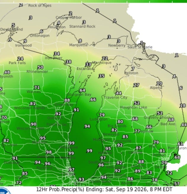
Here’s the probability of measurable rain on Saturday — a whopping 97% in Holland and 92% for Grand Rapids. However, if you go up to the Mackinac Bridge, the odds of measurable rain drop to about 10% (that may be a little low, but it may very well be a dry day in much of the U.P.)
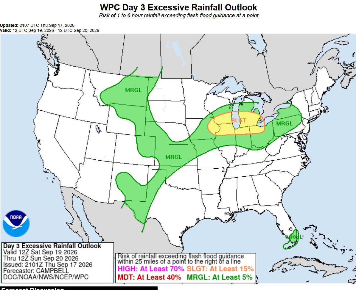
This is the excessive rainfall outlook from the Weather Prediction Center. That’s a level 2 Slight Risk Area from eastern Iowa to Lake Erie. That’s a 15% chance of rainfall exceeding flash flood guidance within 25 miles of a given point.
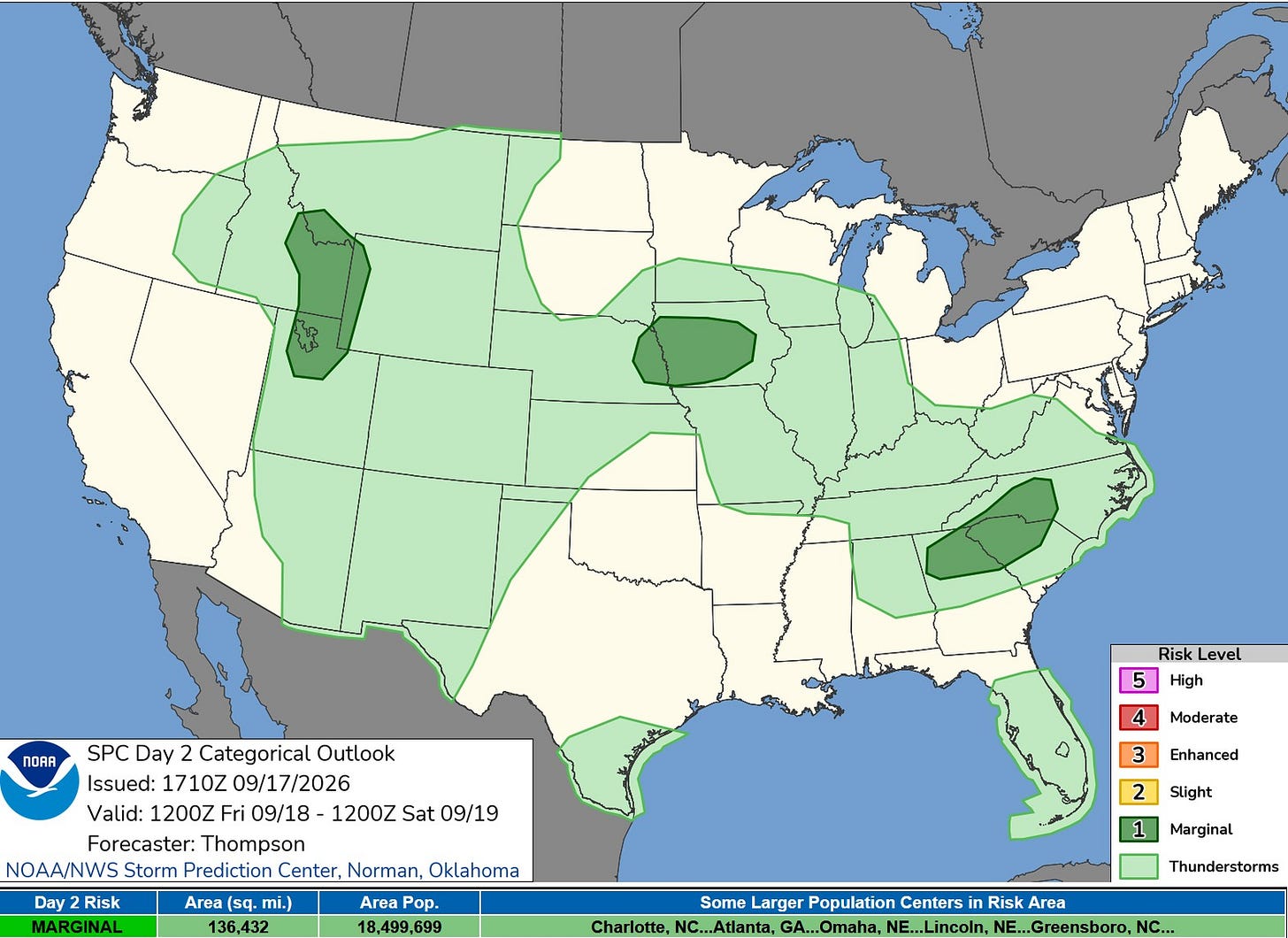
This is the Severe Weather Outlook Map for this Friday. There are 3 “blobs” of level 1 or marginal risk … one in the west, one in the central U.S., and one in the east. Isolated wind damage is the main threat.
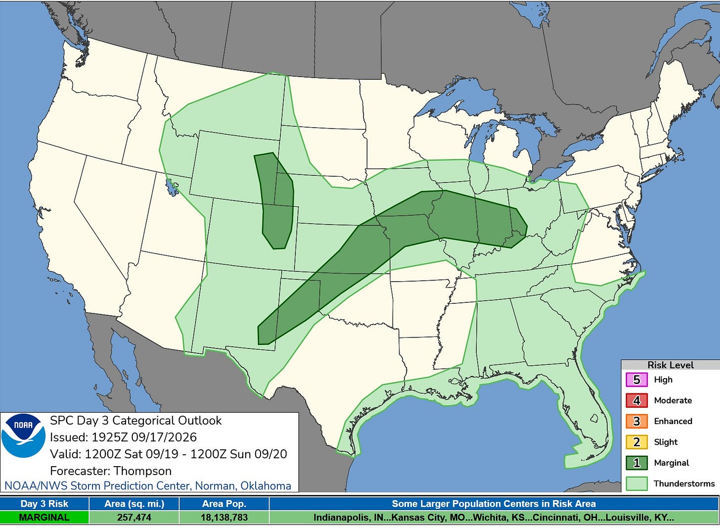
Here’s the Severe Weather Outlook Map for Saturday. Despite the heavy rain, we don’t expect any severe weather in Michigan or Wisconsin. There is a marginal risk area from southeast New Mexico to southwest Ohio. Again, an isolated strong wind gust is possible.
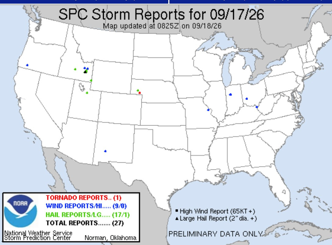
Not much severe weather on Thursday. There was one small, brief tornado touchdown in western Nebraska. Fifteen of the 27 severe reports were in Idaho. Tennis ball-sized hail fell in Rose, Idaho, and there was one injury in Ashland, Kentucky, when a tree fell on someone.
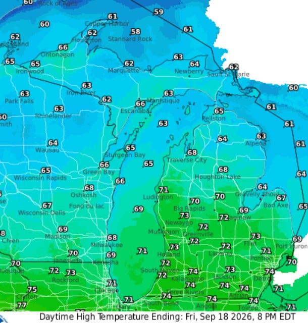
Here are high temperatures for this Friday … ranging from the low-mid 70s over southern Lower Michigan to the low 60s along the Lake Superior shoreline. It should be a pretty nice day, with some morning sunshine and some high clouds moving in during the afternoon.
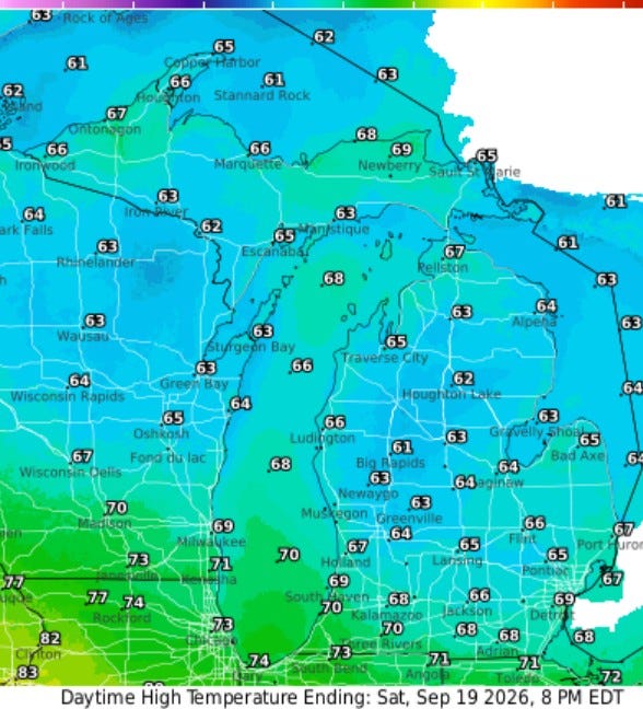
Here are the high temperatures for Saturday. In the rain, much of the day will be in the upper 50s to near 60, so a jacket plus the rain gear will be the order of the day.
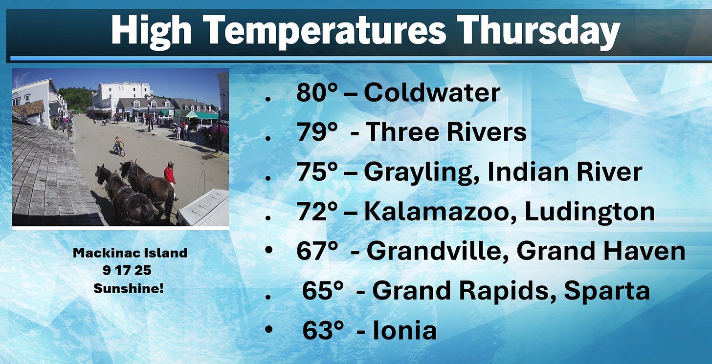
Here are the high temperatures from Thursday. It reached 80 in Coldwater (Branch County) and 79 in Three Rivers. Grand Rapids hit a high of 65, a full 15 degrees cooler than Coldwater. Ionia was only 63. Farther north, there was some sunshine (note the sunshine in the picture of Mackinac Island from Horn’s Bar). Grayling and Indian River climbed to 75 — 10 degrees warmer than Grand Rapids.
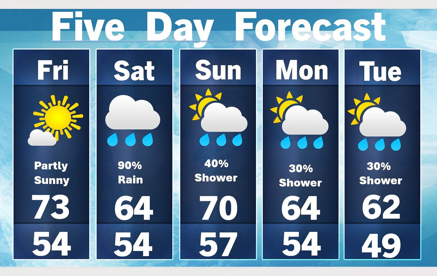
Today will probably be the best day of the bunch. Saturday, there is a +90% chance of measurable rain. We’ll have an extended stretch with east-to-northeast winds.
Much of Sunday, Monday and Tuesday will be dry, but with a chance of a shower. If we get a shower on Sunday, it may be early in the day. Look at those high temperatures in the low-mid 60s — we’ve turned a page toward fall.
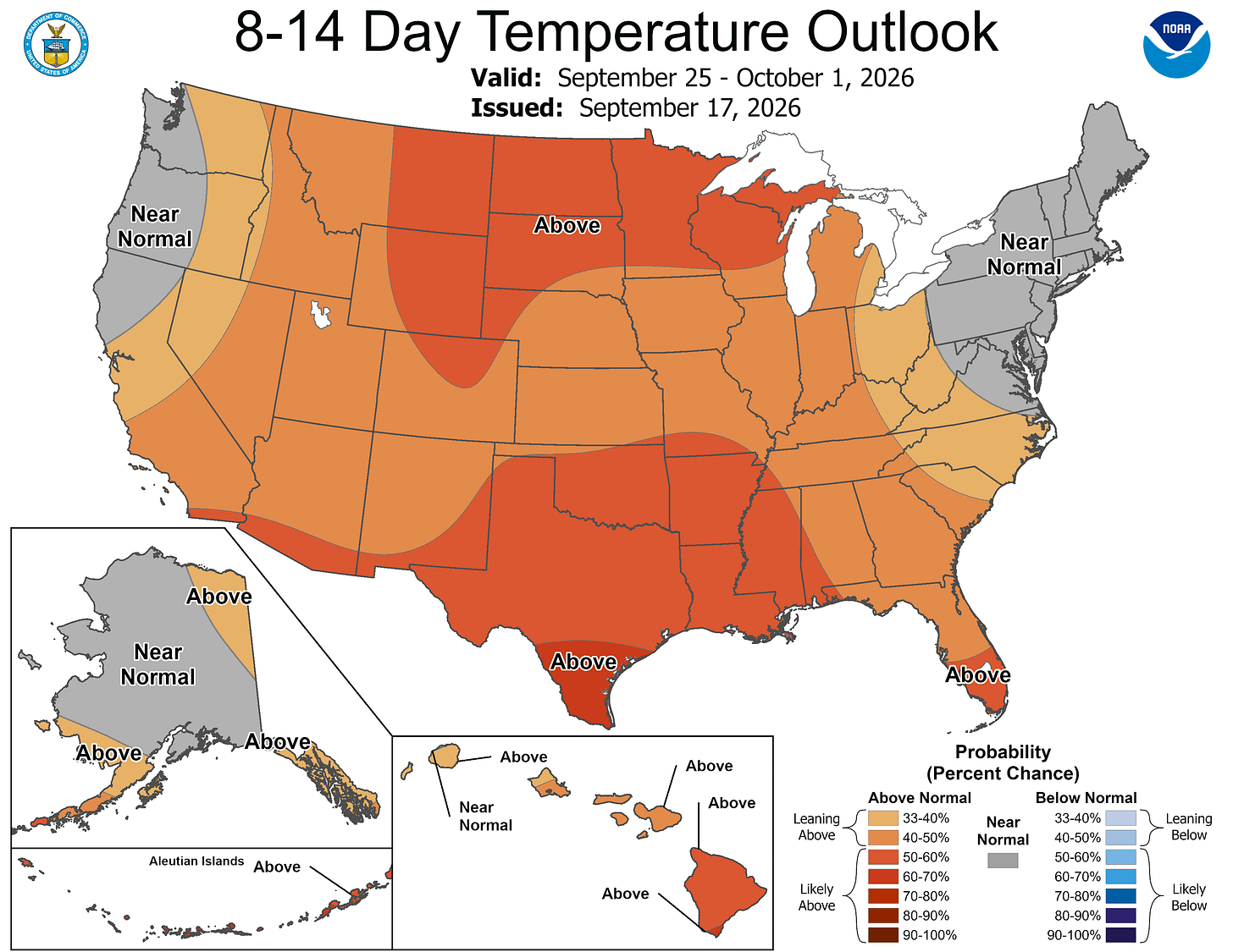
Still no sign of any really cold air on the 8- to 14-day outlook. The map above showers-warmer-than average temperatures in Michigan into early October. With the mild pattern, peak fall color may not occur until the last couple of weeks of October.
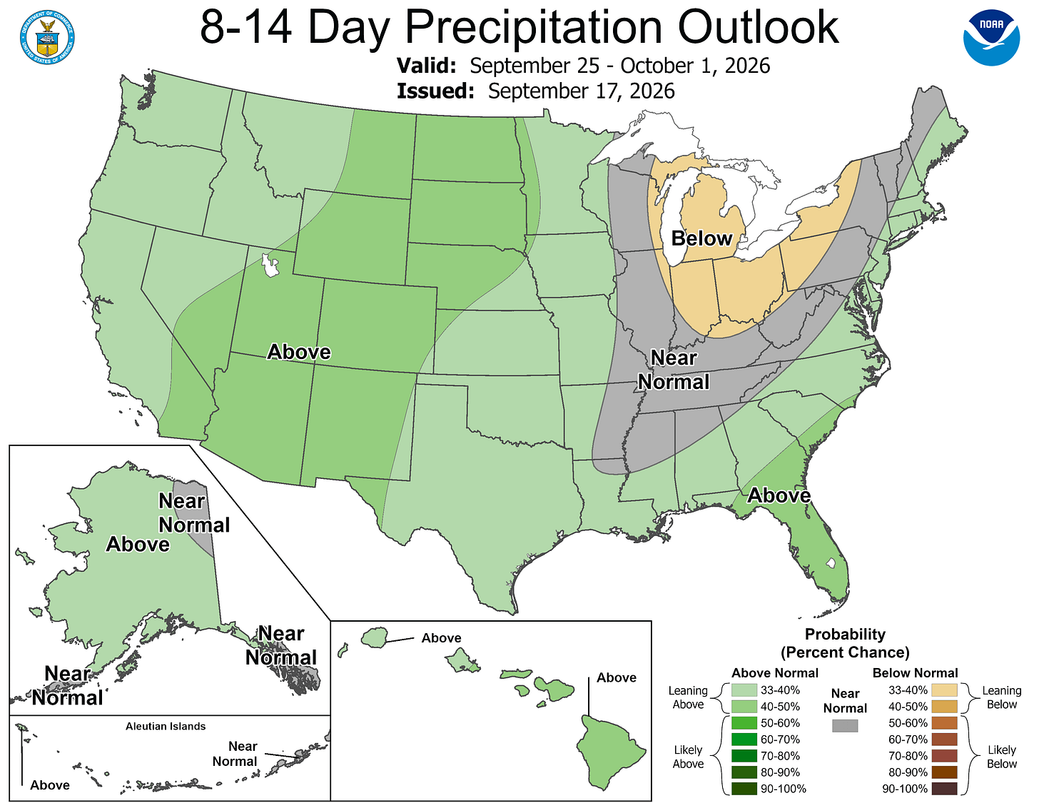
The 8- to 14-day rainfall outlook again shows a dry pattern for the last week of September.
Five-day forecast
- Friday: Mostly sunny, pleasant and less humid. High: 73 degrees. Tonight, cloudy with periods of rain and a thunderstorm late. Low: 54 degrees.
- Saturday: Breezy in the morning; cooler with periods of rain and a thunderstorm; there can be ponding on streets and highways. High: 62 degrees. In the evening, cloudy with a couple of showers. Low: 57 degrees.
- Sunday: Mostly cloudy and warmer. High: 70 degrees. In the evening, a steady breeze in the evening; otherwise, clouds breaking. Low: 53 degrees.
- Monday: Breezy in the morning; variable clouds with a passing shower. High: 64 degrees. In the evening, expect partly cloudy skies with breezy winds. Low: 49 degrees.
- Tuesday: Breezy in the morning; variably cloudy with a couple of showers. High: 64 degrees. In the evening, partly cloudy with a low of 51 degrees.
— Subscribe to Bill Steffen's Substack.


