

Seasonal outlook: Higher-than-normal temps, no early snowfall. Get Bill Steffen's forecast
Probably not a lot of early season snowfall like we had last year.

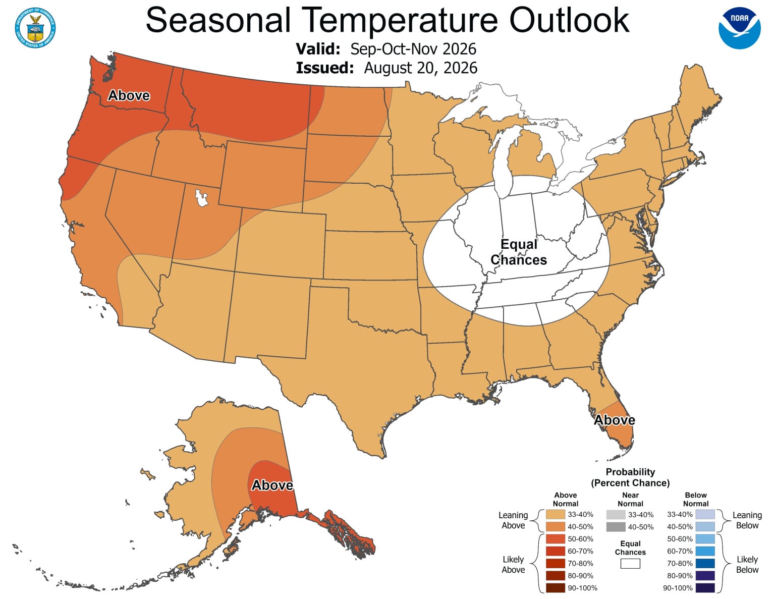
The Climate Prediction Center has released its seasonal forecast for the fall season. There’s a lot of “warmer than average” on this forecast map, not surprising considering the El Niño we have, which should continue through winter.
West Michigan is in the “Equal Chances” and “Leaning Above” categories. This would imply a little troughiness (is that a word?) over the Ohio Valley.
Probably not a lot of early season snowfall like we had last year. Last year, Grand Rapids had our first inch of snowfall on Nov. 9. We ended the month of November with 8.3 inches of snow on Nov. 29-30. On the morning of Nov. 30, Grand Rapids had 8 inches of snow on the ground.
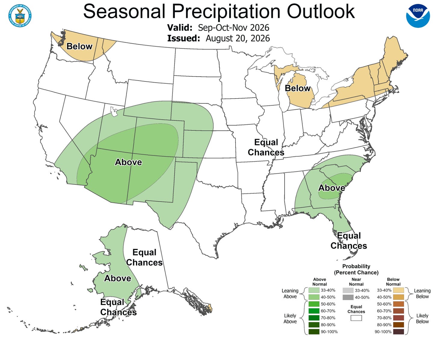
Here’s the precipitation forecast for September-November. Michigan is in the “below-average” category. This would imply not only below-average rain/snow, but with warmer-than-average temperatures, a higher percentage of the precipitation might be rain instead of snow.
I’ve mentioned before that during the strong El Niño winter of 1982-83, we had only 36 inches of snow, and the snowiest day of the winter was March 21 — the first day of spring.
Now, let’s take a moment and talk tropical weather. There will be several tropical storms developing in the next week.
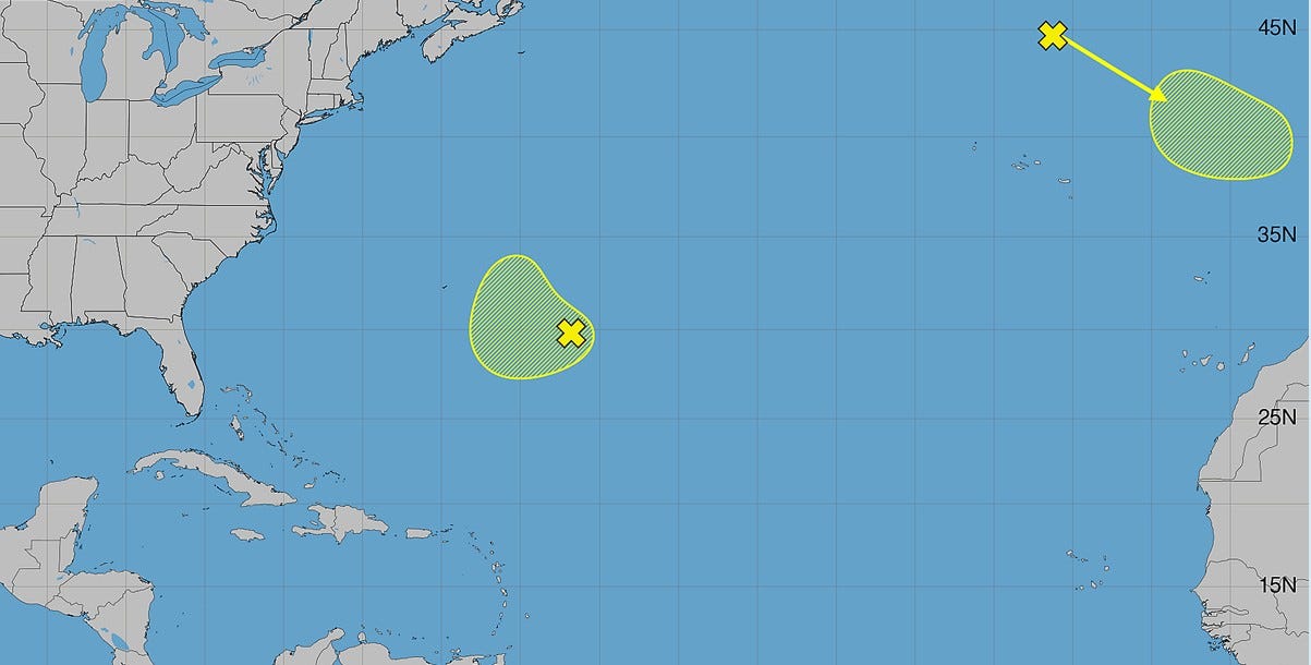
This map from the National Hurricane Center shows the Atlantic/Caribbean/Gulf. Two areas are highlighted. Both had only a 10-20% chance of developing and both are far from the U.S.
However, many of our computer models have a tropical storm developing in the MDR (main development region - off the coast of Africa) in the next 7 to 10 days. These storms are sometimes referred to as “Cape Verde Storms.” They sometimes tend to turn northwest and then north before they reach the Caribbean or U.S. So, don’t get too excited about a potential storm just yet. El Niños often feature a below-average number of Atlantic storms.
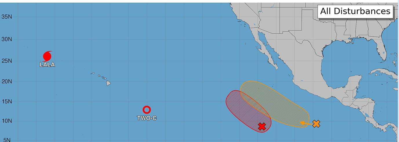
Another characteristic of a strong El Niño is an active Pacific sector, and that has been the case. First, Lala (that hit Hawaii) is still a hurricane. However, it’s moving north toward cooler water, where it will meet its demise.
Next, we have tropical depression TWO-C. This will become tropical storm “Moke” and head northwest toward Hawaii. I think Moke’s path may be slightly farther south than the path of Lala, and it may be slightly less intense. Let’s hope that’s right.
The red “X” is going to become another tropical storm, and the orange X may become a tropical storm. Both of these systems are far enough west that they shouldn’t pose a threat to mainland Mexico.
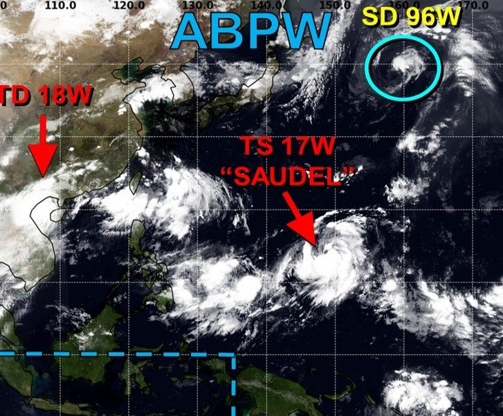
In the western Pacific, we have tropical storm “Saudel,” which will become a significant typhoon.
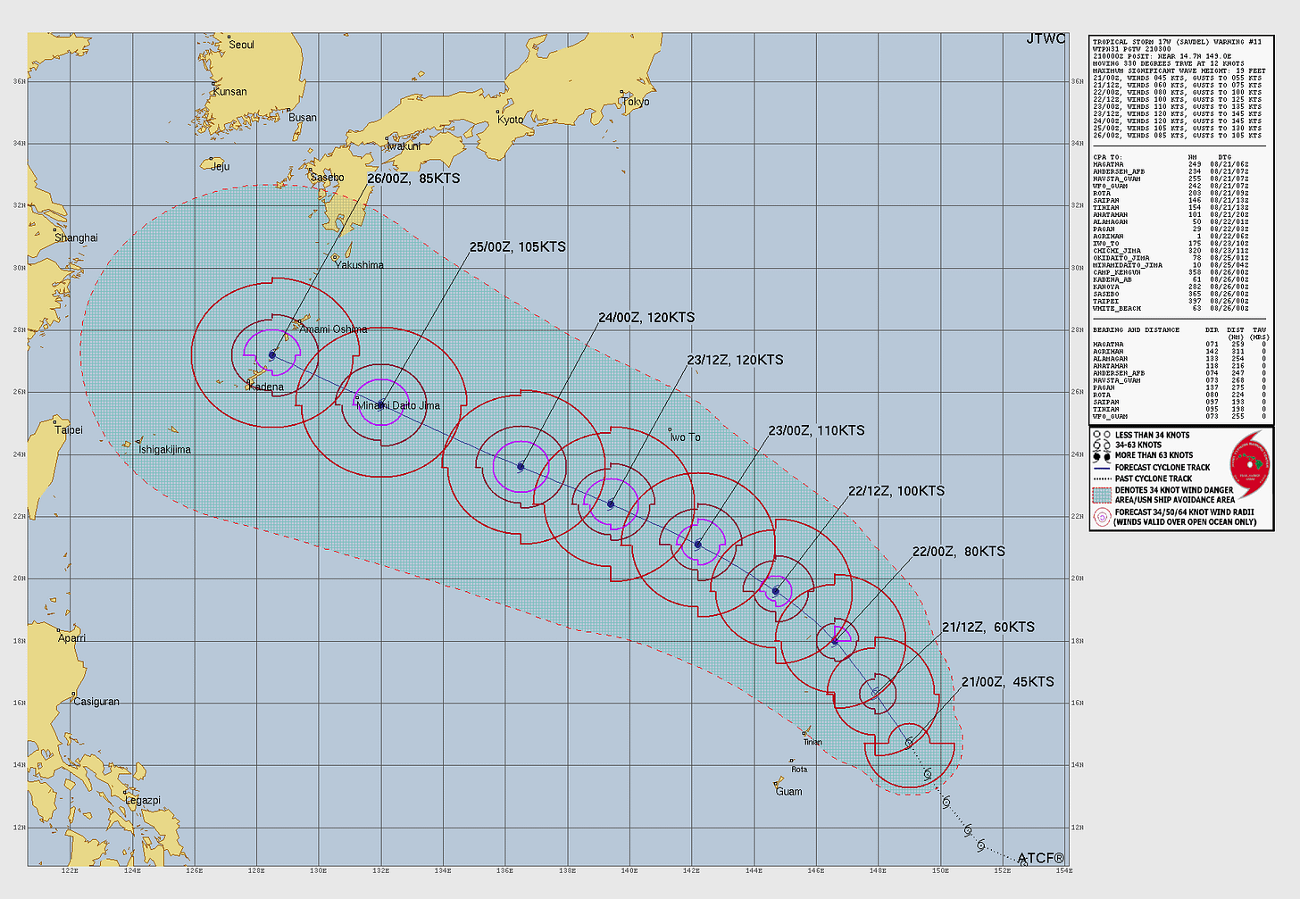
Here’s the projected path of Saudel … moving west-northwest south of Japan and heading toward Shanghai and mainland China.
High temperatures in the first three weeks of August have been quite consistent, between 77 and 86 … we may get through August without a 90-degree day.
This week
No storms today … we’ll see mostly sunny to partly cloudy skies and high temperatures in the mid-70s.
Our next chance of rain will be Tuesday night into Wednesday. Still no sign of any 90-degree days or any unusually cool weather as we move through late August.
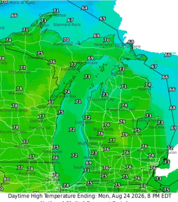
Winds may continue to be a little brisk on Monday, west to northwest at 10-20 mph.
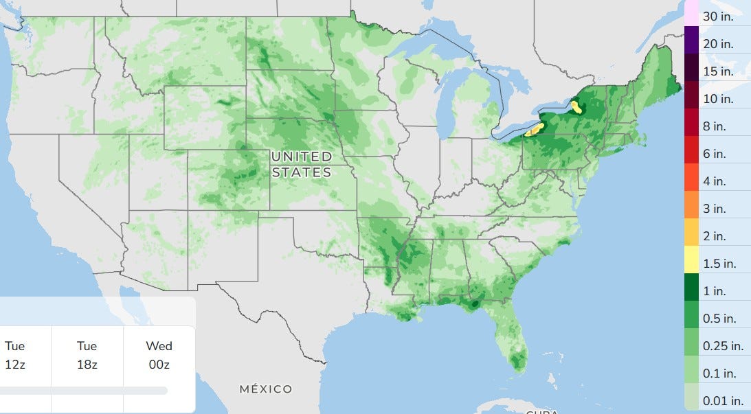
Here’s the three-day total rainfall. No big storm systems in the U.S., just areas of showers and storms, most not severe. Monday and Tuesday look dry. So with three dry days in a row for most of us, the map above shows no measurable rain for Grand Rapids.
Here’s the storm's total rainfall from Saturday:
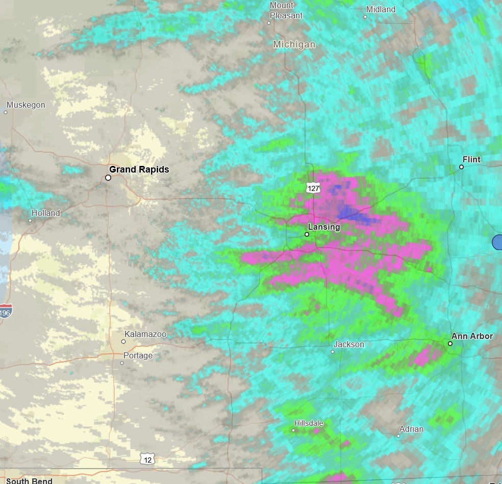
Here’s the storm's total rainfall for Saturday. I had just a trace, one little ol’ sprinkle, but heavy rain fell in the Lansing area. The dark blue on the map above is over 2 inches.
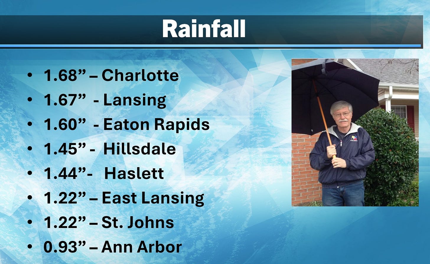
Here are some more rainfall totals from Saturday.
Five-day forecast
- Monday: Sunny for much of the day and pleasant. High: 72 degrees. Tonight, clear to partly cloudy with a low of 52 degrees.
- Tuesday: Partly sunny and pleasant. High: 77 degrees. In the evening, partly cloudy with a low of 63 degrees.
- Wednesday: Times of clouds and sun, breezy and humid with a thunderstorm in spots; thunderstorms can bring localized damaging wind gusts. High: 77 degrees. In the evening, mainly clear and humid. Low: 64 degrees.
- Thursday: Partly sunny and humid with a shower. High: 76 degrees. In the evening, expect clear skies with a low of 59 degrees.
- Friday: Mostly sunny, pleasant and less humid. High: 78 degrees. In the evening, partly cloudy with a low of 60 degrees.
— Subscribe to Bill Steffen's Substack.


