

Severe storms to sweep Midwest with high winds, tornado risk. Get Bill Steffen's forecast
There is a Slight Risk (level 2) of a severe thunderstorm or tornado along and south of I-94 on Wednesday afternoon. The rest of Lower Michigan is at marginal risk.

Areas of heavy, gusty and severe thunderstorms will barrel across the country this week, disrupting outdoor activities and travel.
Much of the downpour and severe thunderstorm activity will focus along a front that slowly presses eastward this week.
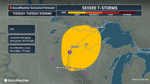
One pocket of severe weather will extend from north-central and northeastern Minnesota, including the Minneapolis metro area, to northwestern Wisconsin and part of Michigan’s Upper Peninsula through Tuesday evening.
The main threats will be damaging hail and wind gusts up to 70 mph.
By Wednesday, the risk of severe thunderstorms will continue over parts of the High Plains, while the most active thunderstorm zone shifts farther to the Midwest.
Severe thunderstorms are forecast Wednesday afternoon and evening from the Chicago area to Indianapolis and Fort Wayne, Indiana; Champaign, Illinois; southern Michigan; and northwestern Ohio.
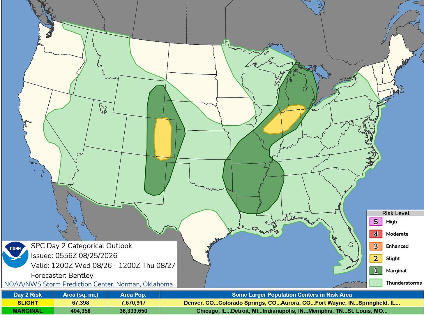
There is a Slight Risk (level 2) of a severe thunderstorm or tornado along and south of I-94 Wednesday afternoon into the evening (yellow on the map above). The rest of Lower Michigan is in the Marginal, or Level 1, Risk Area.
These storms will bring the risk of damaging wind gusts and localized flash flooding.
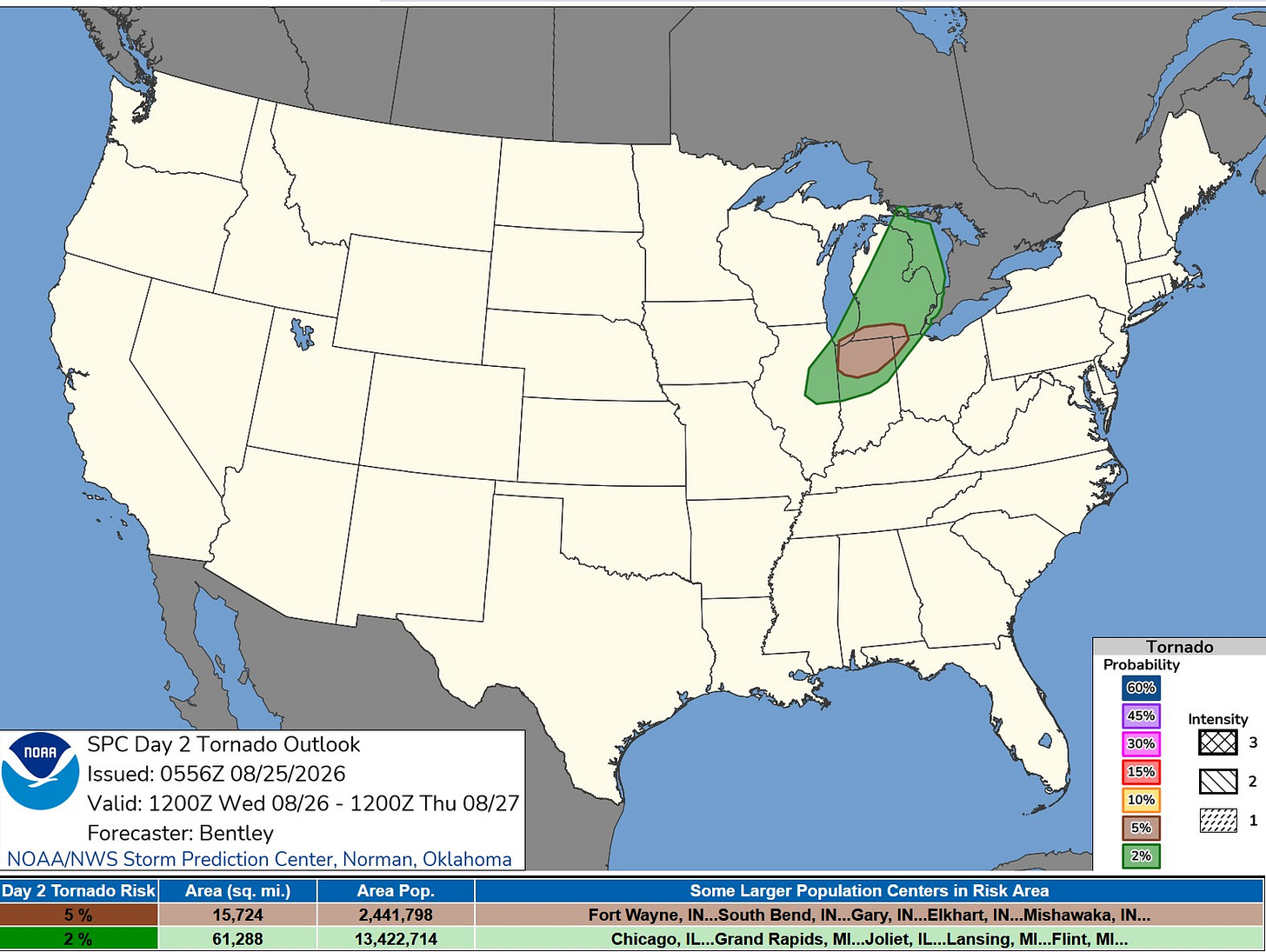
Here’s the tornado risk map. It’s a 5% risk of a tornado within 25 miles of a given point for areas along and south of I-94 and a 2% risk for much of the rest of Lower Michigan
“Large hail and damaging wind gusts will be the primary threat; however, some tornado threat may also exist," the National Weather Service's Storm Prediction Center said. "Low-level hodographs are small, but do show modest directional shear. This low-level shear combined with a supercell storm mode may result in a tornado or two."
On Thursday, the risk of severe thunderstorms and flash flooding will shift into the eastern third of the nation late this week. Most storms will not become severe, and most downpours will not cause flooding. However, the strongest storms could produce damaging winds, travel disruptions and localized flash flooding.

— Subscribe to Bill Steffen's Substack.


