

Chance of a severe T-storm this evening as smoky skies persist. Get Bill Steffen's forecast
Once again, the entire state of Michigan is under an Air Quality alert for elevated levels of fine particulates due to smoke from wildfires in Canada and Minnesota.

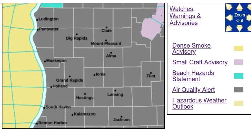
Once again, the entire state of Michigan is under an Air Quality alert for elevated levels of fine particulates due to smoke from wildfires in Canada and Minnesota.
I didn’t get an update from Ontario, where most of the smoke in Michigan is coming from, but Manitoba reported they have 22 helicopters, six water bombers and four other planes (probably dropping fire retardant) fighting wildfires there.
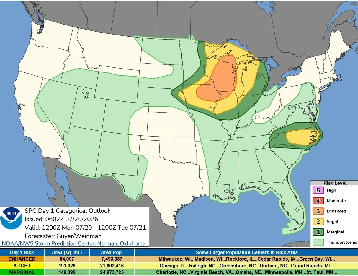
The next story is the severe weather potential across the western Great Lakes. This is the outlook for Monday afternoon/evening from the Storm Prediction Center. That’s a level 3 Enhanced Outlook for much of Wisconsin and a good portion of Upper Michigan. The Slight Risk comes east to a line from South Bend to Alpena and the Marginal Outlook in dark green covers the rest of Lower Michigan.
SPC says: “Severe thunderstorms are expected across portions of the Upper Midwest and Great Lakes vicinity, especially late this afternoon and tonight. Swaths of damaging winds, large hail and a few tornadoes will all be possible."
Keep an eye out for forecast updates today.
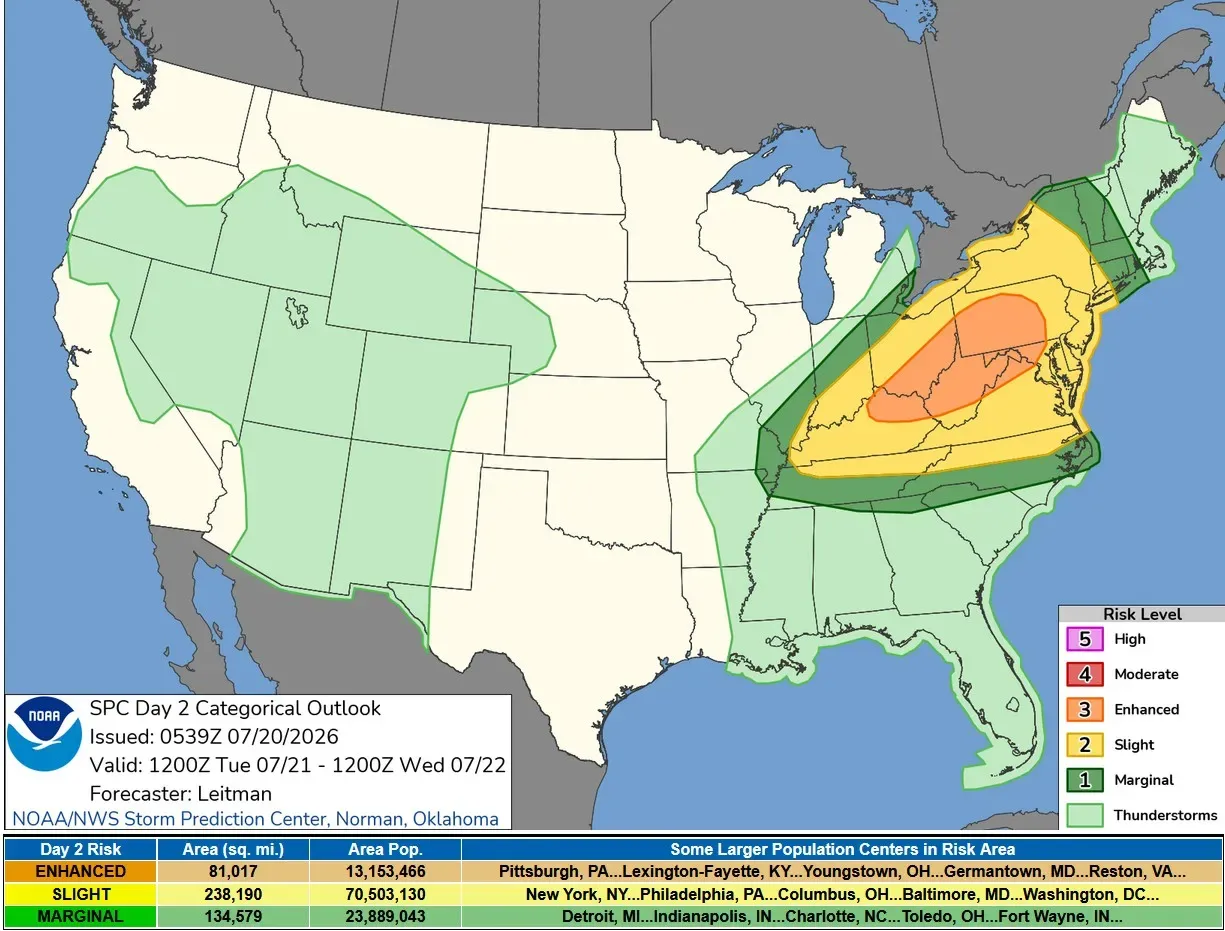
On Tuesday, this strong system shifts east of Michigan. The East has had a lot of severe weather and rain this month. New York (Central Park) has had 6.84 inches of rain so far this July.
Five-day forecast
- Monday: Partly sunny and breezy; a strong thunderstorm in spots late this afternoon; wildfire smoke will reduce air quality. High: 80 degrees. Tonight will be mostly cloudy, breezy and humid with a couple of showers and a heavy thunderstorm, which could bring damaging winds and hail.
- Tuesday: Windy and humid with some sun; a brief shower or two in the afternoon. High: 79 degrees. In the evening, breezy; otherwise, partly cloudy and cooler. Low: 57 degrees.
- Wednesday: Breezy in the morning; otherwise, less humid with clouds giving way to some sun. High: 74 degrees. In the evening, clear skies. Low: 56 degrees.
- Thursday: Sunny and pleasant. High: 76 degrees. In the evening, partly cloudy with a low of 60 degrees.
- Friday: Sunny with a high of 79 degrees. In the evening, expect clear skies with a low of 63 degrees.
— Follow Bill Steffen's Substack.


