

Nice weather with some showers before slight cooldown. Get Bill Steffen's weekend forecast.
Lots of 70s this weekend and next week. August might not see a 90-degree day.

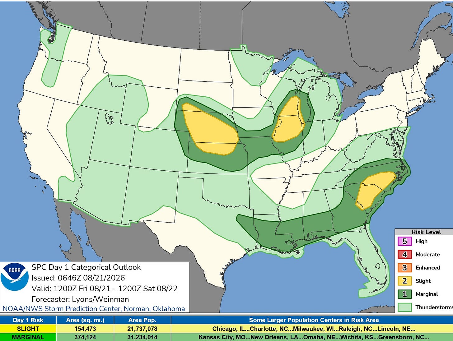
Here’s the Severe Weather Outlook Map for Friday, Aug. 21.
There’s a level 2 (slight risk) area across Lake Michigan, southeast Wisconsin, and northern Illinois. Storms will form out by the Mississippi River and move east to Lake Michigan. Isolated strong winds are expected in the strongest storms. The storms are expected to weaken a bit before moving into West Michigan.
SPC has a level 1 (marginal risk) in the lakeshore counties, but just a general (not severe) outlook east of US 131.
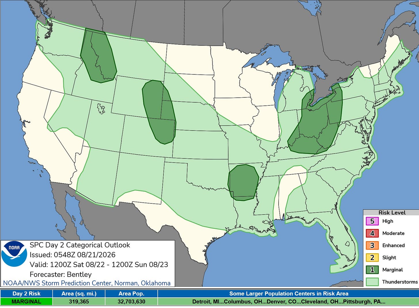
Here’s the Severe Weather Outlook Area for Saturday. The best chance of a storm will be in southeast Michigan. Any activity in West Michigan is likely to be non-severe, and the vast majority of the day should be dry.
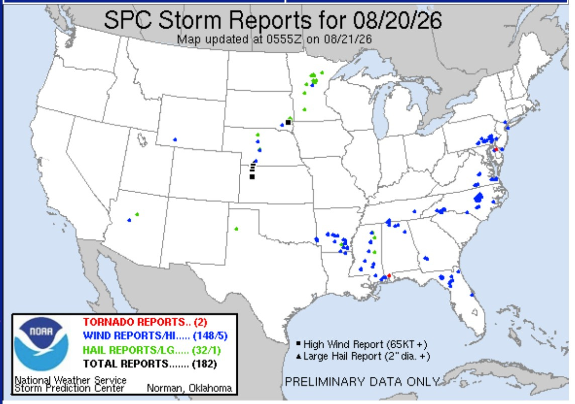
Here are severe storm reports from Thursday. There were two small tornadoes. The one in Delaware was just the second tornado they’ve had this year. The other twister was near Mobile, Alabama; no injuries and relatively minor damage. There was an 83 mph gust in Oakley, Kansas, and an 80 mph gust in Ludell, Kansas.
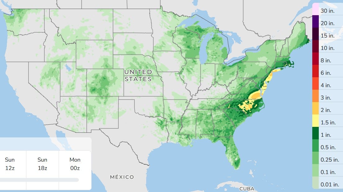
Here’s the three-day total rainfall. The heaviest rain will be along the East Coast. Rainfall will be heavier in eastern Wisconsin than in West Michigan.
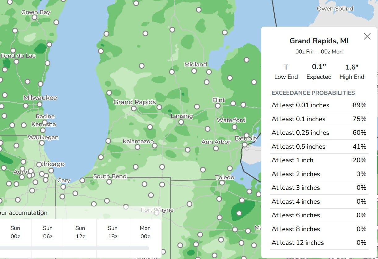
Rainfall in West Michigan will be quite spotty, with some areas getting half an inch and others 1/10th of an inch.
By the way, 10 days after the derecho hit northwest Indiana, they still (as of 6 a.m. Friday) have 46,672 customers without power in Indiana. Most of them are in Lake County (Gary, Hammond, Munster), where 39,074 customers do not have power. Next door, Porter County has 6,195 customers without power.
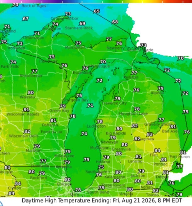
Here are the high temperatures for Friday. We’ll be near 80 by mid-afternoon — a touch more humid than yesterday. A southwest wind will keep it a touch cooler near Lake Michigan.
High temperatures in the first three weeks of August have been quite consistent, between 77 and 86. We may get through August without a 90-degree day.
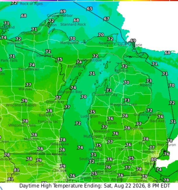
Here are the high temperatures for Saturday — just a bit cooler, with mid-70s inland and low 70s at Lake Michigan. Highs in the mid-to-upper 70s are likely on Sunday, with lots of 70s in the afternoon next week.
Five-day forecast
- Friday: Intervals of clouds and sunshine with a thunderstorm in spots this afternoon. High: 79 degrees. Tonight, partly cloudy with widely separated thunderstorms. Low: 65 degrees.
- Saturday: Partly sunny with a thunderstorm. High: 77 degrees. In the evening, mostly clear with a low of 59 degrees.
- Sunday: Breezy and less humid with plenty of sun, with a high of 74 degrees. In the evening, clear to partly cloudy with a low of 51 degrees.
- Monday: Mostly sunny and comfortable, with a high of 71 degrees. In the evening, mainly clear with a low of 55 degrees.
- Tuesday: Pleasant with periods of clouds and sun. High: 77 degrees. In the evening, expect partly cloudy skies with a shower in spots late. Low: 68 degrees.
— Subscribe to Bill Steffen's Substack.


