

Ottawa County Water Forum outlines regional solutions for aquifer, watershed health
Water professionals, environmental researchers, local officials and community members gathered at the Pinnacle Center in Hudsonville for the 21st Annual Ottawa County Water Quality Forum to address the region’s most pressing water management challenges.

HUDSONVILLE — Water professionals, environmental researchers, local officials and community members gathered at the Pinnacle Center in Hudsonville for the 21st Annual Ottawa County Water Quality Forum to address the region’s most pressing water management challenges.
Hosted by Ottawa County Water Resources Commissioner Joe Bush in partnership with the Outdoor Discovery Center Network, the Ottawa Conservation District and the Holland Board of Public Works, the forum continued a collaborative tradition established in 2006.
The daylong event serves as a central hub for regional policy discussions, scientific research presentations and community engagement surrounding West Michigan's watersheds.
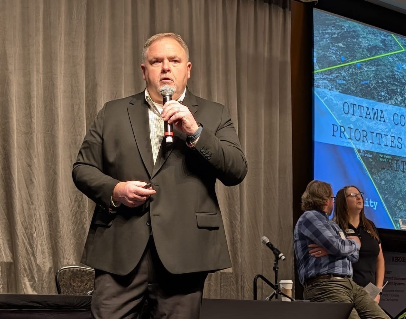
Growth, water security, community action
Opening the forum, Bush reflected on the evolving scope of his office, emphasizing that managing water resources extends far beyond traditional drainage infrastructure.
"Water resources really makes more sense, especially talking on all the topics that we're going to be talking about today," Bush said. "Water matters to me. Water is the most valuable nonrenewable resource we have, and we really need to take care of it."
Bush said water is a critical resource, especially in Ottawa County, where the underground aquifer has declined 40 to 45 feet over the past 40 years.
Jennifer Brozowski, director of the Ottawa County Community Action Agency, detailed the critical need for utility assistance across the county. Over the past three years, the agency provided more than $65,000 in water utility assistance to 171 local families facing shutoffs.
"Water is easy to take for granted, especially here along the lakeshore," Brozowski said. "Behind every number is a person, a family and a story. That is why access to safe, reliable water matters, and why efforts like this event are so important in our community."
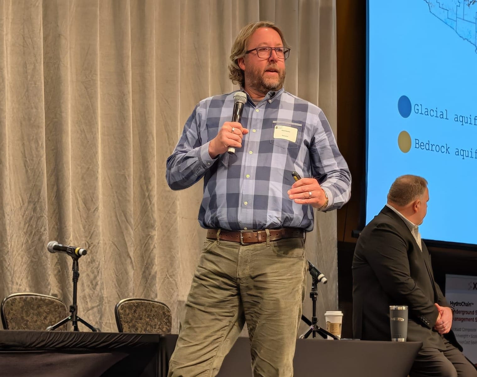
Development, geologic realities
In the session's keynote presentation, Bush and Strategic Impact Director Paul Sachs outlined the core drivers of Ottawa County's complex groundwater challenges.
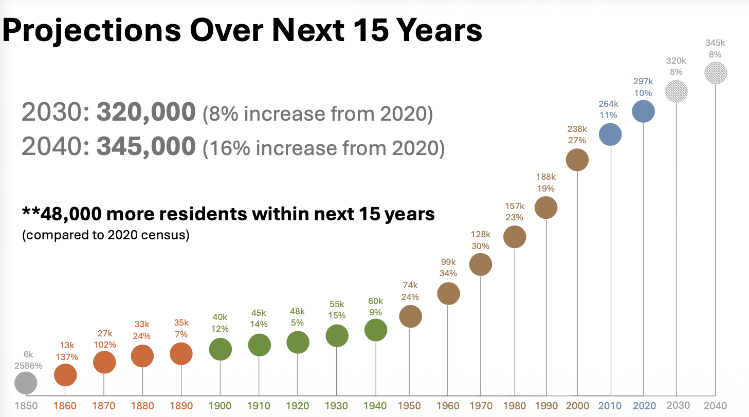
As Michigan's fastest-growing county, Ottawa's population has more than doubled since 1970, topping 300,000 residents and generating rapid residential expansion.
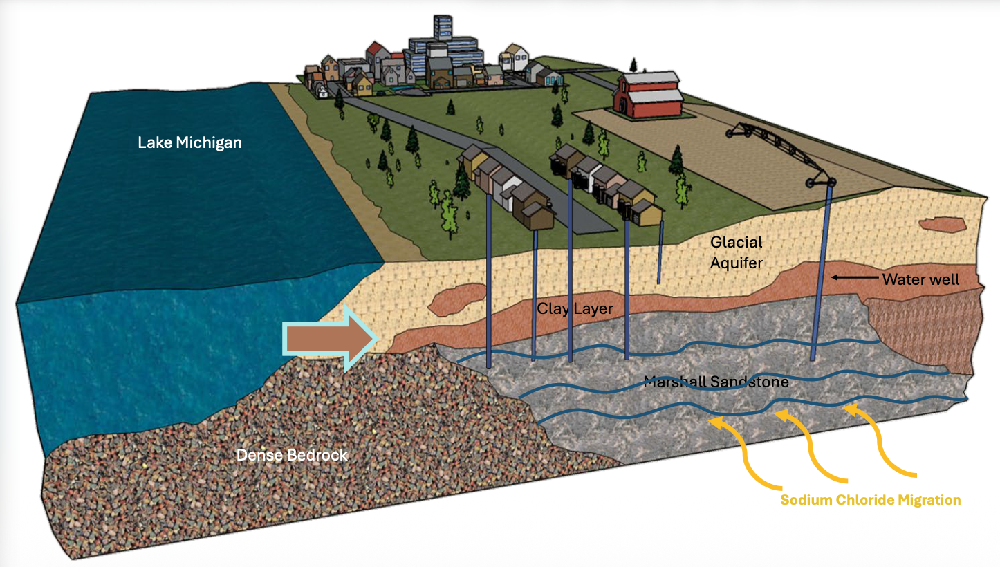
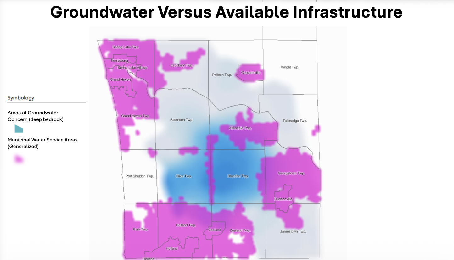
Sachs explained that while 75% of households rely on municipal water systems, roughly 25% — over 27,000 homes — rely on private wells. Crucially, about 6,000 households draw water directly from the deep bedrock Marshall Aquifer due to a distinct regional geological hurdle.
A dense subterranean clay layer separates the shallow glacial surface aquifer from the deeper Marshall sandstone bedrock, blocking natural rainwater from replenishing the lower system.
"That clay layer [is] capping the ability for the natural recharge of the system," Sachs said. "We are pumping more water out of that Marshall sandstone than can actually go back into it."
As residential development accelerates in unpiped rural areas, intense lawn irrigation and high well density are causing static water tables to drop while pulling up underlying prehistoric sodium chloride deposits.
"As we've continued to grow, and you put more straws into that Marshall sandstone, what we're noticing is that water level is dropping," Sachs said.
Data from local monitoring wells reveal severe seasonal drawdowns every summer, followed by incomplete winter rebounds when pumping pauses.
Compounding the problem, the county has converted nearly 42,000 acres of agricultural land to other uses over recent agricultural census cycles.
"Conversion of that farmland does not help the groundwater situation in this county," Sachs said, explaining how residential developments replace open land and draw heavily on bedrock wells.
Managed recharge, advanced mapping
To counter long-term supply depletion, county leaders are actively exploring new management strategies, including recharging the aquifer with deep injection wells — a process used in arid Western states.
Bush secured a $500,000 state grant through bipartisan legislative support to initiate a comprehensive recharge feasibility study to explore the concept for Michigan.
"Out in Arizona, it's a commodity. Recharge is a commodity," Bush said. "No water left behind out West. ... We've never looked at recharge as a source for the future. Managed aquifer recharge is viable, and it could happen, but there's a lot of complexity to it, and a lot of science and data."
Additionally, Sachs and Bush highlighted multi-agency monitoring initiatives. Strategic Impact staff have installed 23 dedicated monitoring wells countywide, with plans to bring 11 more online to track real-time seasonal water table fluctuations.
In collaboration with state and federal geological agencies, low-flying helicopters equipped with airborne electromagnetic sensors have gathered deep subsurface data across central Ottawa County.
"We're going to get a really refined understanding of our geologic conditions," Sachs explained. "The best decisions that we're going to make need to be informed with real data."
Local control, adaptive planning
Addressing audience questions regarding potential policy mandates, Bush and Sachs emphasized collaboration and voluntary stewardship over top-down regulations.
Bush reiterated his commitment to local municipal control, encouraging townships to update local zoning ordinances to support native, low-water landscaping rather than imposing countywide mandates.
"I do not like the word 'require'; it's always a recommendation," he said, discussing site development and zoning. "It's about collaboration because we each bring something to the table. ... We really, really come together when times get tough to come up with solutions."
[Courtesy/Ottawa County]
Addressing long-term growth, officials noted that while expanding municipal water pipelines remains an option, the infrastructure costs are immense.
Collaborative inter-municipal utility loops — such as recent expansions connecting Georgetown and Blendon townships — along with countywide strategic growth planning, remain vital tools to shield residents from future supply failures.
"This isn't something that's an emergency today, but it's something to think about for Ottawa County's future," Bush said. "Water should be nonpolitical. ... Everybody needs water, no matter where you live."
The challenges of city drinking water
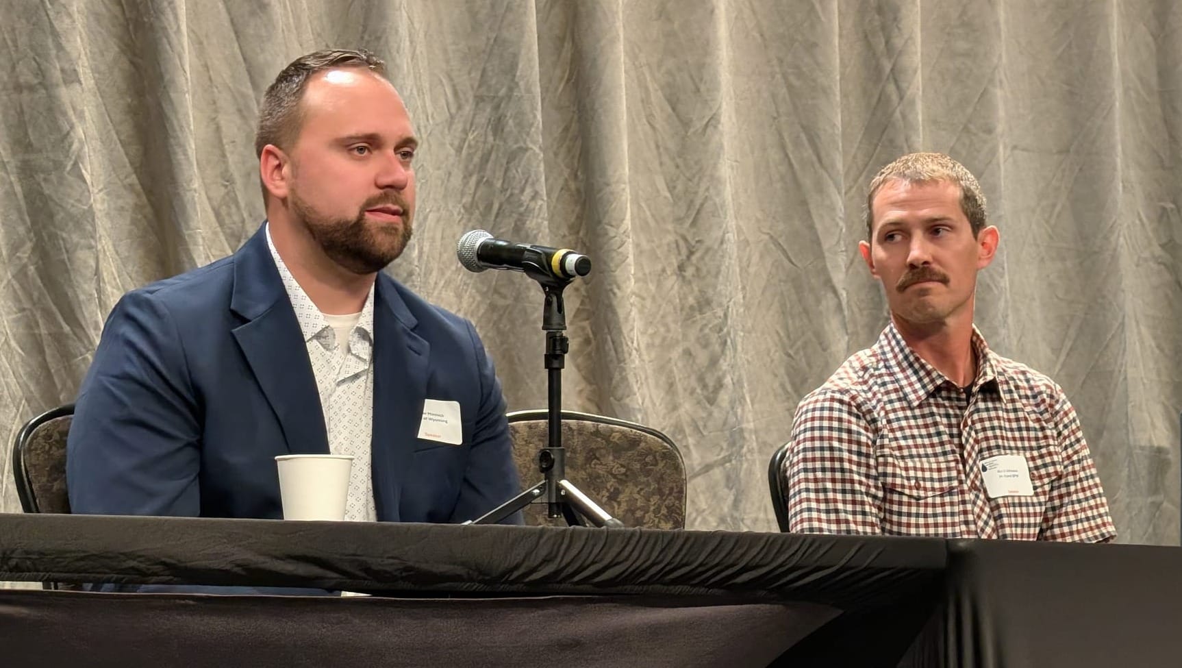
In a session focused on drinking water, Nate Johnson, drinking water treatment plant superintendent for the Holland Board of Public Works, and Peter Minnich, lab services manager for the city of Wyoming, outlined the complex work of serving roughly 300,000 regional residents.
For both utilities, the immediate hurdle is the physical limit of pipes, pumps and treatment basins. Wyoming operates a treatment plant rated for 120 million gallons a day, piping water to its residents and a sprawling network of customer communities. Five years ago, an engineering study projected that meeting regional expansion over the next two to three decades would carry a $500 million price tag.
"One of the biggest challenges we're facing is the financial implications of those investments," Minnich explained, "and making sure that we are not putting the financial burden on today's customers for future generations' water consumption."
To eliminate critical bottlenecks, Wyoming is burying a massive, 5-foot-diameter steel transmission main across the county.
Seasonal weather presents an immediate operational strain. During winter, Wyoming pushes around 30 million gallons per day (MGD) through its system. On scorching summer afternoons, that figure surges to 80 or 90 MGD, driven primarily by lawn irrigation.
To combat peak surges without triggering premature, multimillion-dollar plant expansions, Holland BPW uses voluntary conservation programs alongside a tiered water rate structure. Residents pay a base rate for normal indoor use, while heavy summer outdoor irrigation triggers higher rates.
Beyond physical operations, modern water management requires digital defense against potential cyber threats. Both leaders reassured attendees that local systems can be instantly "air-gapped" and operated manually on-site.
"We've got measures at the water plant where we can run very locally without being connected to the internet," Johnson said, noting Holland BPW works closely with the FBI on security protocols. "If something were to happen and we noticed an intrusion, we can pull the plug, so to speak, and run very locally."
Addressing public health standards, both facilities maintain fluoride levels at targets set by the Centers for Disease Control and Prevention (0.6 to 0.7 ppm) and consistently test well below lead action thresholds.
However, under Michigan's updated lead and copper rule, utilities must replace all lead service lines regardless of test scores.
"Even though our lead levels in our testing come back well below what the state allows ... we're still required under the state's newest law to replace those lines," Johnson said. "That's a major financial burden that we're taking on right now."
The state of Lake Macatawa
Tucked along the West Michigan shoreline near Holland, the drowned river-mouth of Lake Macatawa has long struggled under a heavy burden of phosphorus and sediment.
What began as a straightforward ecological rescue mission, however, recently took a plot twist that left environmental scientists reevaluating everything they thought they knew about the lake’s inner workings.
To understand where things stand today, one has to go back to 1997.
That year, state environmental regulators placed Lake Macatawa on Michigan’s list of impaired waters, setting a strict total maximum daily load (TMDL) requirement to cut incoming phosphorus by 70%.
At the time, total phosphorus concentrations sat around 125 micrograms per liter. The interim goal was to bring that number down to 50 micrograms per liter.
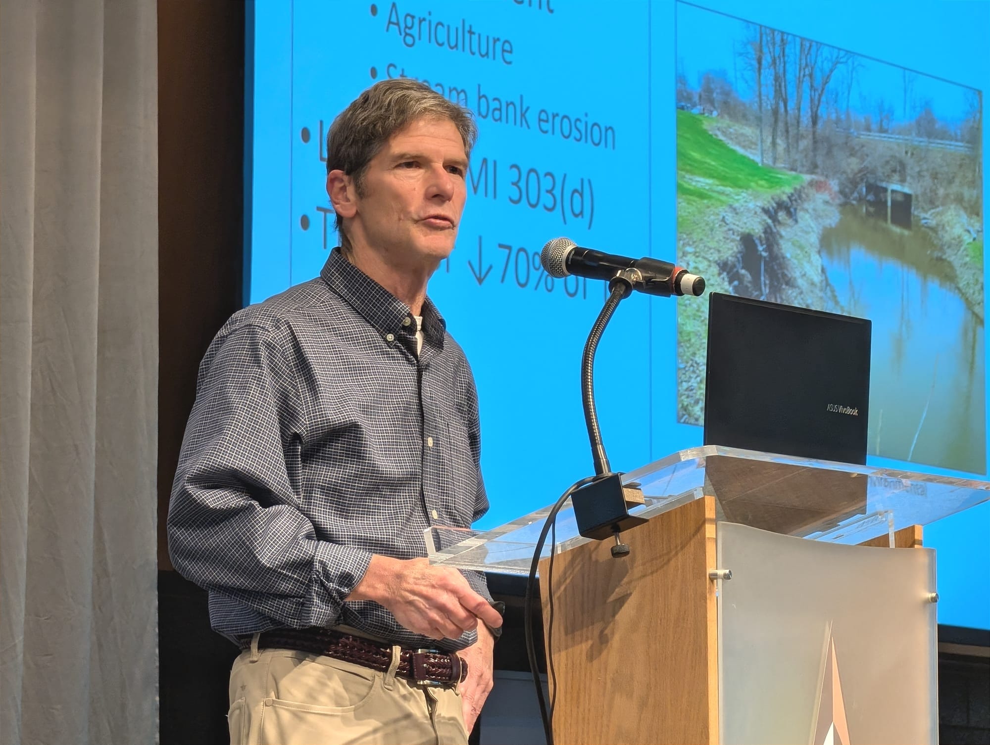
Instead, three years later, concentrations surged to a staggering 250 micrograms per liter — "really high concentrations" that Alan Steinman, of the Grand Valley State University Annis Water Resources Institute, noted cause "a lot of impairment in the lake."
Recognizing that throwing treatments into the lake while pollution continued to pour in from upstream was a losing battle, community partners launched Project Clarity in 2013. Spearheaded by the ODC Network, the campaign adopted a watershed-first strategy.
"The feeling was, if we started to work on the lake early, and all this phosphorus and sediment was still coming into the system, that any benefits you would have in the lake would be very short-term, and therefore we needed to stop the sources before we worked on the lake," Steinman said.
Over the next decade, conservation teams implemented more than 250 restoration and conservation projects across the surrounding landscape. Modeling estimates showed the efforts paid massive dividends on paper, keeping roughly 46,000 tons of sediment and 40,000 pounds of phosphorus out of the lake every year. For a time, the lake responded, and phosphorus concentrations dropped by about 60% over the first 10 years.

Then came the backslide.
By summer 2025, long-term monitoring across five key sampling sites revealed that phosphorus levels had crept back up to 129 micrograms per liter — higher than when the TMDL was originally implemented. Chlorophyll-a concentrations — a proxy for algal blooms — averaged 38 micrograms per liter, far above the target range of 10 to 20 micrograms per liter.
"Overall, on the current state of the lake, efforts to reduce the sediment and phosphorus loading have had some successes ... limited success," Steinman said. "However, the chlorophyll and phosphorus concentrations are still way too high to have a healthy lake."
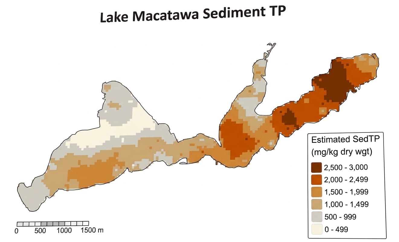
Determined to find where the lingering pollution was coming from, researchers at the Annis Water Resources Institute turned their attention to the lakebed. They mapped Lake Macatawa into 127 individual grid cells, taking soil cores across 126 of them to analyze sediment chemistry.
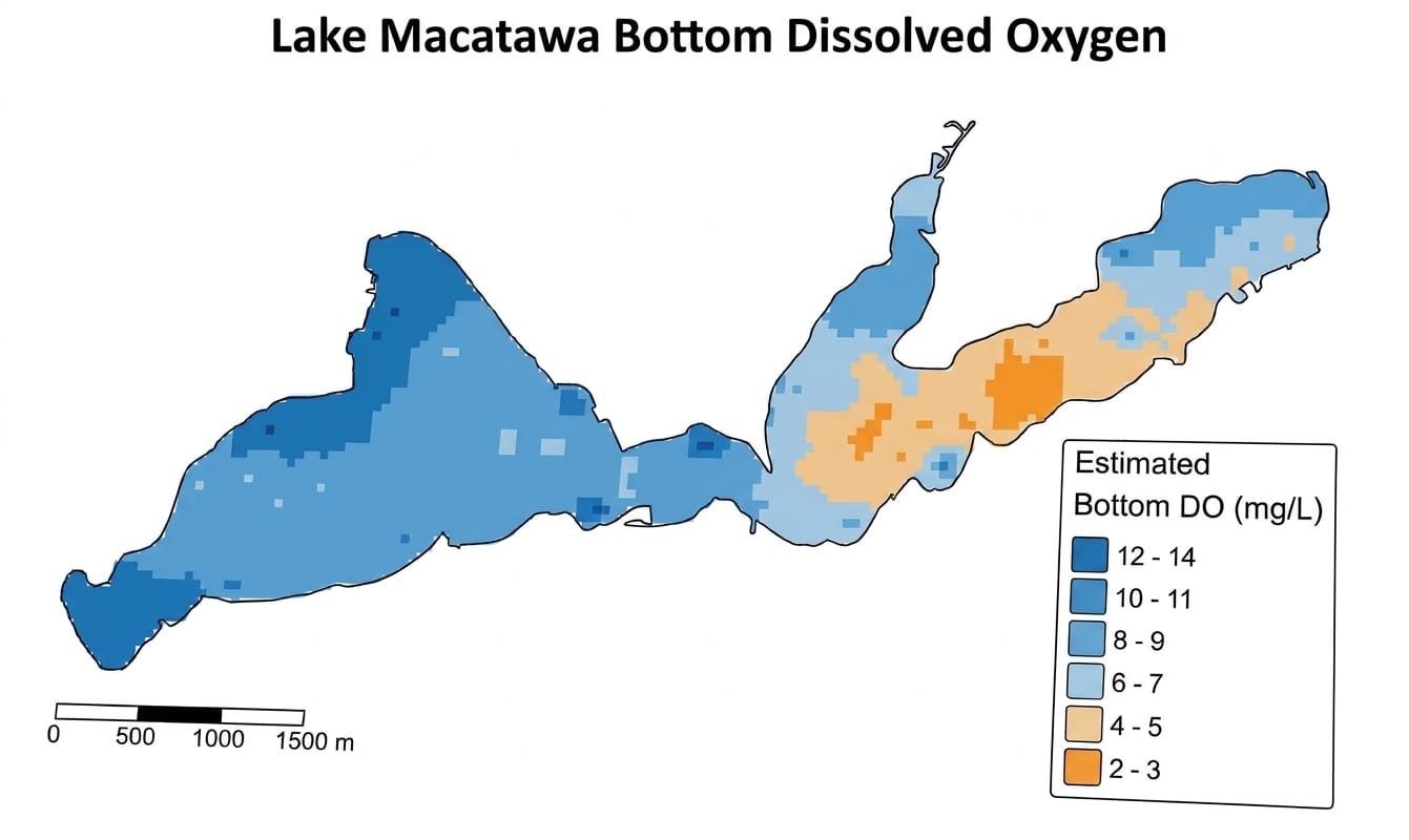
The primary suspect was passive "internal loading" — phosphorus leaching out of the sediment during low-oxygen conditions. In many regional lakes, this chemical release acts like a continuous internal pollution engine, boosting phosphorus output two to 10 times higher under anoxic (oxygen-depleted) conditions compared to oxic conditions.
When Steinman's lab brought the Macatawa sediment cores back to the laboratory and tested them under oxygen-starved conditions, they braced for massive phosphorus leakage. Instead, they found the exact opposite. Not only was the phosphorus failing to escape the mud, but the sediment was actually absorbing extra phosphorus out of the water column.
"The sediments are actually acting as a sink, not as a source in Lake Macatawa," Steinman revealed. "Totally surprising. We did not expect this at all, and it's actually in some respects good news, but you also have to explain why we're still getting so much phosphorus in Lake Macatawa."
A closer look at the sediment chemistry explained why: The local soil is naturally rich in iron and aluminum, holding an iron-to-phosphorus ratio of 22-to-1. Ratios above 15-to-1 indicate ample iron to permanently bind phosphorus to the lakebed.
"We have multiple lines of evidence: the metals, the phosphorus release rates, the mobile phosphorus concentrations, all indicating that there's not much diffusive flux, if any, going on in Lake Macatawa," he said.
[Courtesy/Ottawa County]
If the phosphorus wasn't chemically leaching out of the mud, how was the water column staying so heavily polluted? Steinman pointed away from chemistry and toward physical factors.
"This resuspension may be what's happening in terms of the phosphorus flux into the water column. ... We know Lake Macatawa is shallow. A lot of boating action, a lot of props, and then physical wind wave action as well can be stirring up the sediments and releasing the phosphorus that way."
Bottom-feeding fish such as carp and gizzard shad are also likely contributing by physically working through the mud.
This new narrative changes how stewards will approach Lake Macatawa’s future. Instead of applying chemical treatments systemwide, Steinman recommends applying alum or lanthanum strictly in targeted hotspots, particularly in the eastern arm.
"Not only will that provide a preventive cap, but it also strips the phosphorus out of the water column when it's being applied, so you get a double benefit," he said.
To tackle resuspension, managers are evaluating ways to stabilize the sediment naturally by bringing back native aquatic vegetation, while also exploring engineered physical barriers, such as J-curve structures, to break up wave action. Upstream, watershed efforts will focus on high-impact, targeted sub-basins to stop the persistent runoff still entering the system.
Paw Paw Park streambank restoration
On the west side of the road, the city of Holland maintains a wooded park with walking paths that trace the Macatawa River. To the east, Ottawa County Parks converted a former golf course — a property notorious for chronic flooding — into a wetland park crisscrossed by trails, disc golf greens and restoration habitat.
Underneath that serene landscape, however, the river was quietly eating away at its own banks.
Every time heavy rains hit the watershed, the Macatawa River surged, tearing away soil and encroaching dangerously close to public walking trails.
Kelly Goward, watersheds and sustainability director at ODC Network, and Tony Heath, a civil engineer, detailed the goal of fixing a long stretch of collapsing streambank.
After securing funding, Heath made a winter site visit that proved pivotal.
"If you start a project in June, it's a lot harder to tell where the problems are ... vegetation hides a lot," he said. "A lot of times that vegetation on top of the bank grows in the summer ... but it's not putting roots in and holding it. It's just masking a problem underneath."
That winter visit revealed several hundred feet of severe erosion hidden beneath summer foliage, expanding the project limits across critical priority zones before formal surveys even began.
Navigating the engineering design was only half the battle, as regulatory and logistical hurdles quickly escalated costs.
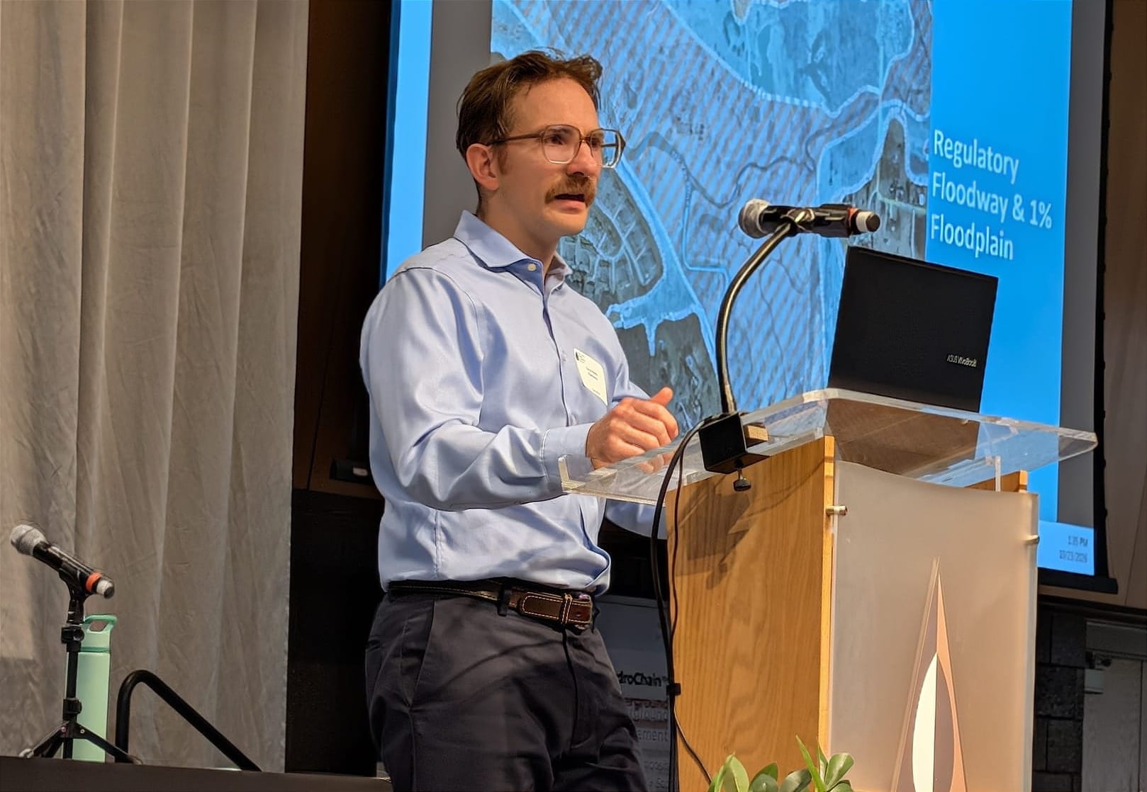
Because Paw Paw Park acts as a natural flood basin, the entire project site sits inside a state-designated floodway. Under regulations enforced by the Michigan Department of Environment, Great Lakes, and Energy (EGLE), placing excavated soil anywhere inside a floodway is strictly restricted to avoid compounding flood risks elsewhere. With nowhere inside the park to spread the excavated mud, engineers had no choice: Every ton of soil pulled from the riverbanks had to be hauled completely off-site.
To stop the erosion long-term, natural channel design principles were applied to fix the river's entrenched shape. The Macatawa River through Paw Paw Park had developed a severe U-shape — a narrow, highly entrenched channel with vertical walls. During heavy rains, rising water had no room to expand, forcing velocities to skyrocket and scouring away the mud banks.
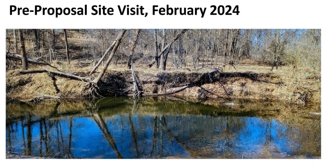
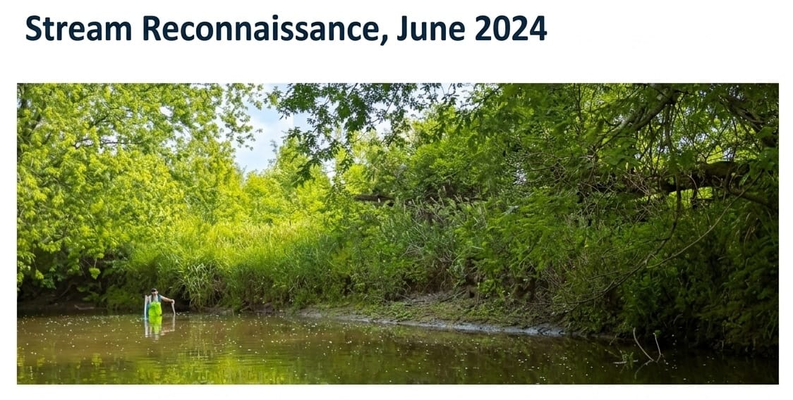
A before and after view of the Macatawa River shoreline in Paw Paw Park after restoration. [Sarah Leach/ONN]
To solve this, the team excavated low-lying flood benches along the riverbanks. During normal flows, these benches remain dry, but during spring surges, the river spills onto them, spreading out energy, slowing down velocity and trapping sediment before it reaches Lake Macatawa.
At critical river bends, contractors installed stone J-hook structures — boulders placed upstream at an angle with a slight hook at the end.
"Smart contractors are smart," Heath noted.
Today, native vegetation and live willow stakes planted by ODC staff and community volunteers are taking deep root along the Macatawa River, stabilizing Paw Paw Park's banks for years to come.
Getting students involved in stewardship
For Matt Bain, saving a river isn’t just about collecting water samples — it’s about handing the lab equipment to a middle schooler, pointing toward a muddy stream bank, and asking, "What do you see?"
Bain, an aquatic specialist and education coordinator at the Grand Valley Metro Council’s Environmental Programs Department, split his time between stream monitoring and classroom teaching. A few years ago, however, he realized something was missing. The core mission — to protect and improve the Lower Grand River watershed — needed to reach the next generation, particularly in communities that bore the brunt of industrial pollution.
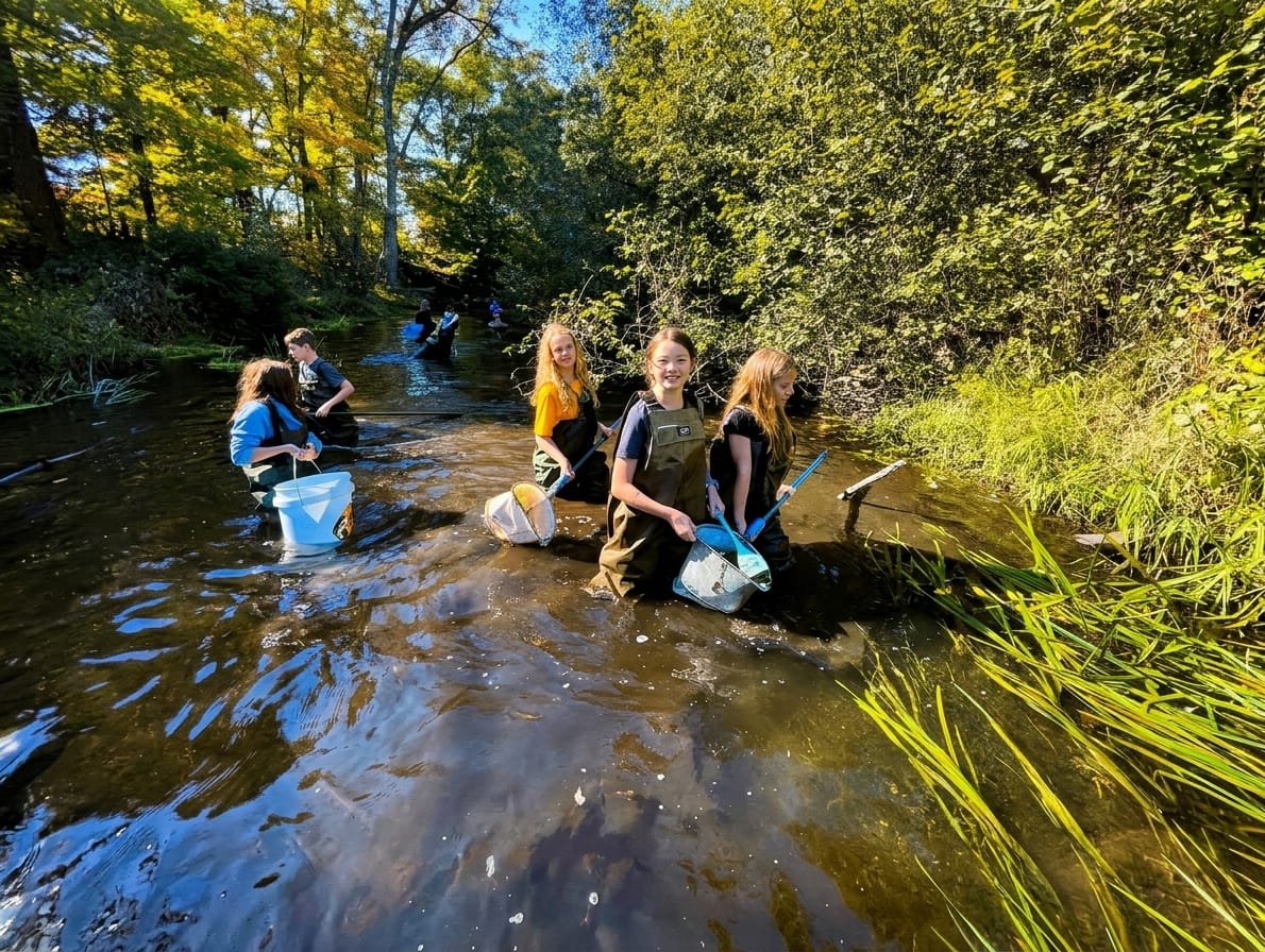
With funding from a Great Lakes Stewardship Grant via the Great Lakes Fishery Trust, Bain launched "Living the Mission: Watershed-Based Experiences and Stewardship" for the 2025-26 academic year. The premise was to empower students in school districts to study their local waterways, analyze human impacts and pitch real environmental solutions.
To decide where the program was needed most, Bain and his team turned to geographic information system (GIS) mapping software. They overlaid Michigan school district lines with Environmental Protection Agency data, filtering for census block groups in the 90th percentile or higher for socioeconomic and environmental burdens.
The resulting map highlighted dense urban corridors in Grand Rapids, Wyoming and Kentwood, but it also pointed to lakeshore communities like Grand Haven, Fruitport, Spring Lake and Allendale.
"In simple language, these communities have the heaviest socioeconomic burdens in Michigan," Bain explained. "They also have the heaviest environmental burdens, in that their water and their air quality is the poorest. So this is a way for us to work in areas that need it, and also provide equity."
Before setting foot in the water, students learn watershed fundamentals in the classroom — using miniature "EnviroScape" models sprayed with water bottles to mimic agricultural and urban runoff. Then, they head into the field.
First, classes visit pristine waterways such as Sand Creek at Aman Park or Honey Creek at Seidman Park — places wrapped in miles of lush green tree canopy. There, students pull aquatic macroinvertebrates from the streambed. Because the insects and larvae make up 96% of species in streambed ecosystems, their presence (or absence) tells an immediate story about water quality. Using ice cube trays, magnifying glasses and forceps, students sort their catches into categories based on pollution tolerance.
Next, students visit an impact stream, often an industrial drain or channelized creek right in their own neighborhood.
The contrast is stark.
"The difference is [in] Sand Creek ... there's miles of vegetative buffer in all directions. Plaster Creek, just beyond those tree lines, is a turkey processing plant, and there's pretty much factories or other development going up and down the creek."
When students compare the bug counts, the data speaks for itself. Pristine reference streams consistently yielded nearly double the diversity of sensitive insect species compared to heavily developed urban drains.
What sets "Living the Mission" apart from a standard school field trip is what happens after the mud washes off. Students take their raw water quality scores and build formal presentations for local decision-makers.
During a flagship program at White Pines Intermediate School in Grand Haven, 80 middle schoolers prepared a presentation about the Warber Drain running through their campus. Bain reached out to Bush, who showed up alongside city public works staff to hear what the kids had to say.
The students also rolled up their sleeves and cleaned out the local drain, hauling out invasive weeds, bike frames, tires and discarded carpet; planted 20 native plants to stabilize the stream bank and filter runoff; and ran watershed demonstrations for community members and parents.
In its inaugural year alone, the program reached 368 students, sampled 16 streams, identified over 2,000 macroinvertebrates and brought student proposals before 53 policymakers.
The program is currently in its second year. As the initial grant period winds down, the goal is to keep the initiative alive through a fee-for-service model for local municipalities — ensuring Ottawa County students continue to have a seat at the table in protecting their shared waters.
Learn more
- Ottawa Conservation District (OCD): Leads the countywide Water Quality Monitoring Initiative. It publishes watershed management plans and monitoring updates on the Ottawa Conservation District Water Quality Page.
- ODC Network (Project Clarity): Manages the Macatawa Watershed restoration efforts and real-time monitoring. Access technical reports, annual monitoring updates, and project highlights at the ODC Network Project Clarity Hub.
- Ottawa County Water Resources Commissioner: Hosts the annual Ottawa County Water Quality Forum and maintains countywide stormwater and drain monitoring resources. Visit the Ottawa County Water Resources Office.
- Seagull Platform (Great Lakes Observing System): Provides continuous, real-time data from the Lake Macatawa monitoring buoy and regional stream sondes. Access the dashboard directly on the Seagull GLOS Platform.
- GVSU Annis Water Resources Institute (AWRI): Conducts long-term research, sediment studies, and annual water quality reports across West Michigan downriver-mouth lakes and tributaries. Access technical publications through the GVSU AWRI Website.
- Lower Grand River Organization of Watersheds (LGROW): Coordinates sub-watershed planning, water quality mapping, and community education across the broader Grand River basin. Learn more at the LGROW Watershed Hub.
Water quality monitoring update
For decades, environmental monitoring across the county’s rivers, bayous and lakes was a patchwork affair.
That trajectory shifted when Bush approached the Ottawa Conservation District and the ODC Network with an opportunity.
"Hey, there's some funding that has come available at the county. Let's try to put a proposal together and see if we could utilize some of this for water quality monitoring," he said.
Working together, they secured five-year funding from the Ottawa County Board of Commissioners to launch the Ottawa County Water Quality Monitoring Initiative.
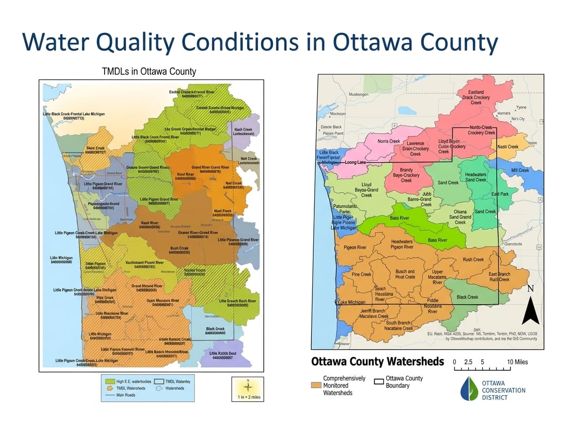
As Sarah Bowman of the Conservation District explained, the central mission of the project is clear: "To protect and improve surface and groundwater quality in Ottawa County by filling data gaps in existing water quality monitoring data."
Now halfway through the project, Bowman and Cole Ockerse of the ODC Network are uncovering a detailed, sometimes surprising picture of the county’s water health.
Tackling nonpoint source pollution is a delicate challenge. Unlike point-source pollution, which flows from a single, permit-regulated industrial pipe, nonpoint pollution comes from everywhere at once.
Across Ottawa County, it broadly stems from two worlds. On agricultural lands, heavy rains wash excess fertilizer, manure and eroded soil off fields and into open streams where livestock wander. In suburban and residential areas, the culprits are lawn fertilizers, pet waste, road salt and aging, failing septic systems.
While state regulators have long designated local watersheds as impaired through official cleanup targets, an official label does little to solve the problem.
Bowman highlighted why hard data is essential for securing real resources.
"If we can't prove that there's a problem, it's harder for us to get grant funding to fix it in the future," she said.
To build that proof, the team deployed a blend of high-tech continuous sensors and hands-on field testing.
In the southern half of the county, the ODC Network anchored an advanced data buoy in the deep narrows of Lake Macatawa. Floating beside automated stream sensors placed at the mouths of major tributaries, the buoy continuously measures water temperature, oxygen levels, clarity and algae indicators every 15 minutes, streaming the information directly to a public online platform called Seagull.
Nearby in Rush Creek, continuous loggers rely on partnerships with local homeowners who granted scientists access to the streams running through their backyards.
While electronic sensors track physical changes in real time, traditional water sampling provides forensic clarity. By combining field samples with microbial source tracking — a laboratory technique that identifies human DNA markers — researchers can distinguish whether bacterial pollution stems from farm runoff or raw sewage leaking from residential septic tanks.
In the Potawatomi and Lloyd Bayou watersheds, initial sampling revealed elevated bacteria levels, with genetic testing confirming human waste near residential neighborhoods.
Bowman pointed out how these findings create a roadmap for future aid.
"Of course, this watershed is a watershed where we don't have funding to do cost share to help people replace failing septic systems or to do best management practices," she said. "So this information is really going to help us in the future to get more funding because we can show, 'Hey, we've got some issues in this watershed.'"
In the sprawling Crockery Creek watershed, expanding the number of sampling sites allowed conservationists to take detailed maps directly to local farmers. Bowman described the collaborative approach taken with local landowners: "We are noticing some elevated levels of E. coli, and we wanted to work with farmers to see if we can put in best management practices to help reduce those bad pollutants."
Local agricultural producers stepped up to plant cover crops for the first time in years, alongside plans to build vegetated buffer strips and improve retention basins.
The findings in the Spring Lake and Norris Creek watersheds offered an intriguing contrast.
High in the agricultural headwaters, bacteria levels were elevated, but showed no trace of human DNA, pointing toward agricultural land use. Downstream, where residential development becomes denser near Grand Haven, human markers appeared frequently.
Armed with these insights, conservationists are partnering with the local lake board to write a comprehensive, updated watershed management plan. Amid the environmental challenges, field surveys also brought a welcome surprise: Norris Creek was highlighted as the only location in the surveys where researchers uncovered native brook trout.
As the initiative moves into its final years, monitoring will expand into previously unmapped streams like Bass River, Deer Creek and Sand Creek. To make the findings accessible to everyday residents, the team is working with a Grand Valley State University student to build an interactive digital map.
Bowman highlighted the importance of public transparency: "We want people to be able to look up and see, 'What's the water quality looking like in my stream.'"
Set to launch soon, the platform will allow homeowners, farmers and local officials to click on their neighborhood streams and see their local water quality in real time — turning raw scientific data into a powerful tool for community stewardship.
— Sarah Leach is the executive editor of the Ottawa News Network. Contact her at sleach@ottawanewsnetwork.org. Follow her on Twitter @ONNLeach.


