

Risk of severe thunderstorms, flash flooding today and tonight. Get Bill Steffen's forecast
Parts of the Midwest and the eastern United States will be primed for multiple rounds of thunderstorms capable of severe weather and flash flooding into Friday.

Rounds of severe weather and torrential downpours will roll from parts of the Midwest.
Parts of the Midwest and the eastern United States will be primed for multiple rounds of thunderstorms capable of severe weather and flash flooding into Friday.
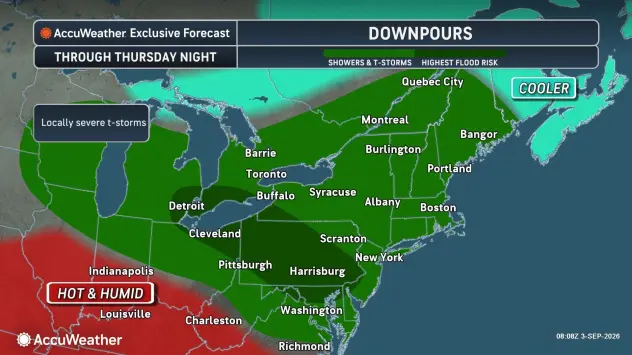
Severe storms are forecast from Thursday to Thursday night from southern Michigan and northern Indiana to coastal waters off New York, New Jersey, Delaware and Maryland.
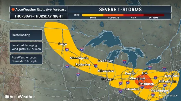
The main threats on Thursday will range from damaging wind gusts and flash flooding and include the metro areas of Detroit; Fort Wayne, Indiana; Cleveland and Columbus, Ohio; Pittsburgh, Philadelphia and Harrisburg, Pennsylvania; Morgantown, West Virginia; Atlantic City, New Jersey; Dover, Delaware; New York City, Baltimore; and Washington, D.C.
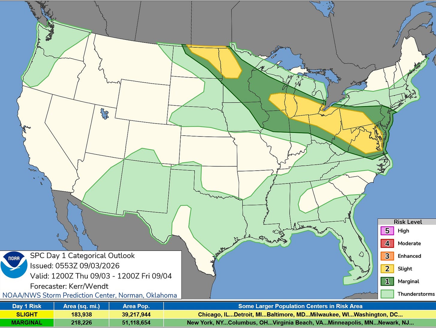
This is the Severe Weather Outlook Map for Thursday and Thursday night. Much of southern Lower Michigan has been upgraded to a level two Slight Risk, and it’s not impossible that we could be further upgraded later today.
The National Weather Service's Storm Prediction Center said: “… Renewed thunderstorm development later today through tonight. Across southeastern Wisconsin through southern Lower Michigan/northern Indiana and Ohio vicinity there appears potential for one or two organizing clusters. It is possible that severe wind probabilities could still be increased further, once forcing for convection and the potential negative impacts of early day convection become clearer.”
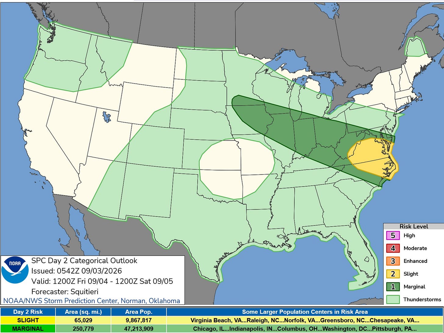
Here’s the Severe Weather Outlook Map for Friday … just a level 1 Marginal Risk south of a line from South Haven to Adrian. SPC says: “Thunderstorm coverage should be quite isolated. However, any storms that manage to mature may become multicellular or supercellular given 30-plus knots of effective bulk shear in place. An instance or two of severe wind or hail are possible.
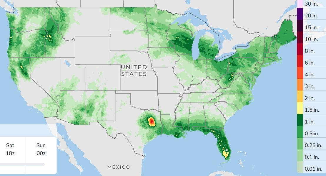
Here’s the forecast three-day rainfall. Note the northwest to southeast half- to 1-inch rainfall across Wisconsin, Lower Michigan, down into Ohio.
Also, there is still a small but significant bullseye of rain in east Texas from the remains of Tropical Storm Edouard. Showers and storms will move along the Gulf Coast.
Moisture from the remains of Tropical Storm Dolly will give some needed rain to Florida, and it stays wet over parts of the Pacific Northwest, the Mid-Atlantic and New England.
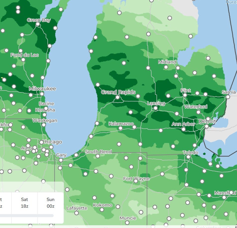
Here’s the map zoomed in to the southern Lakes. The darkest green is an inch of rain over the next three days.
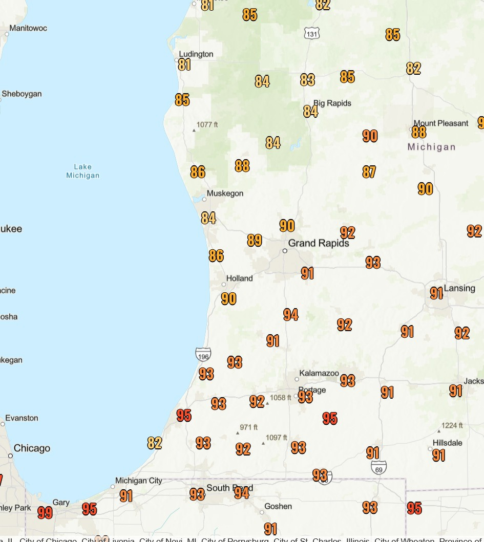
Here’s a look at some high temperatures from Wednesday. Grand Rapids officially reached 92 degrees; it was the warmest September day since 2017.
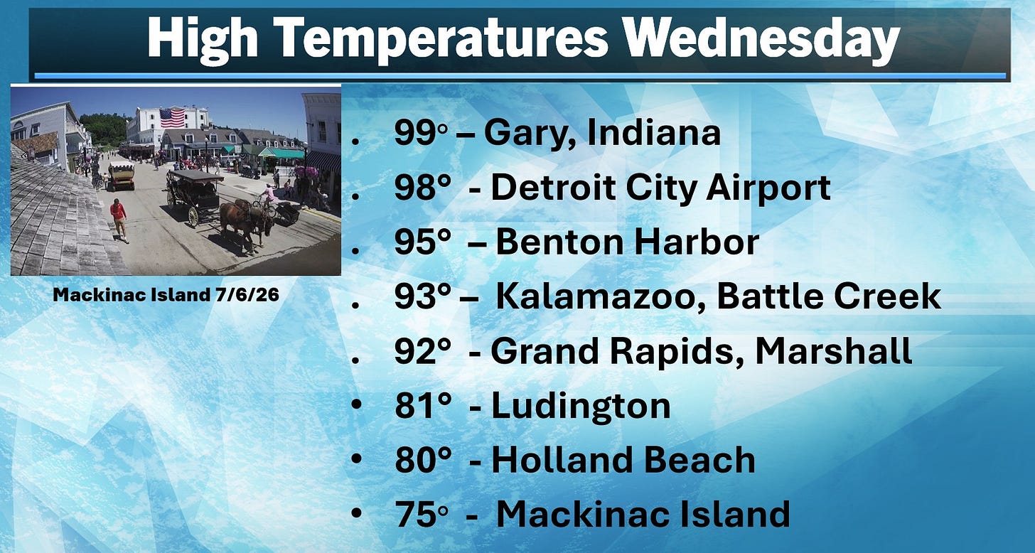
Here are some official high temperatures from Wednesday. It nearly reached 100 degrees in Gary, Indiana, and at Detroit City Airport. The 95 degrees at Benton Harbor is impressive.
Obviously, the wind wasn’t coming off Lake Michigan there, but it was farther north, with a high of just 80 degrees at Holland Beach.
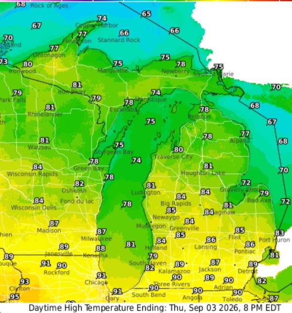
Here are the forecast high temperatures for this afternoon. It’ll climb to near 90 degrees along and south of I-94, mid-80s to the north of I-96. It’ll depend on cloud cover and when any thunderstorms arrive.
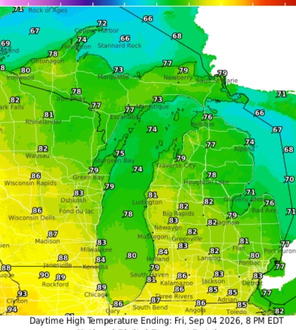
Here are high temperatures for Friday … in general, it’ll be several degrees cooler than Thursday, but still warmer than average.
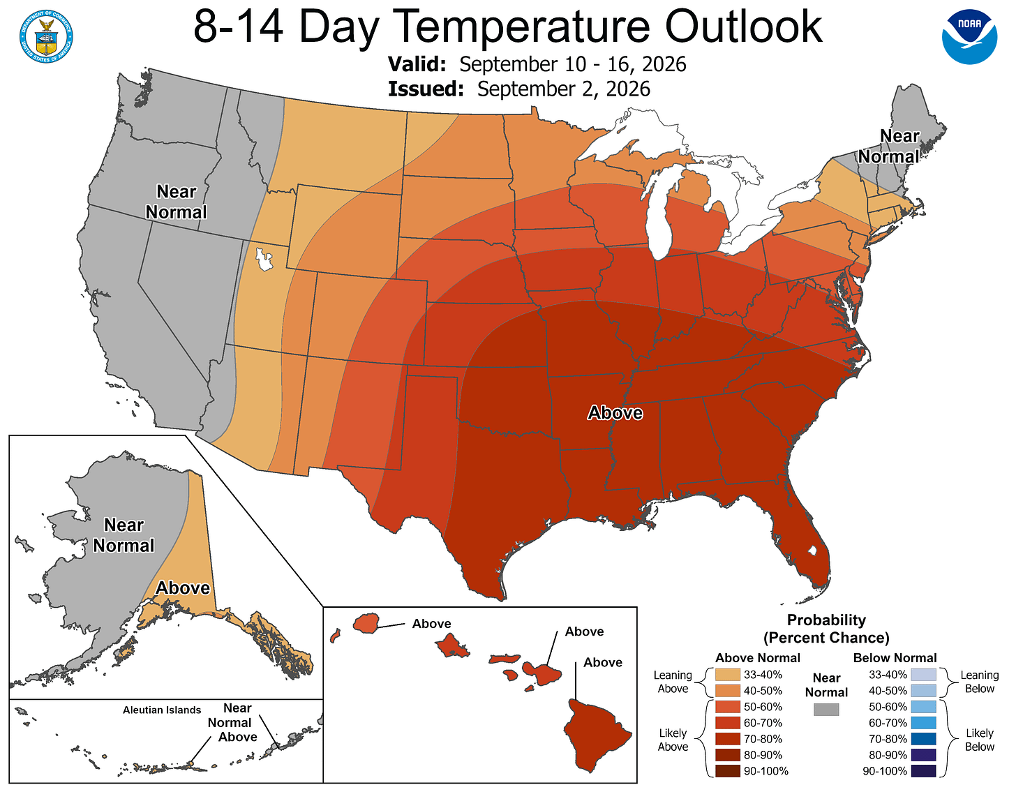
The latest 8- to 16-day temperature outlook continues the idea of a strong ridge centered about over Memphis, but sprawling out to cover much of the country. Remember, we have a strong El Niño pattern, and that can (but not always) lead to warmer-than-average temperatures in the Great Lakes in fall and winter.
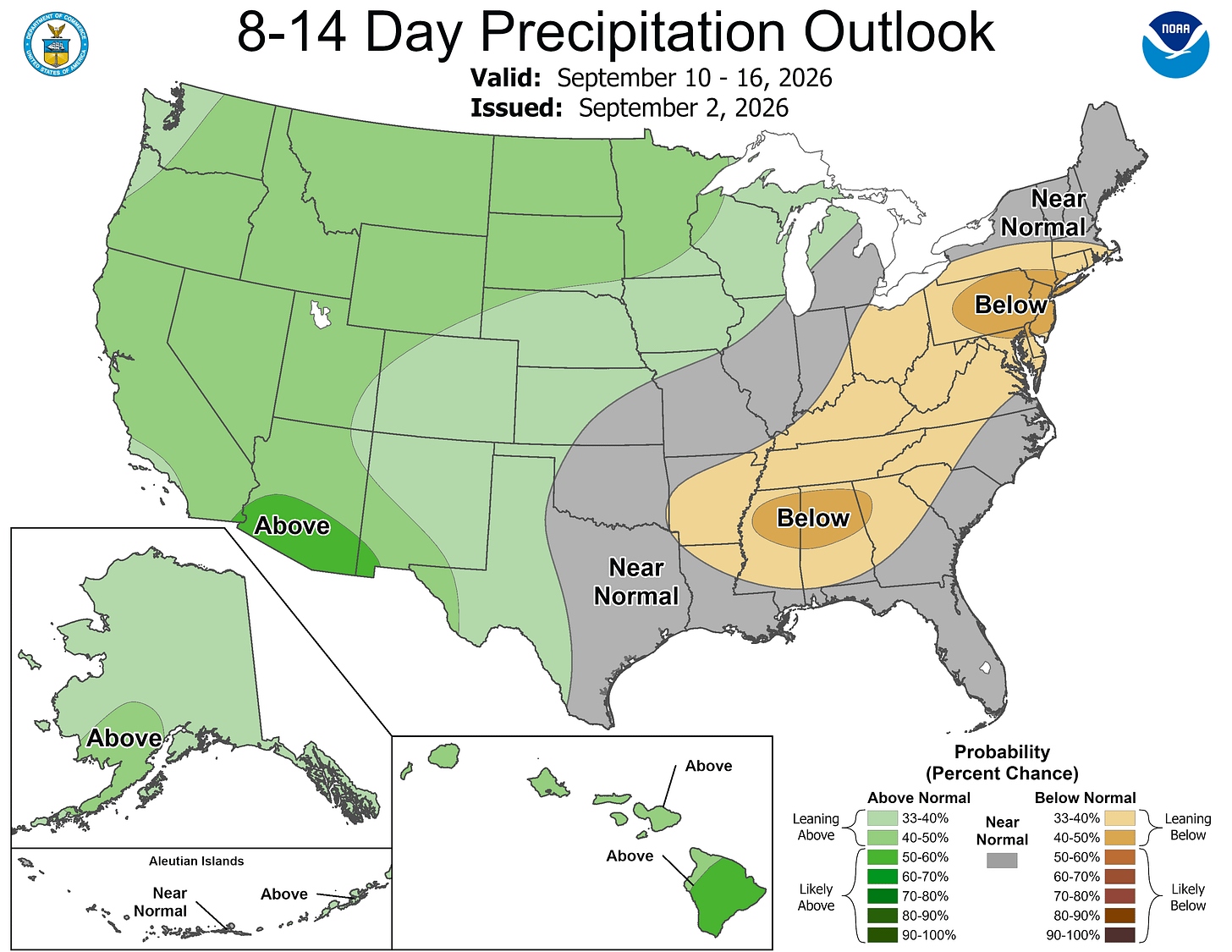
The corresponding rainfall forecast keeps southern Lower Michigan in the Near Normal Category. Monsoon moisture will continue to touch off random thunderstorms in the Southwest. Water levels of the big reservoirs out West continue to be quite low.
— Subscribe to Bill Steffen's Substack.


