

Showers move in this week. Get Bill Steffen's weekend forecast.
West Michigan will get rain the next few evenings.

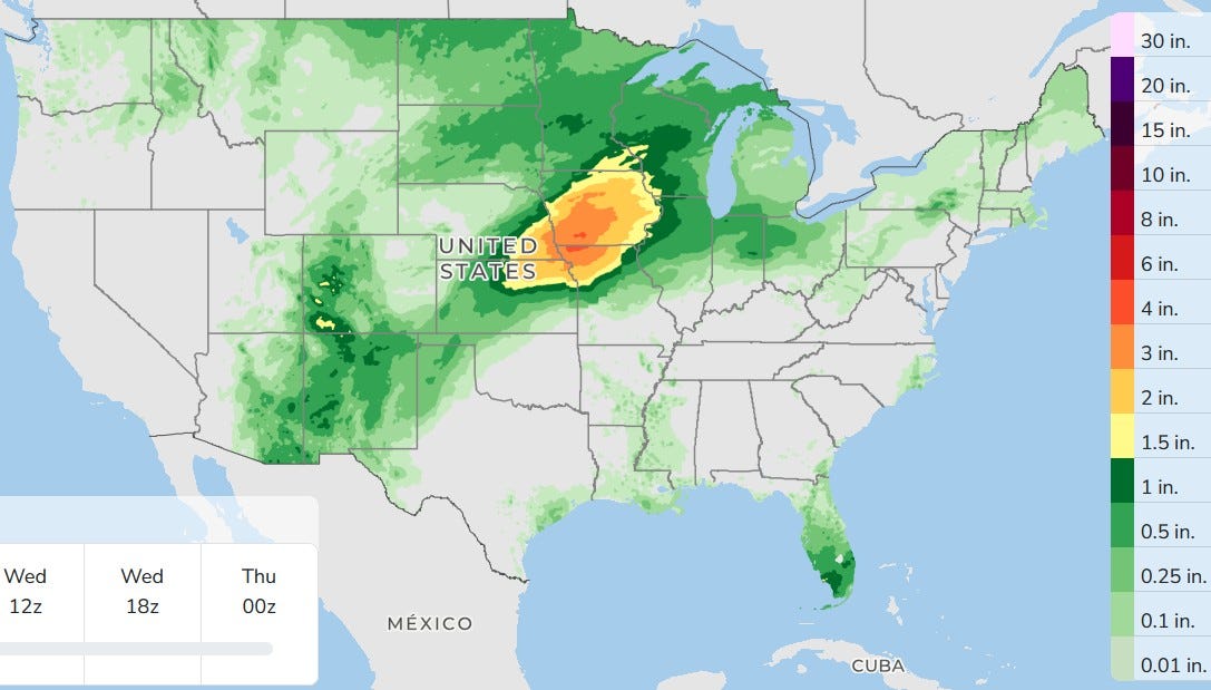
Here’s the three-day total forecast rainfall. It’s going to be a wet couple of days in Iowa. We’ll stay dry in West Michigan today. I guess a shower could sneak into West Michigan after about 6 p.m. (the best bet for that will be north of Muskegon), but most of us will see rain hold off until after sunset.
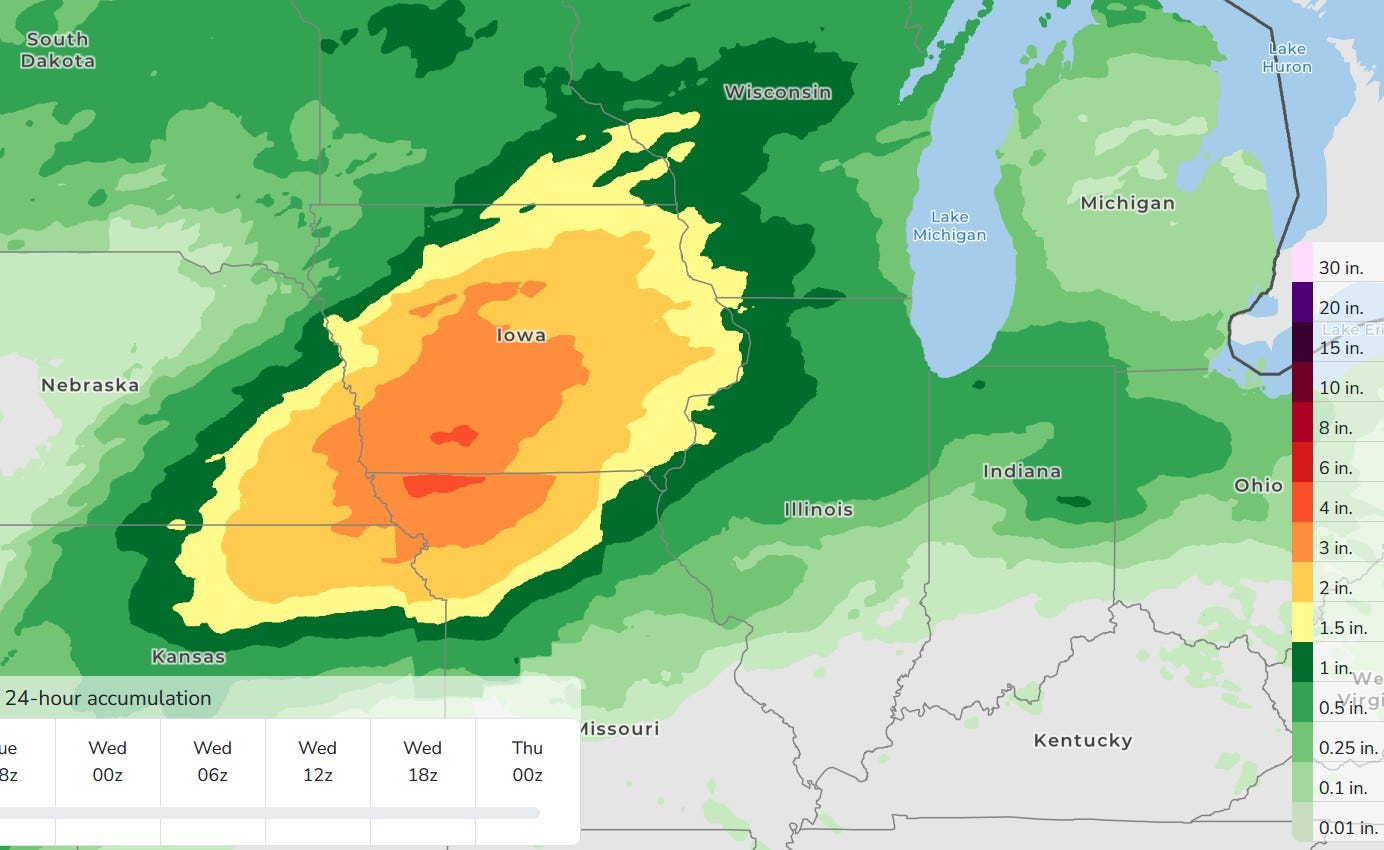
Here’s a closer look. The red is 4 inches of rain, and that’s a large area of more than 3 inches of rain over a three-day period. West Michigan is forecast to get 1/4 - 3/4 inch. You can add more rain to that for Wednesday night and Thursday.
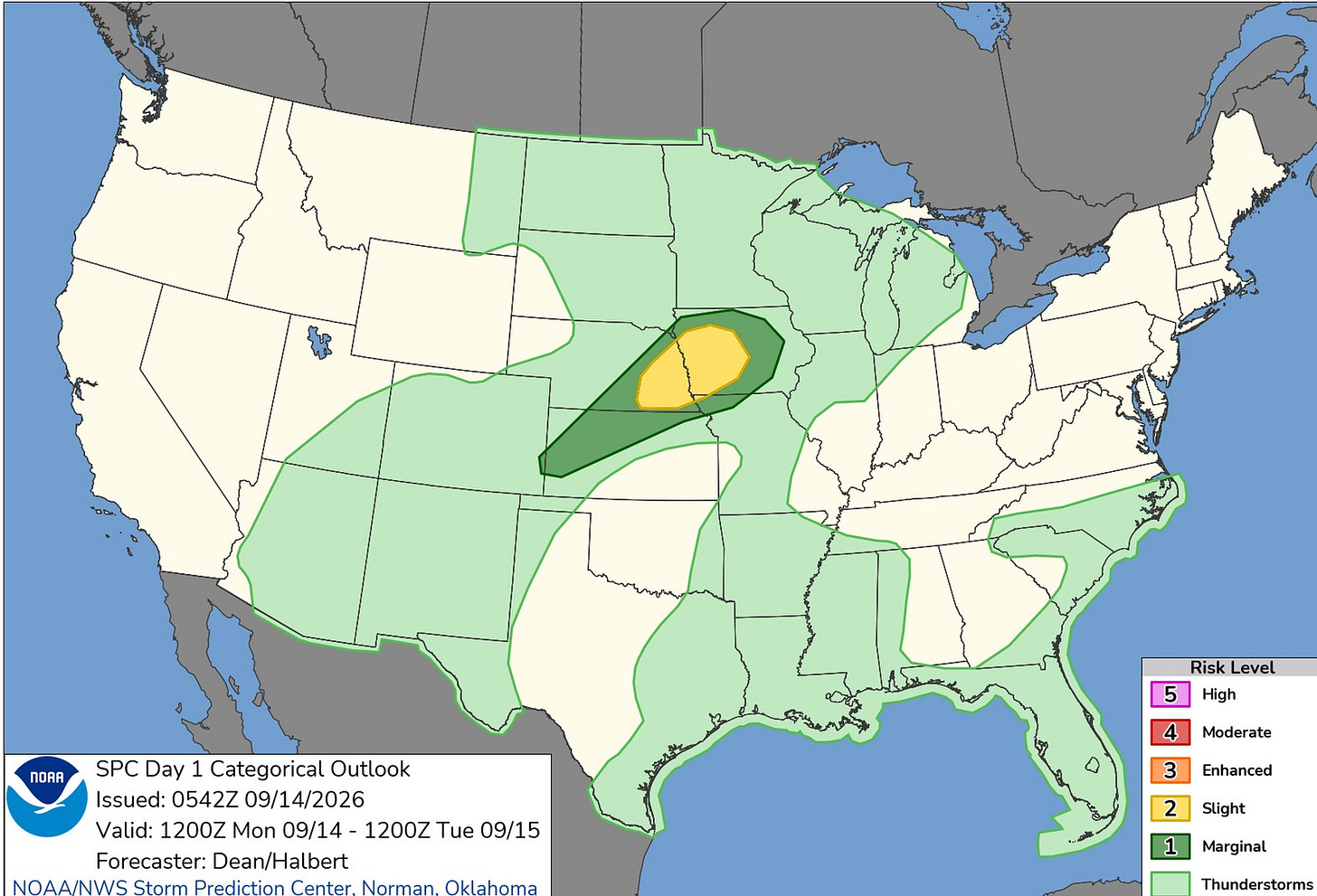
Here’s the Severe Weather Outlook Map for this Monday. There’s a level 2 Slight Risk over eastern Nebraska and western Iowa. The light green in Lower Michigan is for a chance of a non-severe storm later tonight.
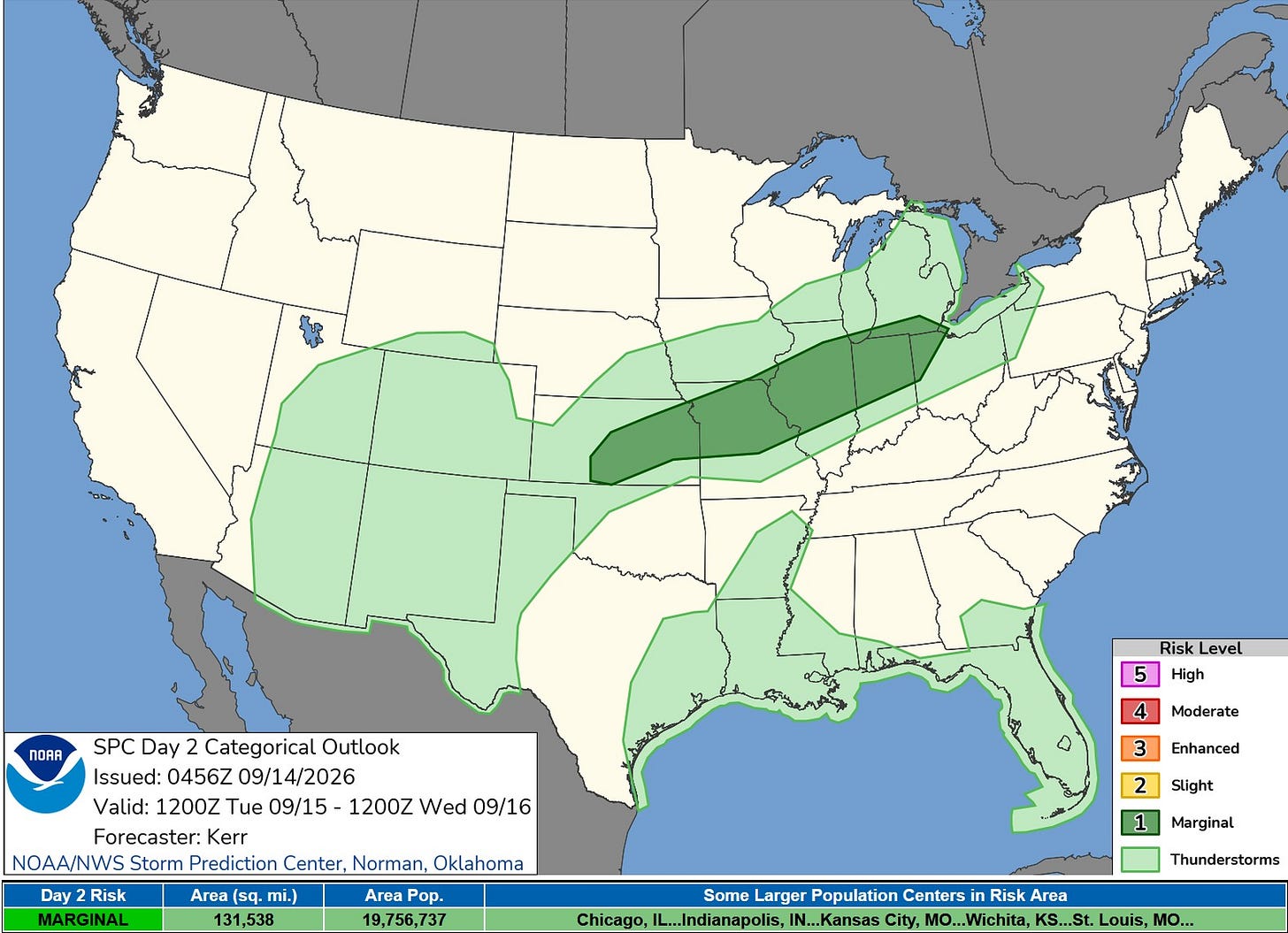
The Severe Weather Outlook Map for Tuesday shows a level 1 risk area from Kansas to Toledo. It does include the area south of a line from Chicago to just south of Lansing to Toledo. An isolated strong wind gust is possible.
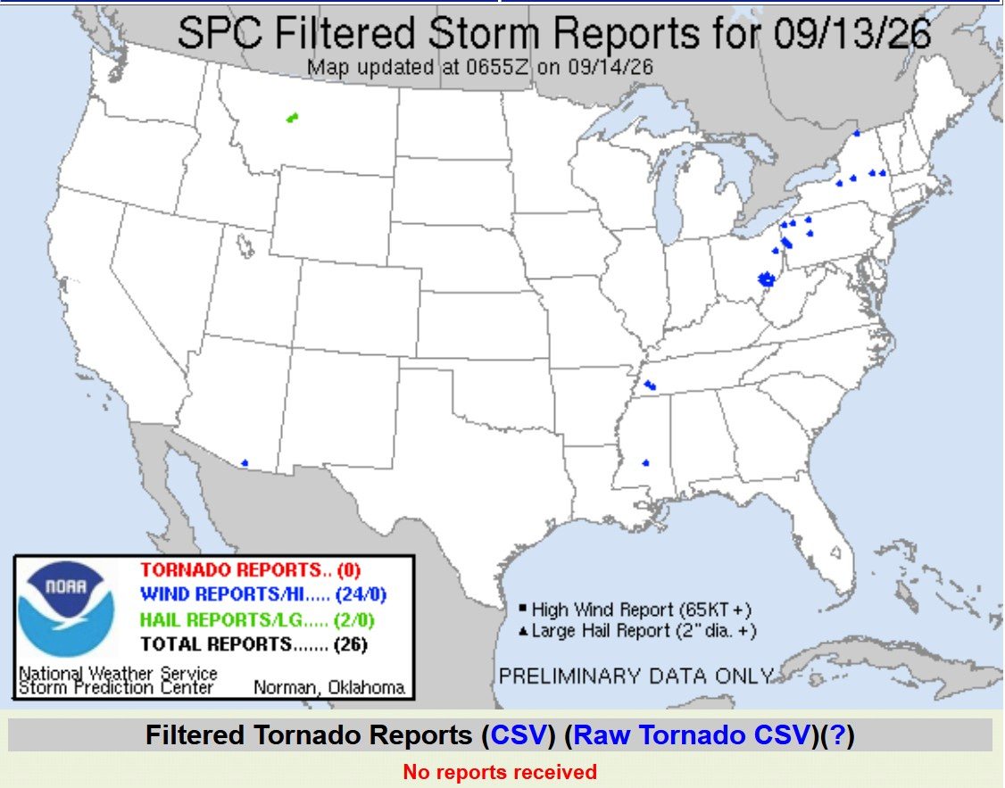
Here are the severe weather reports from Sunday. There were no tornadoes, just two severe hail reports in Montana and 24 reports of wind damage, most of which were isolated tree damage.
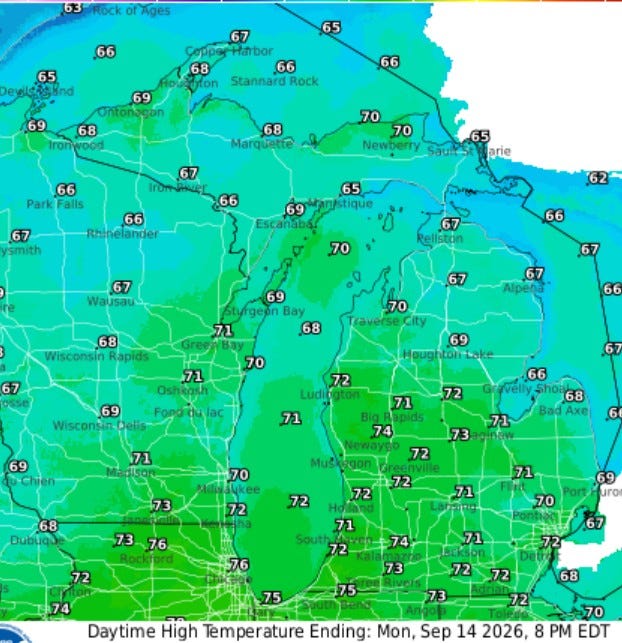
After a cool start to this Monday, temperatures will climb into the low 70s this afternoon. With a light southeast wind, temperatures inland and at Lake Michigan should be similar.
Looks like the state parks have stopped taking water temperatures. I’ll try to pass along an occasional water temperature when I get one. Sunday, I got 70 degrees at the Holland Channel and the Port Sheldon buoy and 68 degrees at the South Haven buoy. Waves were up around 3-4 feet Sunday evening, but should be back to 6 inches or a foot nearshore today.
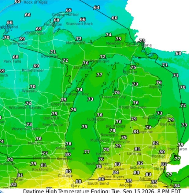
Tuesday’s high temperatures may be the warmest of the week, with readings ranging from the mid-80s at the Indiana border to near 80 degrees in Grand Rapids and Lansing and mid-70s toward US-10 (Ludington/Baldwin/Reed City).
Five-day forecast
- Monday: Some sun, then increasing clouds. High: 71 degrees. Tonight, breezy with rain most of the time. Low: 61 degrees.
- Tuesday: Mostly cloudy and humid with a couple of showers and a heavy thunderstorm; windy in the morning; any heavier downpours can lead to localized flooding. High: 74 degrees. In the evening, cloudy with a low of 59 degrees.
- Wednesday: Partly sunny and less humid. High: 73 degrees. In the evening, periods of rain and a thunderstorm. Low: 62 degrees.
- Thursday: Humid with clouds yielding to sun. High: 75 degrees. In the evening, mainly clear with a low of 57 degrees.
- Friday: Nice with sunshine and a few clouds. High: 76 degrees. In the evening, mainly clear with a thunderstorm possible. Low: 61 degrees.
— Subscribe to Bill Steffen's Substack.


