
Band of showers, T-storms will move through tonight. Get Bill Steffen's weekday forecast
The latest 8- to 14-day temperature outlook continues to forecast cooler-than-average temperatures over the Great Lakes.
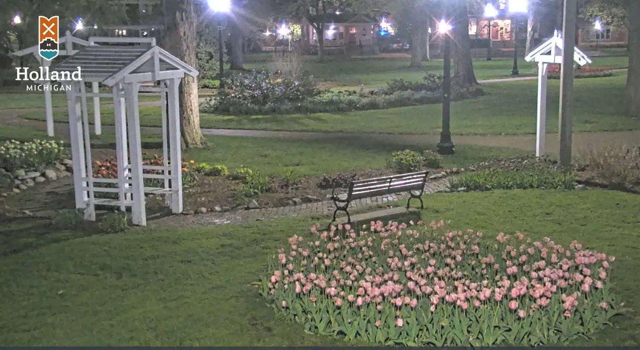
This is a webcam grab of Centennial Park in Holland around 2:30 a.m. on Saturday. LOTS of tulips are in bloom now, literally over a million blooming in Holland right now. The blossoms are out on the ornamental pear trees downtown, and we’re counting down the days until Tulip Time. There are two big parades now at Tulip Time … the Children’s Parade on Thursday and the Music Parade on Saturday (2 p.m.).
So far, April is averaging 5.2 degrees warmer than average. We’ve had 16 days that have been warmer than average, seven days that have been cooler than average, and one day that was exactly average.
The record high temperature today is 86, and that occurred back in 1915. The record low temperature was 22 in 1967 (the year we had the big blizzard on Jan. 26). Sunrise today is at 6:43 a.m. and sunset at 8:37 p.m. We’re approaching 14 hours of daylight. The average high temperature for Grand Rapids is up to 62, and the average low is 41.
Most of Monday will be dry, but probably after sunset, a band of showers and thunderstorms will move in from the west. The European model gives Grand Rapids .3 inch of rain from sunset Monday into early Tuesday. That’s not enough to have much effect on the area rivers.
So far this month, Grand Rapids has had 7.19 inches of rain, and that’s 4.15 inches above average.
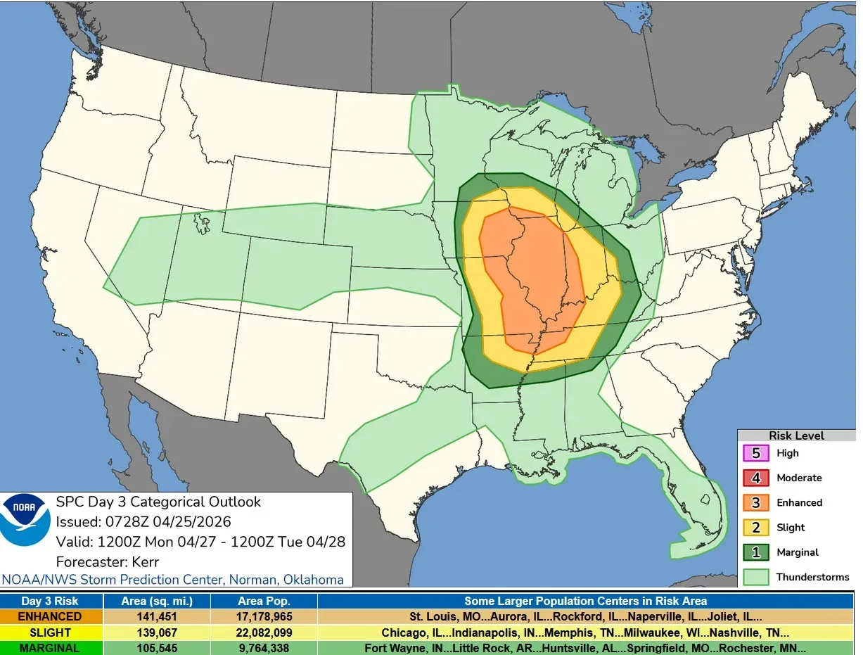
This is the Severe Weather Outlook Map for Monday. It looks like another big day of severe weather, with a large level 3 Enhanced Risk area centered on Illinois. Again, tornadoes are possible, and scattered wind damage is likely. Storms should be weakening as they cross Lake Michigan well after sunset.
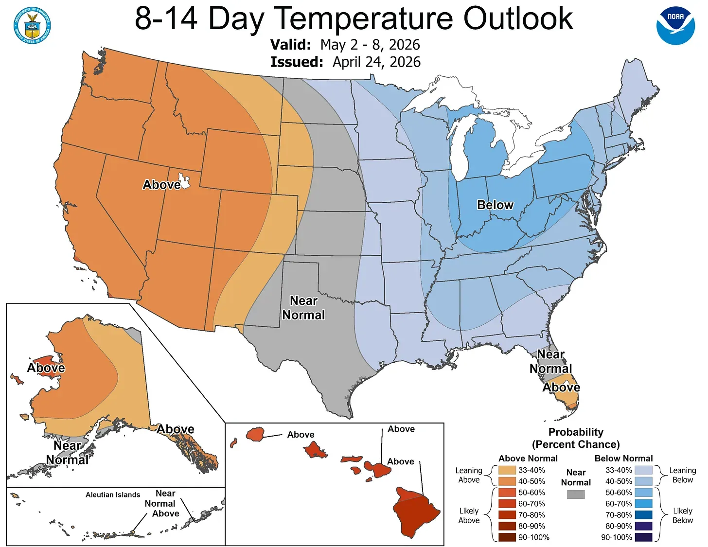
The latest 8- to 14-day temperature outlook continues to forecast cooler-than-average temperatures over the Great Lakes and Northeast. Keep in mind that this is a seven-day average … it may be cooler than average at the beginning of the period, but trend warmer toward the end of the seven days.
Nevertheless, I’d continue to hold off planting anything frost-sensitive.
5-day forecast
- Monday: Mostly cloudy and windy; a thunderstorm this afternoon; thunderstorms can bring localized damaging wind gusts. Expect a high of 69 degrees and a low of 49 degrees.
- Tuesday: Windy in the morning; cooler with some sun, then turning cloudy. Expect a high of 55 degrees and a low of 46 degrees.
- Wednesday: Partly cloudy, with a high of 53 degrees and a low of 40 degrees.
- Thursday: Partly sunny and chilly, with a high of 50 degrees and a low of 37 degrees.
- Friday: Mostly cloudy and chilly; breezy in the afternoon. Expect a high of 47 degrees and a low of 35 degrees.
— Check out Bill Steffen's Substack channel.


