
Warming up by mid-May. Get Bill Steffen's weekend forecast
While the warmer air will get a bit stronger as we move into mid-May, there is still the potential for a relatively cool period as long as all that snow, ice, and cold water extends from Lake Superior to the Hudson Bay area.
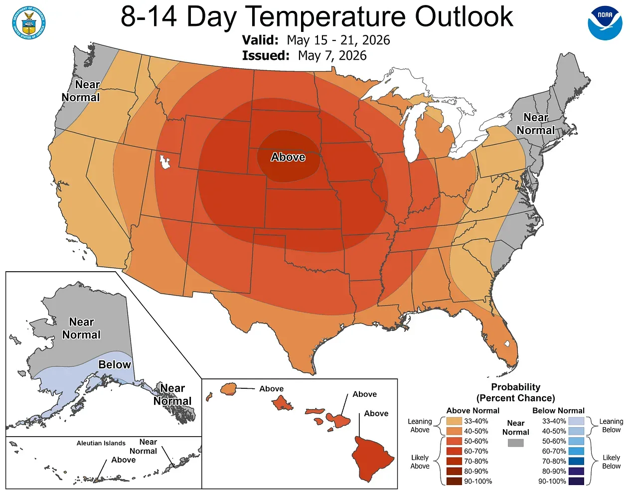
Here’s the latest 8-14 day temperature forecast from the Climate Prediction Center. This is for May 15-21. They forecast a heat bubble of sorts over the central U.S. with above-average temperatures. This would mean high temperatures in the 70s and 80s.
However:
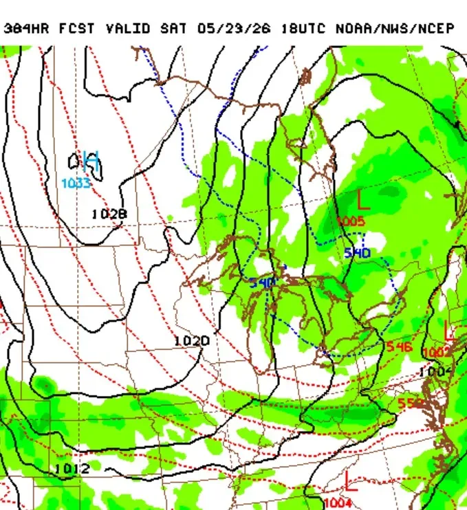
This is from the GFS model forecast for Saturday, May 23. There’s high pressure north of North Dakota and a cool flow of air from the Hudson Bay area (where there is still snow on the ground) to Michigan.
It’s way too early to pin down anything this far out, but while the warmer air will get a bit stronger as we move into mid-May, there is still the potential for a relatively cool period as long as all that snow, ice, and cold water extends from Lake Superior to the Hudson Bay area.
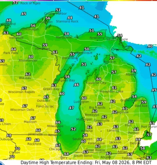
Here are the high temperatures for this Friday. We’ll see readings in the low-mid 60s in inland areas and mid-upper 50s near Lake Michigan. Readings should reach the mid-50s in the U.P. and approach 70 by the Mississippi River.
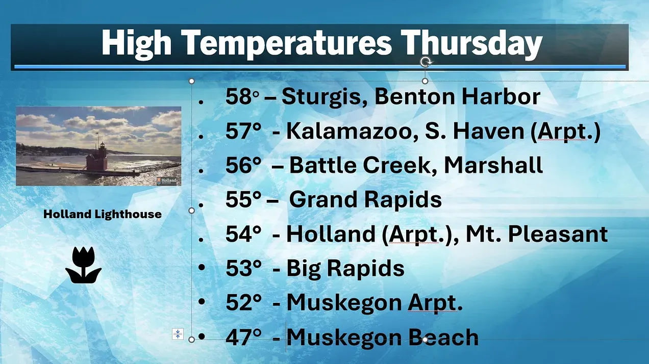
Here are the high temperatures from Thursday. Another cool day. The average high temperature for Grand Rapids is now 67, so the 55 reading was 12 degrees cooler than average.
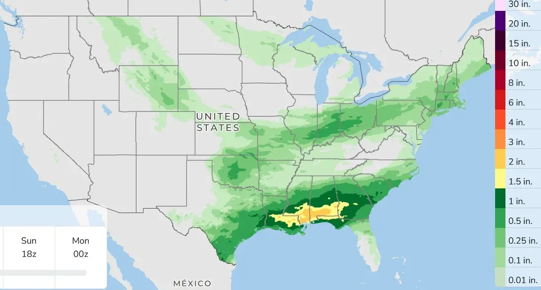
Here’s the three-day total rainfall. Again, lots of rain in the South and very little in Michigan. The main front across the South is the focus for the significant thunderstorms, while relatively dry air implies rainfall amounts will continue to be spotty and light in the Great Lakes.
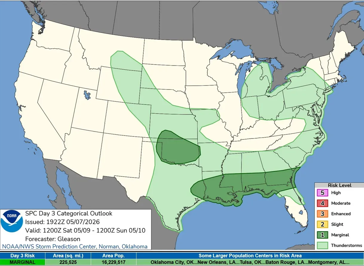
On Saturday, there is a chance of a non-severe thunderstorm in most of Lower Michigan. There’s a level 1 Marginal Risk over much of Oklahoma and from east Texas east to Jacksonville, Florida, and Savannah, Georgia.
5-day forecast
- Friday: Clouds and sunshine today, with a high of 60 degrees. Tonight, partly cloudy with a low of 49 degrees.
- Saturday: Breezy with times of sun and clouds. A passing shower is possible. Expect a high of 57 degrees. In the evening, it will be mainly clear with a low of 40 degrees.
- Sunday: Intervals of clouds and sun with a high of 56 degrees. In the evening, there's a possibility of showers; otherwise, mainly clear and chilly, with a low of 39 degrees.
- Monday: Sunny and cool, with a high of 54 degrees. In the evening, mainly clear and chilly with a potential frost. Low of 38 degrees.
- Tuesday: Mainly cloudy and cool; breezy with a couple of showers in the afternoon. High: 52 degrees. In the evening, breezy with overcast, with a brief shower or two. Low: 44 degrees.
— Check out Bill Steffen's Substack channel.


